Did a bit of hiking earlier this month... rightmost of the North Peak couloirs on Wednesday (8/3/10 - rest day #1), Dana Couloir on Thursday (rest day #2), and finished up with U Notch on N Palisade on Friday (a much less restful day). My goals were simple: to get out for some exercise and to check out conditions after this past winters decent snowfall so I could better know what to expect in these and other couloirs this Fall.
Too early to really expect ice in the couloirs, but not so late that all of last winters snow would have been melted off exposing years of underlying, loose rock debris of which I have seen so very much in recent years. The weather was mildly warm during the day and chilly at night (ranging from less than 40 to a high of about 70 according to the CDEC monitoring station at Ellery Lake at 9645) chilly enough that the snow (ice?) up in the couloirs would likely refreeze each night. Maybe
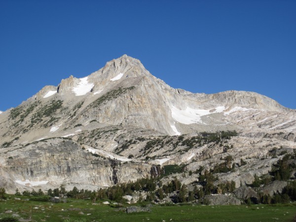
The hike to N Peak (12,242) is pleasant and scenic with lush green meadows:
 North Peak - 8/3/10 Credit: BMcC |
||
On the trail to N Peak with its north side couloirs hidden in the shadows left of the summit:
 North Peak Credit: BMcC |
||
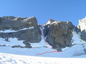
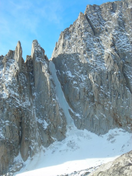
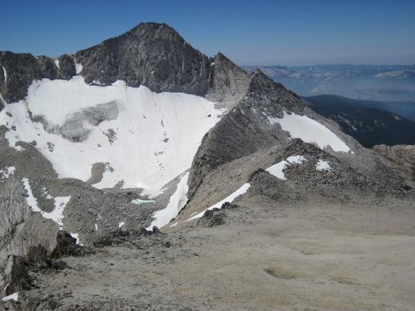
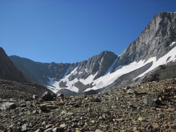
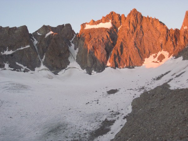
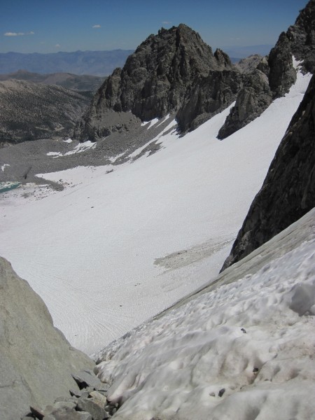
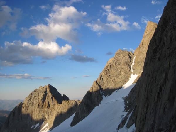
North Peaks 3 prominent couloirs coming into view. I had climbed the leftmost couloir with silly-easy, styrofoam-like snow on 9/17/93 and the rightmost couloir (in the middle of this picture) on a handful of subsequent N Peak hikes with conditions ranging from soft snow (darn) to styrofoam snow (fun) to actual ice (hooray):
 North Peak - 8/3/10 Credit: BMcC |
||
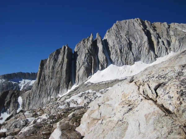
Had excellent conditions in 2008 (not all melted out as Dana had been earlier that year):
 North Peak - 10/19/08 Credit: BMcC |
||
 Vito on his 1st ice climb - North Peak - 10/19/08 (warmed up on Crest Jewel the day before) Credit: BMcC |
||
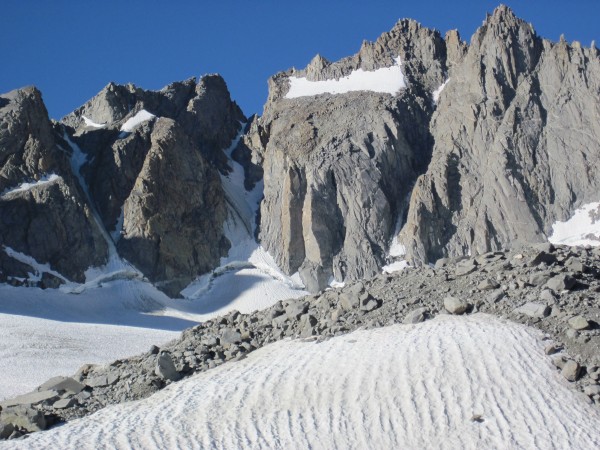
Fast forward to 2010:
 North Peak - 8/3/10 Credit: BMcC |
||
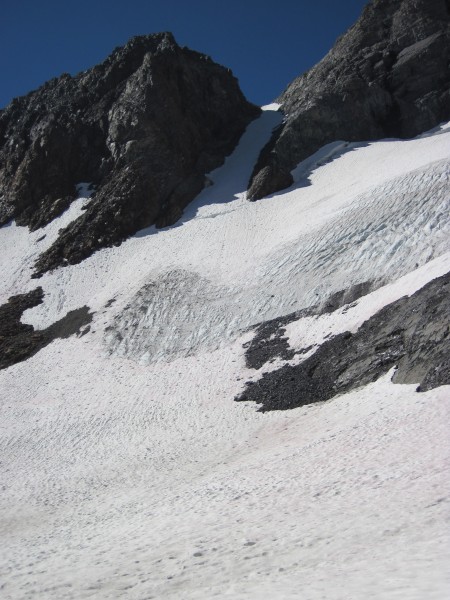
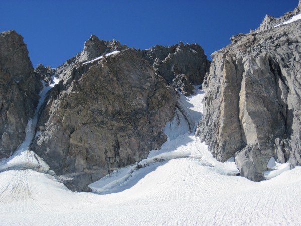
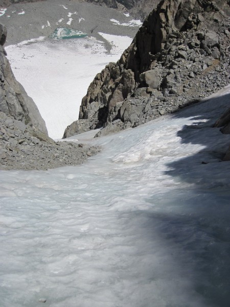
No bergschrund. Found much of the couloir to again be silly-easy styrofoam snow with some moderate-angle ice on which to play a few hundred feet from the top of the couloir:
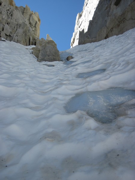 Icy patch on North Peak - 8/3/10 Credit: BMcC |
||
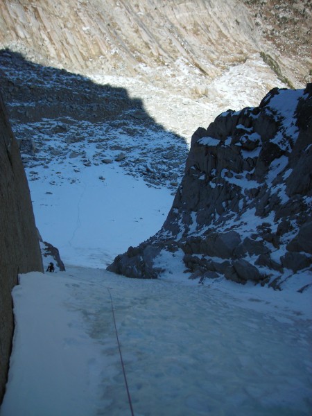
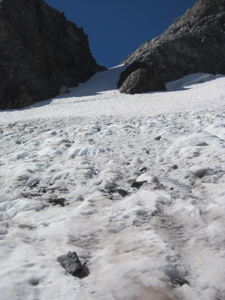
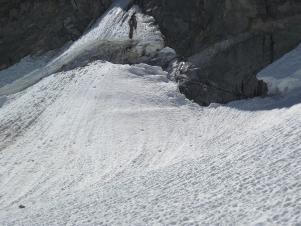
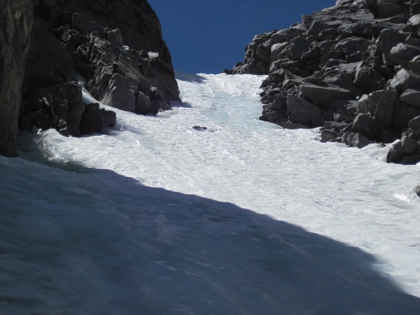
Party of 3 visible below on left. Seems safest to belay on the (ascending) climbers right side of the couloir when climbing this route, as falling debris tended to fall out and left. I moved out and left into the middle of the couloir when I passed by them to both access the ice and so that any ice or snow I dislodged would be more likely to miss the other climbers:
 3 climbers barely visible along the ice/rock margin in the shade - North Peak - 8/3/10 Credit: BMcC |
||
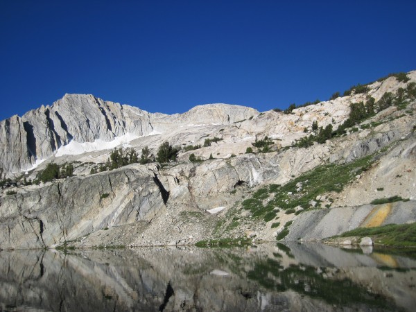
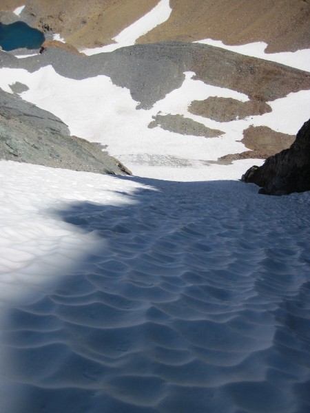
The N ridge of Mt Conness beckoning. Traversing the N ridges of N Peak and Conness makes for a nice hiking outing (with one ~5.6 spot) with excellent views:
 Mt. Conness - 8/3/10 Credit: BMcC |
||
On my hike out from N Peak, I scored a Nikon Coolpix camera complete with a string of cute little beads. Checked with groups of hikers and fisherpeople as I passed them (lots were out) to see if anyone was missing a camera. Jogged down to the boat dock at Saddlebag Lake just as the boat was pulling away with the young owner of the camera.
Missions accomplished: checked out conditions in/on the couloir, got some exercise, had fun, and got the camera back to its owner. Hiked out to my vehicle (about 10 miles round trip) for a few hours of reading and relaxation.
Heres a shot of Mt. Dana (13,053') and its couloir as seen from the road to Saddlebag Lake on Wednesday morning just before my N Peak culoir hike:
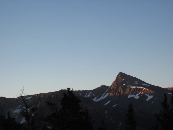 Mt. Dana and Dana Couloir as seen from road to Saddlebag Lake - 8/3/10 Credit: BMcC |
||
On 8/17/08, heres what Dana Couloir looked like:
 Dana Couloir - 8/17/08 Credit: BMcC |
||
 Dana Couloir - 8/17/08 Credit: BMcC |
||
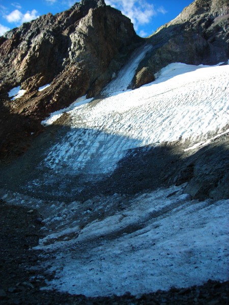
Dana couloir coming into view on Thursday 8/4/10 morning:
 Dana Couloir - 8/4/10 Credit: BMcC |
||
Much more promising than 2008:
 Dana Couloir - 8/4/10 Credit: BMcC |
||
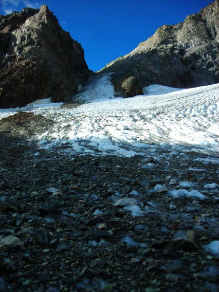
Despite the obvious evidence of rockfall and rocks from prior seasons already melting out, nothing flew at or by me during this easy snow hike. The bergschrund was well filled in and easily passed on the right:
 Dana Couloir - 8/4/10 Credit: BMcC |
||
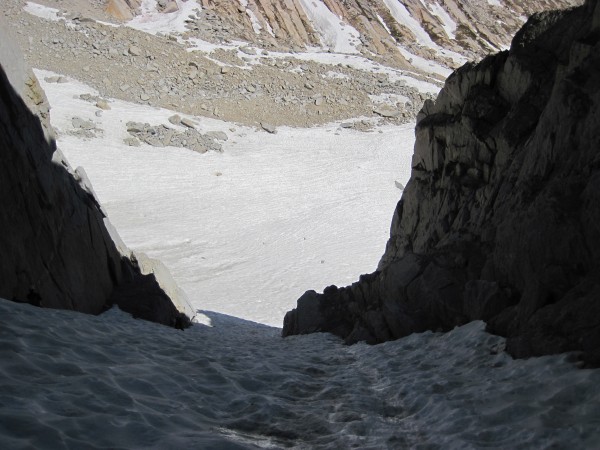
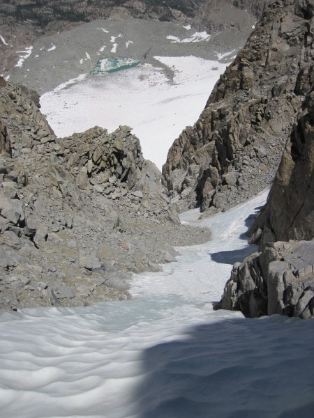
 Looking down Dana Couloir - 8/4/10 Credit: BMcC |
||
Down via the regular trail (just under 7 miles round trip) for more reading and relaxation a month shy of my 1st solitary hike of Dana Couloir 30 years ago.
Using a picnic table below Lembert Dome in Tuolumne, I organized my gear for U Notch on N Palisade (14,242) before driving down into the heat on the E side and S to the Palisades.
Bad news and good news. Was unable to avoid running over a skunk (it did its best to get run over), but lucked out in that it did not spray my vehicle (in which I was going to sleep again). Got off very lightly with the trace of skunk rather than the reek of skunk.
My kit (helmet, harness, boots, another water bottle, and much misc. other stuff in the pack) just before leaving the N Fork of Big Pine Creek trailhead parking lot shortly after 2 on Friday morning (more than 5 hours earlier than my rest-day departures for N Peak and Dana):
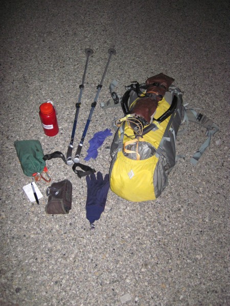 Credit: BMcC |
||
Perhaps I could have used more than two and one-quarter hours of sleep, but I just could not put down the book I had been reading:
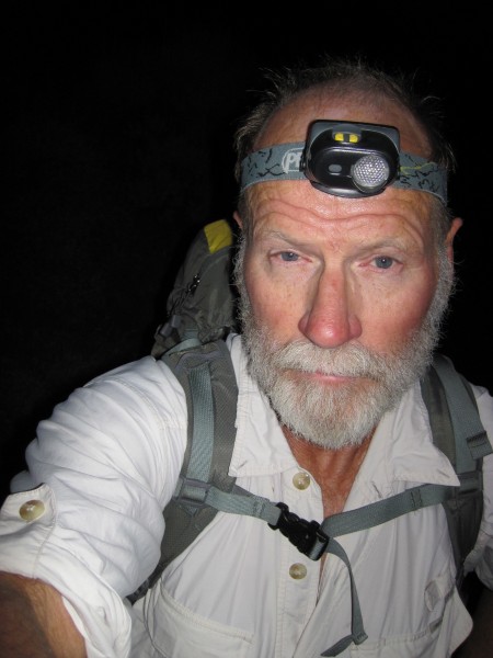 Credit: BMcC |
||
Here are a couple of pictures of the Palisade Glacier and of U Notch from 8/6/08:
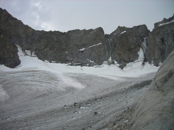 Palisade Glacier, V Notch, Polemonium Peak, and U Notch - 8/6/08 Credit: BMcC |
||
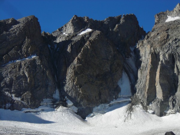 V Notch and U Notch - 8/6/08 Credit: BMcC |
||
Getting there:
 Morning light on V Notch, Polemonium Peak, U Notch, and N Palisade Credit: BMcC |
||
 V Notch, Polemonium Peak, U Notch, and N Palisade - 8/5/10 Credit: BMcC |
||
 Couloirs looking better than 2 years ago - 8/5/10 Credit: BMcC |
||
Bergschrund on V Notch looking not-so-pretty:
 Bergschrund on V Notch - 8/5/10 Credit: BMcC |
||
There was a substantial snow bridge crossing the U Notch bergschrund on the right side, making it trivial to access the couloir. The right side of the couloir did a fine job of receiving and accumulating debris that had fallen from higher up in the gully:
 U Notch - 8/5/10 Credit: BMcC |
||
Some ice making its appearance high in the gully. Lots of loose rock waiting for the right melt out conditions and/or to be kicked or nudged off by other climbers (both parties I encountered on the route were careful and considerate):
 Rock debris high in U Notch couloir - 8/5/10 Credit: BMcC |
||
 Almost icy towards the top of U Notch - 8/5/10 Credit: BMcC |
||
Conditions were soft, easy snow over ice. One melon-sized meteorite jetted by off to my left while I was still relatively low in the gully. Staying to the right while low in the couloir seemed the safer strategy than being out in the middle (higher up I tended towards the middle of the couloir:
 More U Notch rock debris - 8/5/10 Credit: BMcC |
||
Nice view from couloir:
 Excellent weather and views Credit: BMcC |
||
Gear for N Peak:
Helmet (Black Diamond Tracer), semi-rigid pair of crampons (Sabretooths), stiff-soled single boots (Scarpa Freney GTX), and short technical ice tools (leasheless Cobras). The short tools were overkill - a longer-shafted ice ax (like my Black Diamond Venom) would have been adequate.
Gear for Dana Couloir:
Same but used my single longer-shafted ice ax.
Gear for U Notch:
Same as N Peak including short technical ice tools (my single longer ice ax would have been better), plus: a light harness; an old Lowe tuber (ATC); a few runners, biners, and 3 screws (unneeded ballast); and a 70m x 7mm trail/rappel line. As my rap line got stuck repeatedly, I actually ended up re-climbing and then down climbing much of the gully simply down climbing once instead would have saved some time.
Conditions:
N Peak fun styrofoam snow with some ice.
Dana sloppy snow over old ice with some rock debris already making its appearance.
U Notch soft, almost sloppy snow with some ice up high in the couloir lots and lots of loose rocks ready to launch.