 Credit: Jay S |
||
Well here is my last trip report had hoped to do many more but!!
Feb 27th
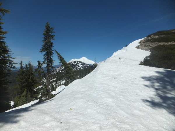
The wind blew all night so zero condensation in my tent this morning. I ski towards Sonora Peak trying to figure out where I should traverse around to the east side of the peak. I briefly consider going to the summit for the potential ski down the north side but I end up in a funky gulley with hard snow that leads to the ridge on the east. My toe barely dents the hard snow as I try to kick steps to proceed upwards. I stay above rocks and trees to catch my fall in the event of a slip. The slope eases back and I round the corner on the side of Sonora Peak with access to the east bowl. I have climbed to high and see my pass below an icy slope. A few careful turns with some side slipping allows a traverse over to the pass above Wolf Creek Lake. The next five miles down the East Fork of the Carson River offer fun touring with enough grade to glide easily through the forest.
I find another god damn balloon in the river
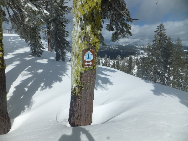
I have not had cell service in a while so I have not been able to load the topo maps on my phone so I am relying on a Halfmile App for PCT hikers that works with the Halfmile maps I have been carrying. I need to climb back up to the crest and it is not obvious where, my map shows the trail climbing up at mile 1028. The app will just tell you how close you are to the actual trail with known waypoints. The app says mile 1028 is still a ways out so I continue skiing down the valley noticing that it is getting cliffy. At this point I realize the map and the app are off a mile or so.
I ski back up the valley and start a traverse up to where I need to be gaining the ridge south of Boulder Mountain. It is nice to be on the crest again. I follow a series of rounded lumps going left or right with some fun short drops. I camp near Bouder Creek making a solid 13 miles today.
The morning is warmer than its been. I hurry to pack trying to make some time. I climb up a gulley to the crest again and decide to drop into Golden Canyon and climb back up the other side instead of traversing. I am greeted with a quick and effortless decent. The climb up the other side is rotten in a few spots but not horrible. Hopefully my friend Chris can meet me at Ebbetts Pass tomorrow with some food as I have one Starbucks coffee packet, one cliff shot with caffeine, 5 cliff bars and two freeze dried meals left and enough fuel to make it all happen.
It is funny how when the terrain gets flatter it is harder to navigate. The rounded humps all look alike and the forest makes it hard to get clear views. I pass point 9,367 and guess where to head next. I can make out the next feature of point 8,982 when the trees allow viewing. I climb up on the side where it opens up for a better view.
Wolf Creek Pass is the low spot here on the crest that the snowmobilers use frequently. I eat a cliff bar and head up to the pass below Tryon Peak. It takes a while to climb up to the pass and I see where the actual Pacific Crest Trail has melted out and head for that carrying my skis the last hundred yards to the top. I have cell service and manage to call Chris in Markleeville. He has the day off tomorrow and could bring some food up to Ebbetts Pass for me but when he finds out I am at the head of Noble Canyon he tempts me to come down for a burger and a beer and says he will walk and ski up to meet me tonight on Highway 4. He tells me something about crossing the stream to get to Highway 4 at some switchbacks. I try to download maps on my cell phone but the signal is to weak. Besides how bad can it be? I should know better than to get off my maps as one time in the Wind River Range I went swimming in a lake with my skis and full pack on and had a really rough day on top of it but that is another story.
I ski right down the main canyon following one brave snowmobile track. I figure If they could make it I will be fine on skis. It tightens down and the snow is soft in the afternoon and I am aware of slide potential. The snowmobile track becomes an obstacle that is best avoided. I cant think of very much I like less than snowmobiles and snowmobilers. The obnoxious sound of them drives me nuts. The whole concept of burning tons of fuel while driving around in circles for lazy fat asses to deny climate change is astounding. The snowmobile track exits the canyon and I continue straight down watching for holes with open water. After several quick miles I exit right. The snow is becoming rotten. I miss the highway switchbacks and dont realize it until I have dropped to low and struggle through deep pockets of rotten snow interspersed with boulders and logs. I eventually find a rough track that I follow that leads to a creek crossing that is big but not dangerous. I plod straight through with ski boots that quickly fill with water and drain my boots on the opposite side. I immediately find the Ebbetts Pass road and I am able to ski a little further as dusk settles in then there is no more snow.
I walk a long ways than see Chris and his dog. It is pitch black and late. It is good to see Chris. We have had many adventures together over the years. It is a long walk to his truck and we get to Markleeville after midnight. So much for a burger and beer.
I spend the next couple of days eating as much as I can and just relaxing. I plan to do the next leg to Carson Pass in 3 days then return to Markleeville. My pack will be light with only three days of food and switching my gear around with a new tent and a lighter sleeping bag.
 Credit: Jay S |
||
March 2
Chris drops me of at the locked gate on Highway 4 early in the morning. It will be another long walk in ski boots to the snow. I check out the ruins of Silver Mountain City with a population of 3000 people in 1866. There is not much left and it is hard to imagine that many people living here in this narrow valley. Makes me wonder what some of our cities will look like in a hundred and fifty years?
I eat a 100mg THC chocolate to help with the boredom when I get to the snow around Silver Creek Campground. It makes the long day more enjoyable. I ski all the way up to the Ebbetts Pass PCT trailhead and fortunately dont see anybody. It is a nice traverse over to Upper Kinney Lake then a climbing traverse to the Mokelumne wilderness boundary. I set up my tent in Raymond Meadows beneath Reynolds Peak hoping to be safe from snowmobilers. I crawl in and eat most of my quick lunch food for dinner and pass out.
In the morning I have to fire up my GPS to find out where I am because a cant recall where I am exactly after yesterdays festivities. More traversing with small drops and climbs in good snow around Raymond Peak leads to Wet Meadows Reservoir. The crest is flat here and I struggle again with route finding to find Tamarack Lake where I camp below its outlet in a descending fog.
It rains for the first time since Mojave then turns to snow and it is a wet night that doesnt freeze hard.
In the morning the snow is saturated so I opt for a lower route traversing around to Upper Blue Lake rather than climbing the steep slopes around The Nipple. I end up following the road to Blue Lake for the next few miles. I ski across blue lake then climb up to the Forestdale divide. I hear a quiet snowmobile approaching. It turns out to be a Forest Ranger on a 4 stroke. He tells me about a new weather system expected the hit the mountains this week then departs.
It is a nice drop to Forestdale creek then a climb up and around the Elephants Back with the first thunder and lightning of the year.
I kick a few steps to gain the ridge then have a nice ski down to Carson Pass. It is wild how there are ski tracks only within a mile or two of roads and then nobody
It is March now and I can feel the winter ending. I saw my first bear tracks this section and will have to be aware of hanging my food soon.
My friend Chris picks me up at Carson Pass where there is a monument to Snowshoe Thompson who carried mail over the Sierra from 1856 to 1876. Thompson used skis over 10 feet long and carried a single pole.
The next storm arrives and I spend a couple of days skiing Kirkwood. It is so different to be surrounded be people and trying to find untracked snow.
The next section I am joined by my friend Chris and his friend Terrance. Terrance has minimal backcountry ski experience but does great on the first day. We camp and break out the whiskey and bowls. The next day is a little trickier and Terrance has difficulties with the Tele setup we gave him.
I take some weight from his pack and discover that he has brought his two foot Bowie Knife for bears. He explains that whoever carries the knife has to jump on the bears back and slit its throat. I cant imagine doing it but Terrance claims to have done so when a bear was in the chicken coup down valley and I have no reason to doubt him. I reluctantly carry the knife with no intention of jumping on a bears back and take a few other items to make it easier for Terrance with his setup.
The snow coming off the pass above Echo is deep and wet and tricky to ski. It becomes dark and I navigate with my phones GPS to reach Highway 50 for our pickup. We arrive after midnight totally worked.
I spend another day or two eating as much as I can the Chris drops me off on Highway 50. It has been a good break but now I am ready to proceed north.
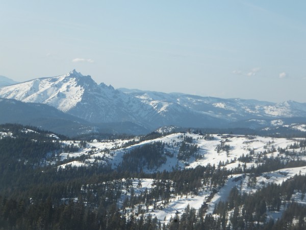
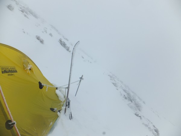
Highlights of the rest of the trip include:
A lot of snow on Dicks Pass
Camping on Alpine Meadows boundary
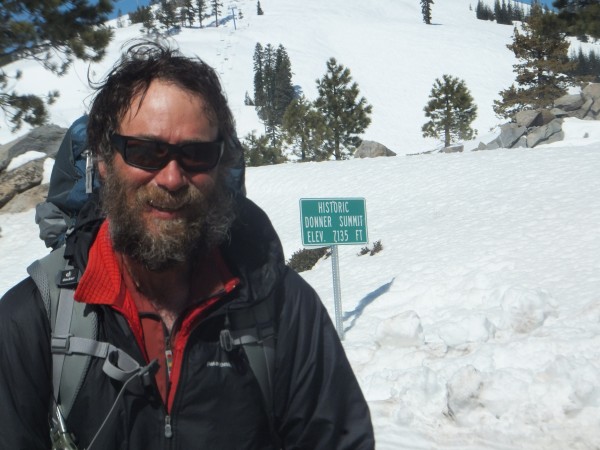
Breaking my solar charger during a fall after Donner
Disillusionment and Getting whiskey Drunk in Chester
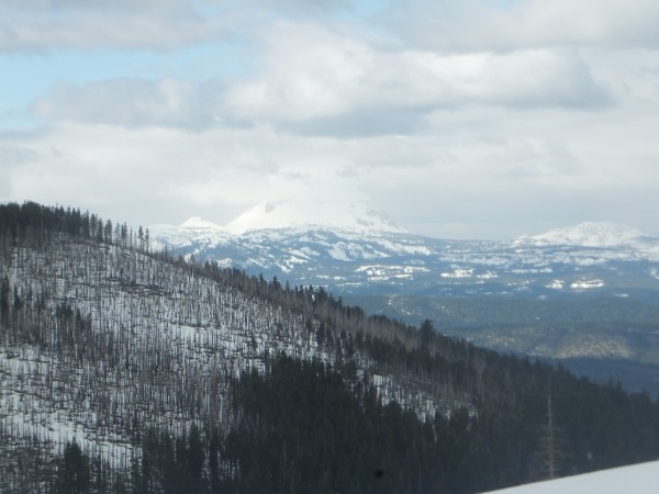
Running out of snow after Mt Lassen
Nice backpacking on the Hat Creek Rim
A Bigfoot forest after Burney Falls
Getting skis again at Mount Shasta
A postal service employee sharing their Dads LSD experience from 1991
Riding the cornices and ridges trying to stay on snow.
Whiskey Ridge where I almost froze to death
Oregon and a last ski off the summit of Mt Ashland
With that every trip must end and I guess the same is true for Supertopos Forum.
My ex-wife used to complain about me spending too much time here but what the hell its been good
JayS
Bold Text
 Credit: Jay S |
||
 Credit: Jay S |
||
 Credit: Jay S |
||
 Credit: Jay S |
||