September 5, 2012
(Carryout Day 1)
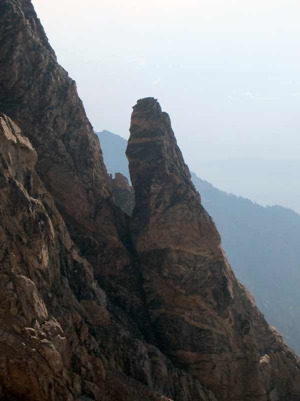
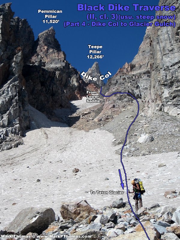
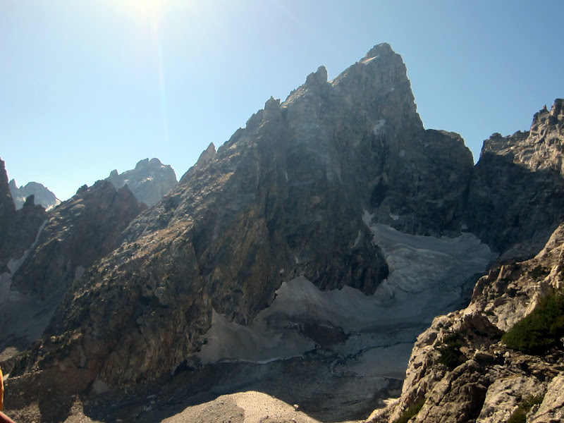
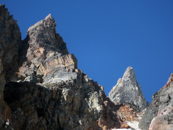 Pemmican Pillar (left) and Teepe Pillar rising above Dike Col. Credit: PellucidWombat |
||
Visit on googleusercontent.com
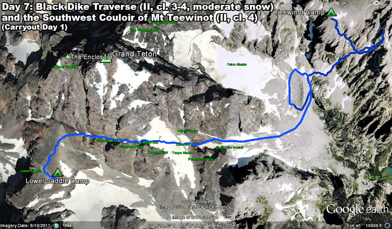
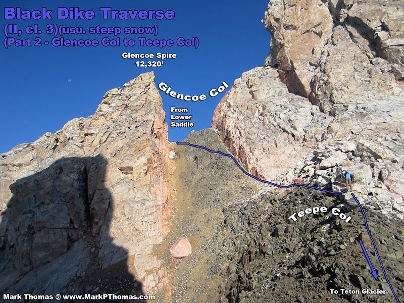
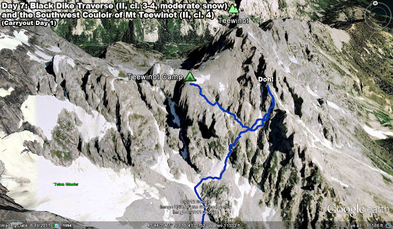
Black Dike Traverse and our day's travels seen from above

Visit on googleusercontent.com
Carryout Day 1
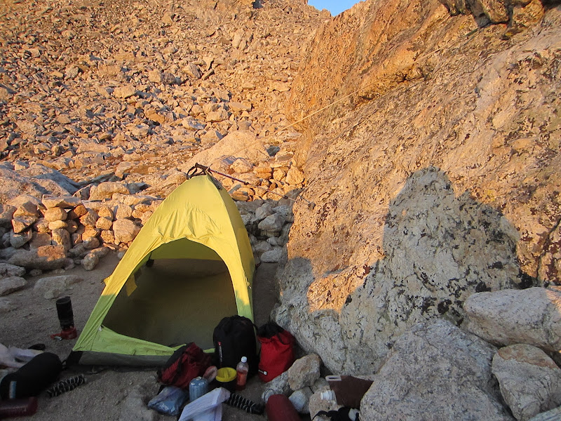
We had become fond of using stays to keep the wind from shaking our tent as much. Upon our return to the Lower Saddle camp the day before, I really got into it. Nerd alert!
Visit on ggpht.com
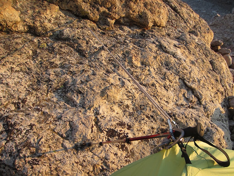
An engineering problem! The aim is to provide a transverse restraint to the top of the tent to reduce wind-induced oscillation. However, the clients desired to keep the sun platform to the east clear of any structure. The solution was to create a tensegrity structure using a tension-only member (alpine sling), anchored to the rock with an SLCD, and a compression-only member, (telescoping hiking pole). Uplift from the wind would cause the hiking pole to fall off of the rock, so the restraints of the compression member were reinforced by post-tensioning the system by telescoping the pole in order to reduce uplift on the compression member. The tent is rigid enough against longitudinal oscillations that no external out-of-plane restraints were necessary.:-)
Visit on ggpht.com
Connection detail of Tensegrity tent system to restrain it against the wind.
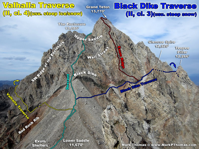
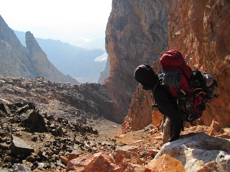
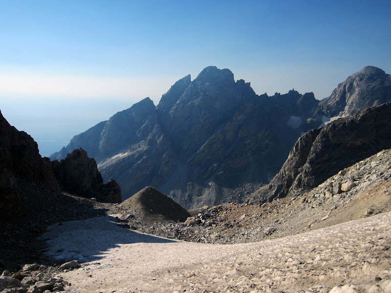
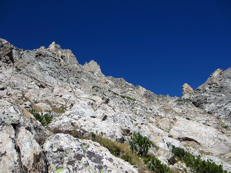
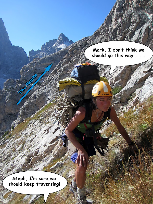
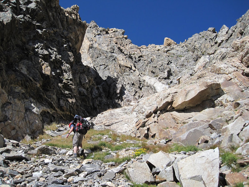
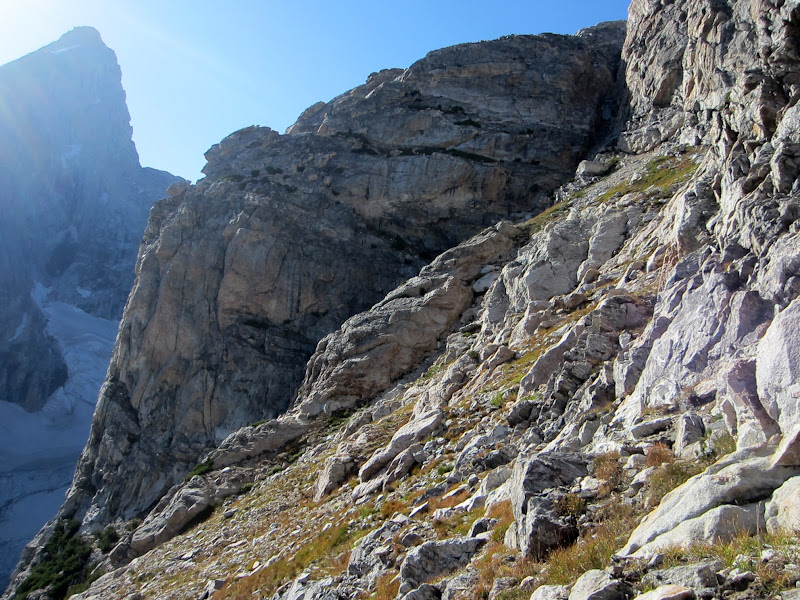
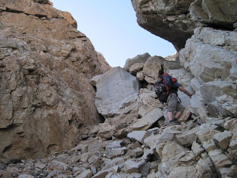
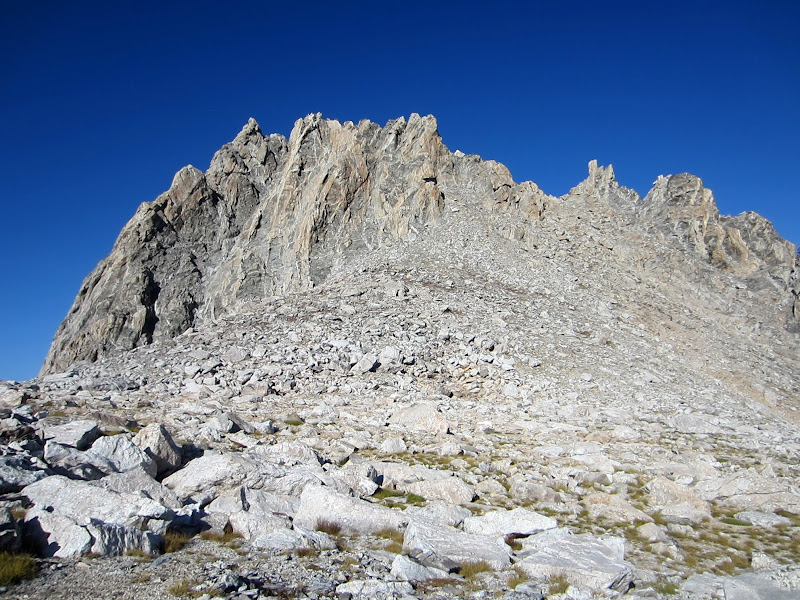
This traverse is the most convenient way to access the North East side of the Grand Teton from the Lower Saddle. As such, it is often used to return to camps near the Teton Glacier after climbing routes like the North Face or the East Ridge. It is also used to access a myriad of nice routes on the Grand itself, as well as some adjacent towers. The routefinding on this traverse is very straightforward, although it has a lot of loose rock. The traverse is probably a lot more enjoyable in earlier season when there is more snow on it - especially on the final long couloir.
Visit on googleusercontent.com
Lower Saddle Area and the first part of the Black Dike Traverse
Visit on ggpht.com
Starting the Black Dike Traverse.

Visit on ggpht.com
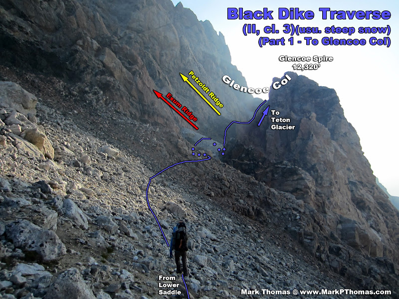
Ascending to Glencoe Col.
Visit on ggpht.com
Optional lower pitches to the Lower Exum Ridge.

Visit on ggpht.com
Base of Petzoldt Ridge.
Visit on ggpht.com
Looking up Underhill Ridge.
Visit on ggpht.com
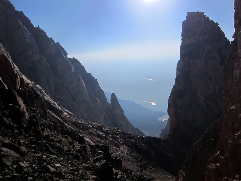
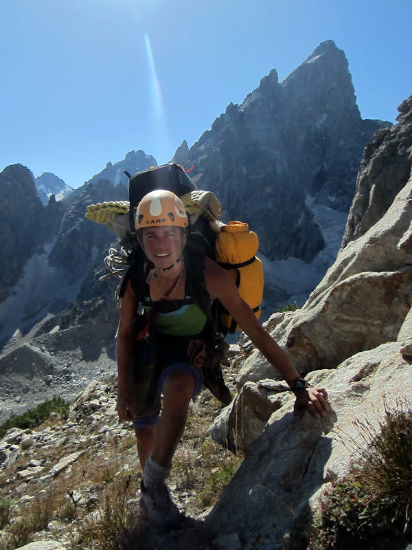
Crossing through Glencoe Col, heading towards Teepe Col. (by Steph Abegg)
Visit on ggpht.com
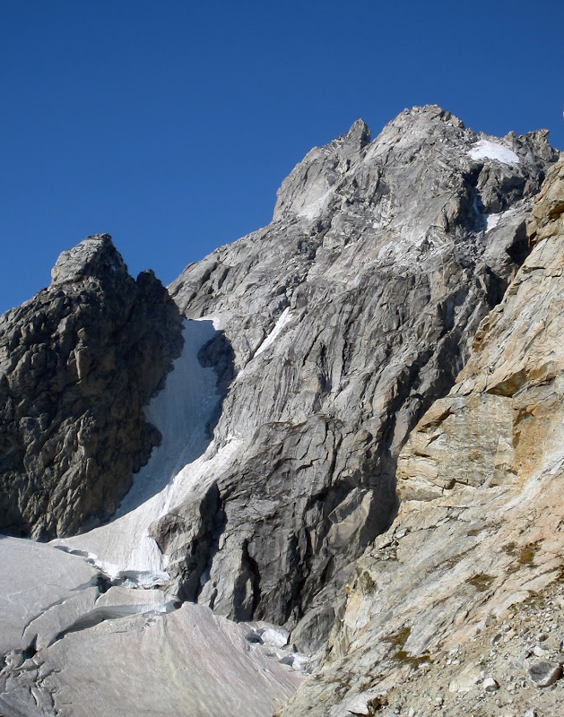
Teepe Col and Dike Col beyond.
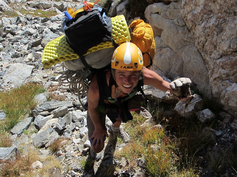
Really the crux of the routefinding was picking the best line down to stay on the least loose of the junky rock. Still, this rock wasn't nearly as bad as the rock on the Valhalla Traverse.
Visit on ggpht.com
Looking at our path descending from Glencoe Col.
Visit on ggpht.com
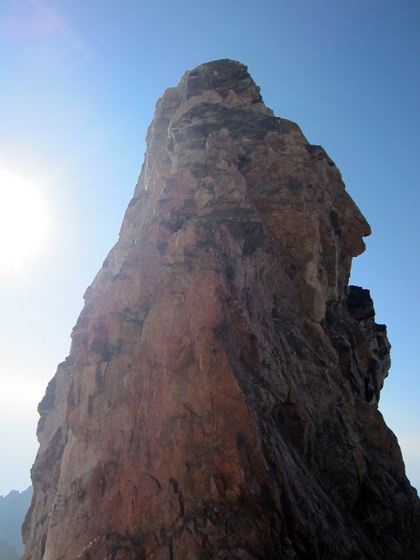
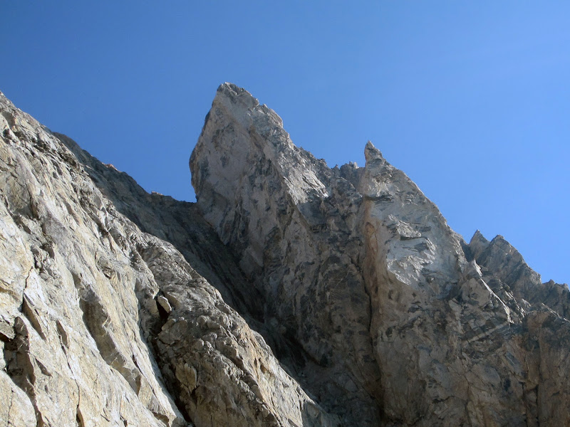
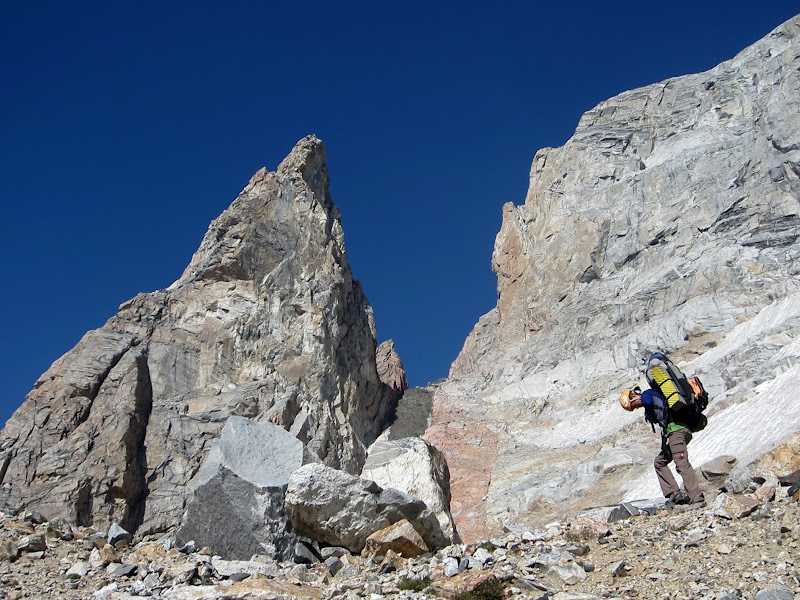
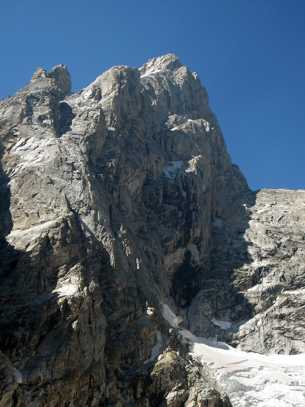
Teepe Pillar.
Visit on ggpht.com
Okie's Thorn from Teepe Col.
Visit on ggpht.com
Second Tower on the East Ridge of the Grand Teton, from Teepe Col.
Visit on ggpht.com
Middle Teton North Ridge seen from Teepe Pillar. Bonney's Pinnacle (left) and Pinocchio's Pinnacle (right) are clearly visible at the base of the ridge.
Visit on ggpht.com
Middle Teton and Middle Teton Glacier seen from Teepe Col. Cloudveil Dome is in the distance on the left.
There is a mandatory glacier crossing, so crampons and an ice ax are always necessary for the traverse. We had an awkward time on the Teepe Glacier, as the recent hail had created a thin layer of slush on top of the ice. I had just barely shed my layers down to shorts and a t-shirt and was attempting to crampon down the glacier in my approach shoes when I took a fall. That slush kept the crampon points from engaging in the ice while creating a nice slippery cushion. So despite the warm sunny weather (for once!) I still managed to get cold and wet today after sliding some 30 ft on the snow before I could self arrest. Steph saw my faux pas and followed much more carefully.

Visit on ggpht.com
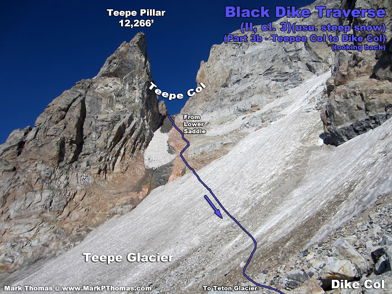
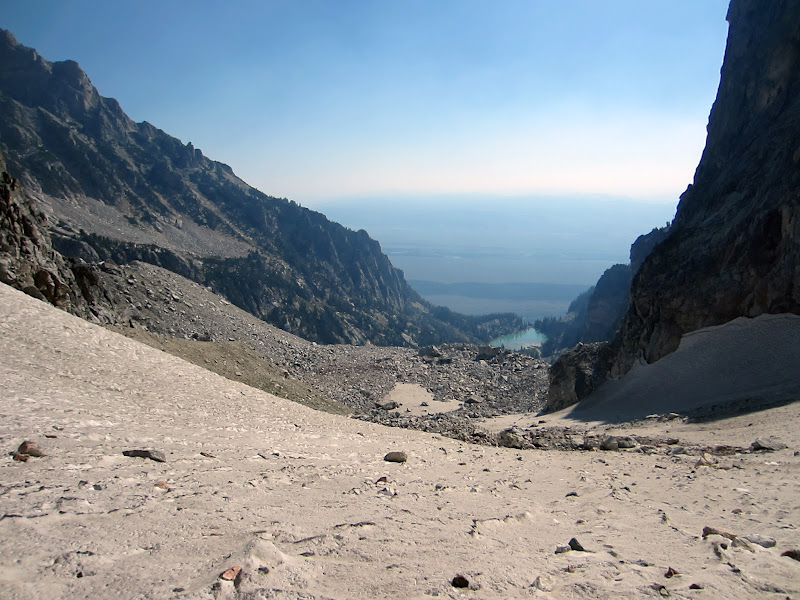
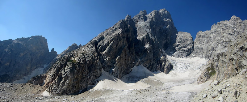
Black Dike traverse from Teepe Col to Dike Col.
Visit on ggpht.com
Black Dike traverse from Teepe Col to Dike Col.
Visit on ggpht.com
Teepe Glacier & Nez Perce. There are Exum Guide huts at the far end of the moraine here. Take note, when we knocked some rocks loose, they went to the far end of the glacier and smashed into the terminal moraine. Don't hang out there!
Visit on ggpht.com
Middle Teton glacier route.
Visit on ggpht.com
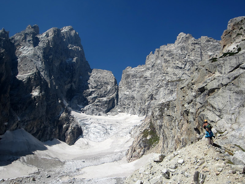
Steph and Teepe Pillar & Col, from Dike Col.
After crossing the Teepe Glacier, we reached the final part of the traverse, which descends a little over 1,000 ft straight down the Black Dike Couloir. This couloir was nearly completely melted out, and with conditions looking similar to the Teepe Glacier, we didn't like the idea of changing back into our crampons to downclimb much steeper terrain. Fortunately we managed to stay on rock to the side most of the way down.
Visit on googleusercontent.com
Black Dike Traverse, seen from the East on the valley floor
Visit on ggpht.com
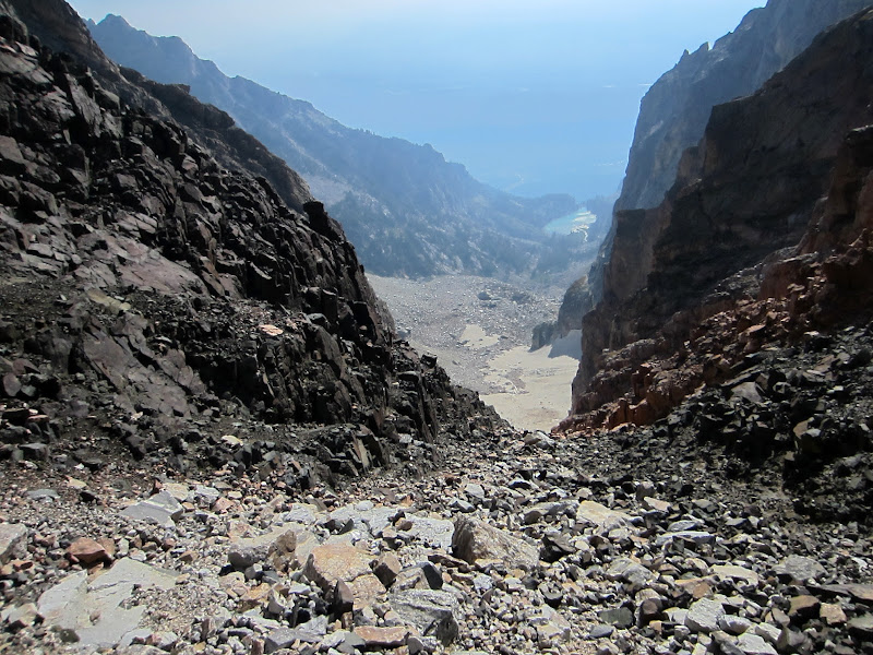
Descending the +1,000' crap chute that is called the Black Dike Couloir. I think this is better when covered in snow . . .
Visit on ggpht.com
Descending the Black Dike Couloir. Loose crud abounds. Wind actually caused some rockfall in here, that reached the terminal moraine below. (by Steph Abegg)
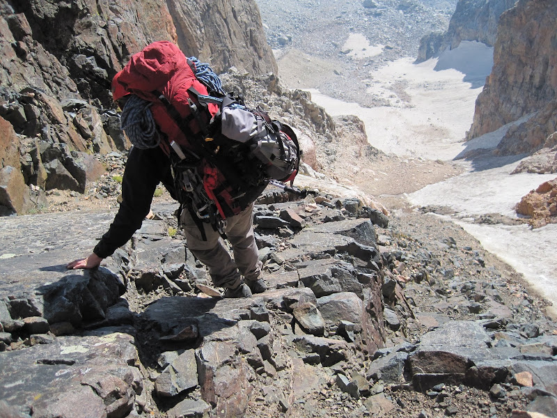
About 2/3 down we cut skier's left into another chute to stay on better rock. There was one step here that was too awkard to downclimb with the packs, so we lowered them on the rope and continued along.
Visit on ggpht.com
Descending the Black Dike Couloir. This was tedious, but not nearly as scary as the Valhalla Traverse. (by Steph Abegg)
Visit on ggpht.com
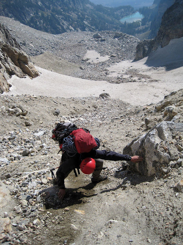
Nearing the Teton Glacial moraine. Wind send rocks flying down the Black Dike Couloir, that zipped past us on the snow and smashed into the rocks of the terminal moraine ahead. A good reason to stay out of the fall line, as we were safely to the side of that!
Visit on ggpht.com
Looking back up the garbage chute to Dike Col.

Visit on ggpht.com
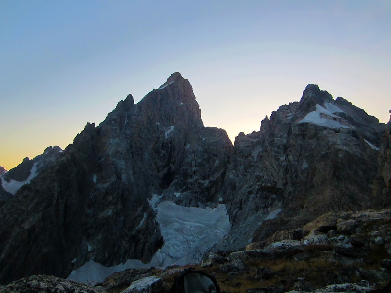
Pemmican Pillar (left) and Teepe Pillar rising above Dike Col.
After the Black Dike Traverse, we contoured around on the Teton Glacier terminal moraine with plans to access the tarn lake. We intended to hang out here for a few hours to have lunch and enjoy the great views of the North East side of the Grand Teton. Also, since our camp on Teewinot would have no source of water, we needed to top off our water here for the slog up to the night's camp.
Visit on ggpht.com
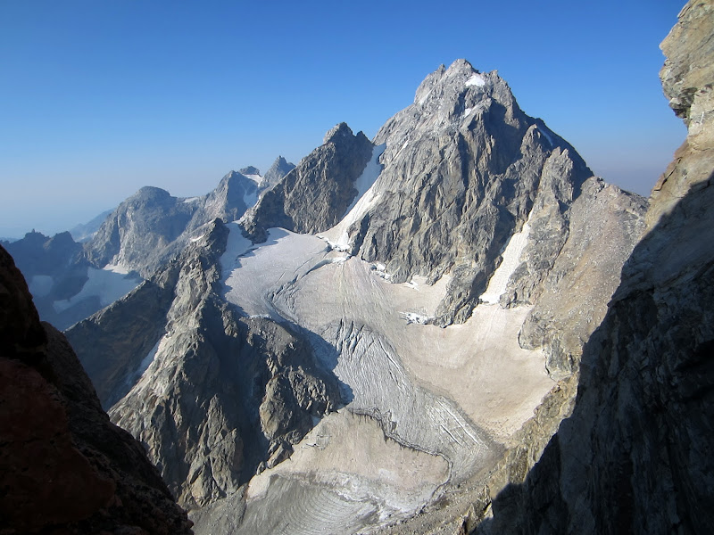
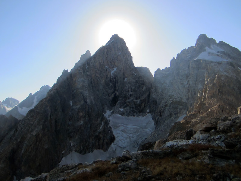
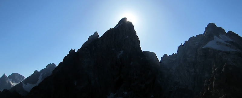
Panorama of the East Ridge of the Grand Teton, and Teton Glacier. The East ridge route rises 3,000' from here to the summit.
Visit on ggpht.com
Steph taking photos from the Teton Glacial moraine.
Visit on ggpht.com
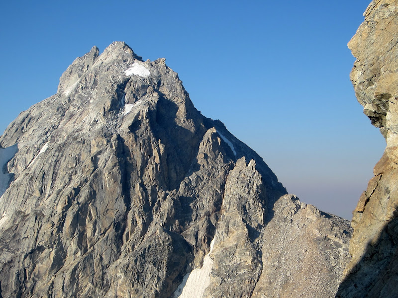
Grand Teton N Face from the Teton Glacial moraine.
Visit on ggpht.com
Steph relaxing at the tarn area.
Visit on ggpht.com
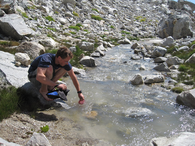
Refilling water at the tarn area. We stocked up on a lot as this was our last water source until we made it back to the car the next day. Yummy glacial silt! (by Steph Abegg)
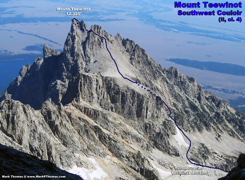
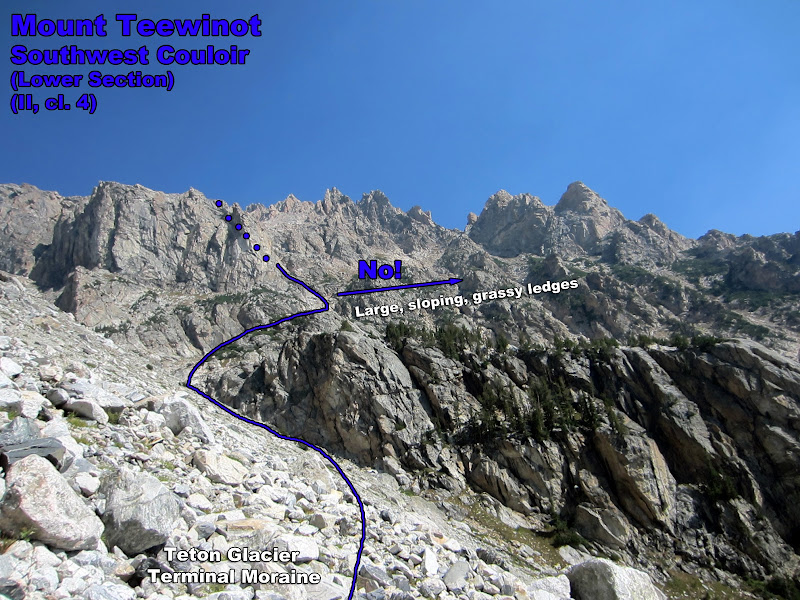
"Contour east for several hundred feet before turning up to the high, flat plateau west and slightly south of the summit of Teewinot. Some of the couloirs leading to this plateau are difficult and require careful routefinding."
 Ortenburger & Jackson, A Climber's Guide to the Tetons
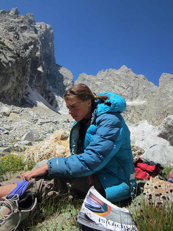
We hadn't yet gotten off route today, so things still weren't quite right. Fortunately we still had the climb up the Southwest Couloir of Mt. Teewinot. Instead of telling us where to go, the guidebook told us in so many words to not get lost and gave misleading information. The accompanying aerial photo also made the lines look very straightforward.
Visit on googleusercontent.com
Wanderings up the backside of Mt Teewinot
Visit on googleusercontent.com
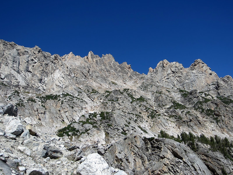
The SW Couloir on Mt Teewinot, seen from the Second Ledge on the North Ridge of the Grand Teton
So after lounging at the tarn lake and river, we loaded up our water (4 liters for me, 6 liters for Steph and her '30 lb' pack) and began the slog.
Visit on ggpht.com
Looking at the SW Couloir route of Teewinot.
The terrain got steep in a hurry and we couldn't match the aerial photo at all to where we were. Eventually we got cliffed out, but I found a way climbing left, around some rappel slings, that seemed to work at about class 4. Things steepened again and I headed a bit right and straight up a low 5th class corner. Steph looked a bit harder and found a class 3 way around to the right.
Visit on ggpht.com
Teewinot SW Chute. This looked much more straightforward from the annotated aerial photo :-P
Visit on ggpht.com
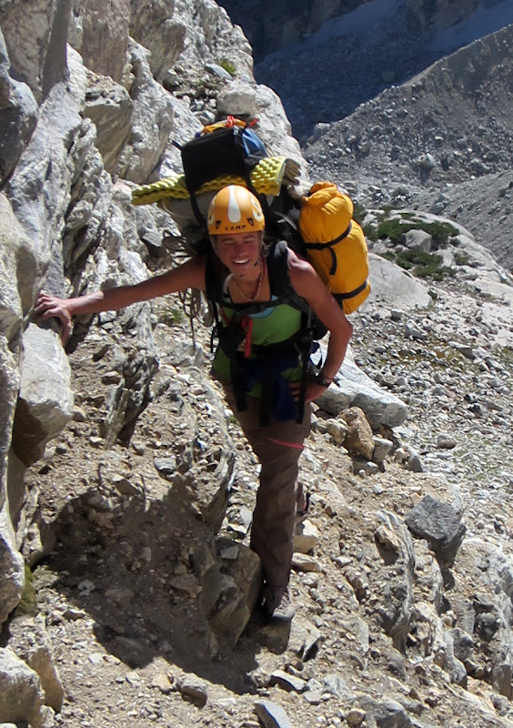
Steph getting in some cardio with her '30 lb' pack, loaded with 6 liters of water!
Visit on ggpht.com
Steph enjoying carrying her '30 lb' pack up the first leg of the SW Couloir.
Visit on ggpht.com
Grand Teton seen from the SW Couloir of Teewinot.
Once we reached the large grassy ledge, we headed right for several hundred feet before looking for a way up and left. None of the chutes looked very reasonable, but the way ahead looked good and seemed to arc around and up to where we wanted to go anyways, so we continued up the grassy ledge.
Visit on ggpht.com
Routefinding up the SW Couloir of Teewinot.
Visit on ggpht.com
Steph slogging up the SW Couloir of Teewinot. The grassy sloping ledge was a nice change of pace from the Black Dike Traverse. The hot conditions were also a nice change of pace from the last few days!
Visit on ggpht.com
SW Couloir of Teewinot routefinding. If you see this, then you're already off route :-P
Visit on ggpht.com
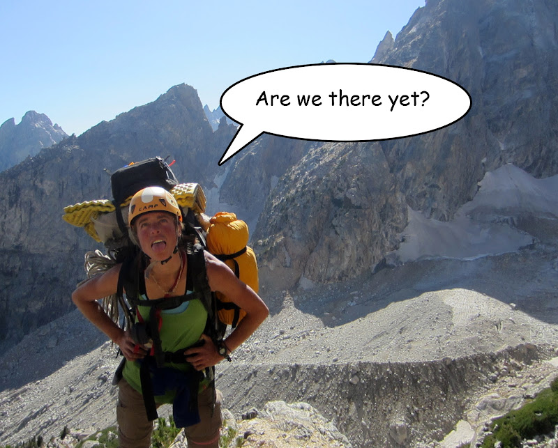
Steph doubting my routefinding.
Visit on ggpht.com
Heading the wrong way. (by Steph Abegg)
Visit on ggpht.com
Steph holding the remains of the last climber who came this way.
It turns out this is the wrong way. As we rounded the corner our path got much steeper. Rather than moving slowly through steep rock with our heavy packs on, we took them off to do a recon higher up. Scrambling up we hit a knife edge ridge and got cliffed out. Oops! At least by looking back I could see better were we had wandered and where we should probably go. We gathered our packs and with only about 30 min time wasted, were back on route.
Apparently the guidebook should have said "as soon as you reach the large grassy ledge, turn left immediately, and head up the nearest large chute". This would have been a much better way to describe the best route. We were able to traverse high into the chute, which appeared to be blocked by a huge chockstone. There was an opening to the right that offered pretty reasonable class 3-4 scrambling, and a short ways higher I saw a good way to traverse out left and onto the western plateau.
Visit on ggpht.com
Course correction. At least I could intersect the couloir higher up! The rib drops off, but there is a ledge that nicely traverses into the couloir at the highest point before the wall.
Visit on ggpht.com
Reaching the crux of the SW Couloir. (by Steph Abegg)
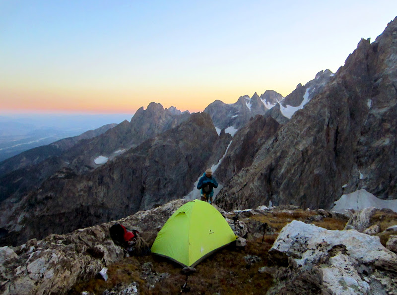
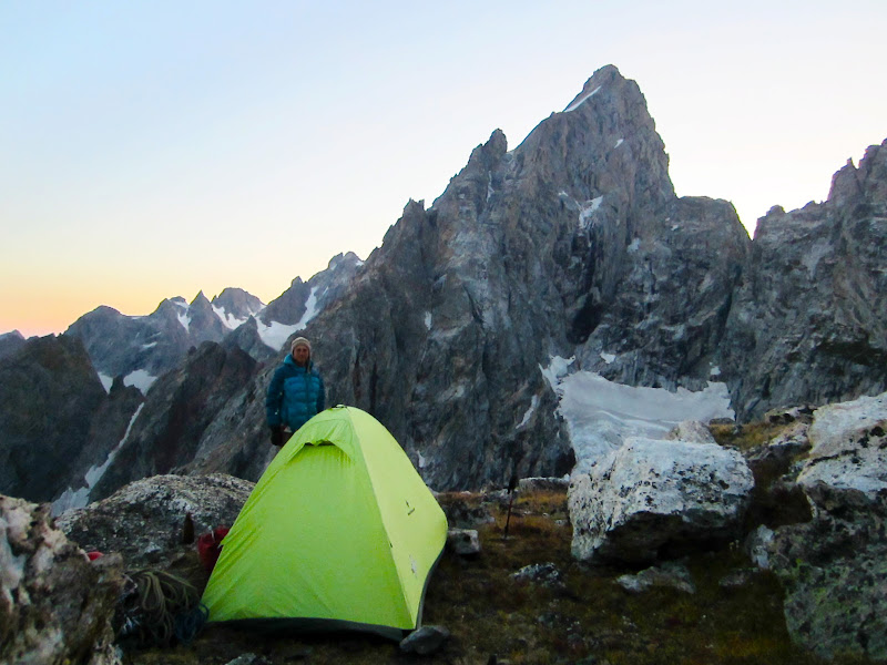
We quickly found a campsite with superb views and settled down for an evening, night, and morning of photography bliss.
Visit on ggpht.com
Teewinot seen from our spiffy new campsite.

Visit on ggpht.com
Nez Perce (left), Cloudveil Dome (center), South Teton (right), Disappointment Pk (foreground, left), Red Sentinel (foreground, center), and the 3 pillars ending with Pemmican Pillar (foreground, right).
Visit on ggpht.com
Grand Teton eclipse.
Visit on ggpht.com
Grand Teton eclipse.
Visit on ggpht.com
Grand Teton at sunset.
Visit on ggpht.com
Steph and our camp at sunset.
Visit on ggpht.com
Steph at camp with the Grand Teton behind at sunset.
Visit on ggpht.com
Stars above the Grand Teton & Owen. 5min exposure.
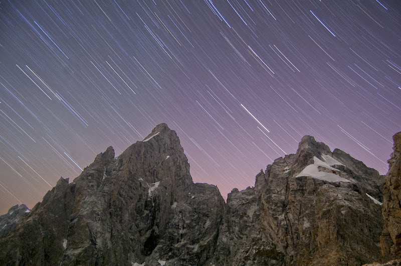
Visit on ggpht.com
30 min exposure of the Grand Teton & Mt Owen.
Visit on ggpht.com
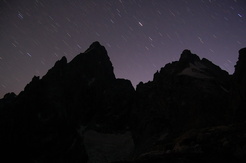
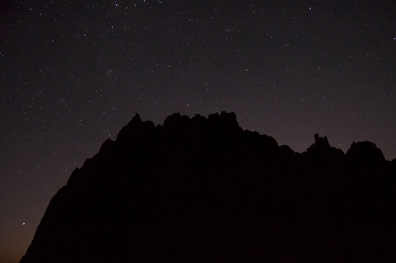
Stars above Teewinot.

Visit on ggpht.com
Moonlit night over the Tetons.
Links
Personal Website
Picasa Photo Album
Day 1: Garnet Canyon Approach and the North Ridge of Middle Teton (II, 5.6)
Day 2: Complete Exum Ridge of the Grand Teton (III, 5.7)
Day 3: The Valhalla Traverse (II, cl. 3-4, steep ice/snow, rockfall & icefall hazard)(Carryover Day 1)
Day 4: Serendipity Arete of Mt Owen (IV, 5.9, 15P)(Carryover Day 2)
Day 5: Owen-Grandstand Traverse (II, 5.7, 3-5 rappels)(Carryover Day 3)
Day 6: North Ridge of the Grand Teton (Italian Cracks Variation)(IV, 5.7) (Carryover Day 4)
-
Day 8: Mt Teewinot via the Southwest Couloir (II, cl. 4) and East Face Descent (II, cl. 4)(Carryout Day 2)
Day 9: Southwest Ridge of Symmetry Spire (II, 5.7)