September 1, 2012
(Carryover Day 1)
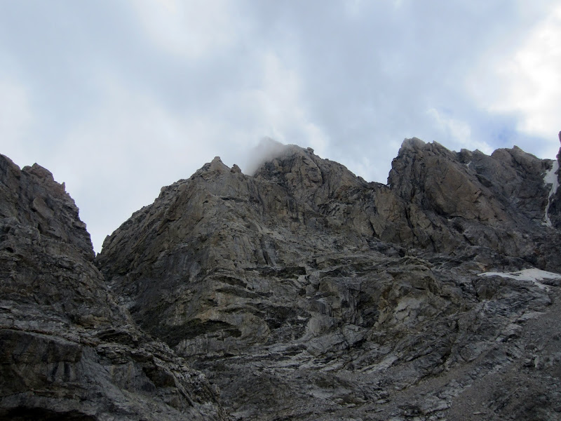
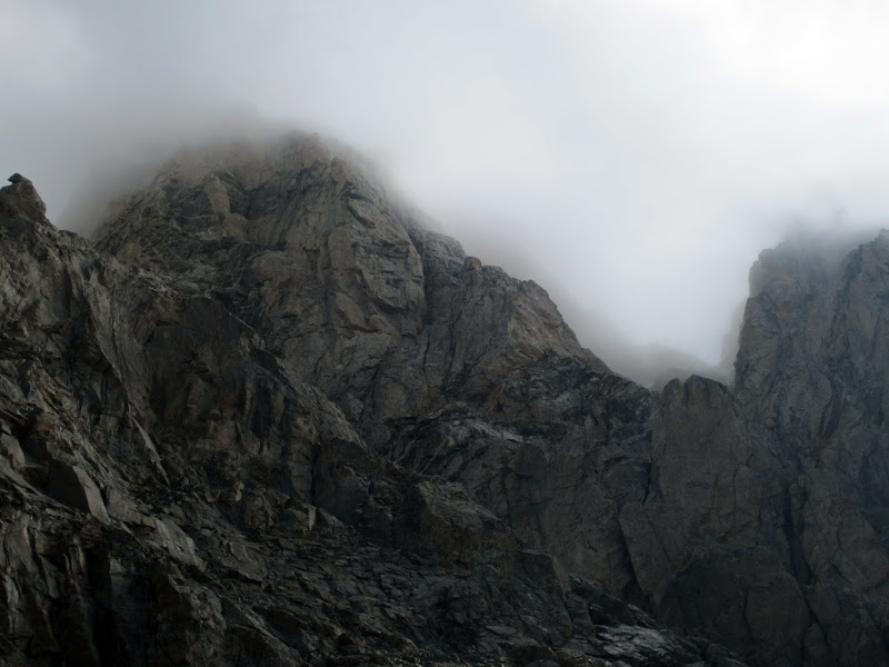
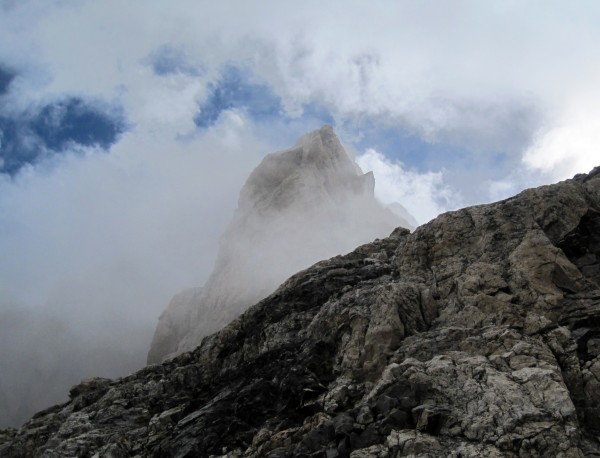 The Enclosure enshrouded in clouds, seen on the Valhalla Traverse. Credit: Steph Abegg |
||
"This [Valhalla] traverse is a serious undertaking, as even in the driest of conditions one can expect to find ice and wet rock. In certain sections the rock is of the poorest quality, and belay anchors and protection are difficult or impossible to obtain."
 Ortenburg & Jackson, A Climber's Guide to the Teton Range.
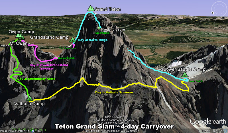
The Carryover Idea
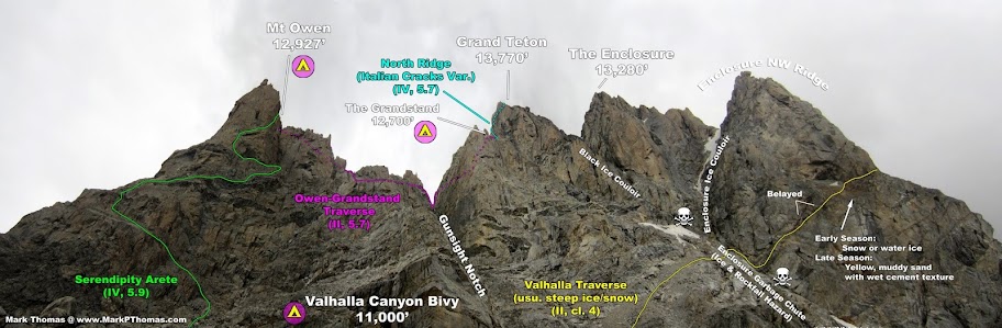
With careful reading of guidebooks and time spent farting around on Google Earth, I had pieced together several multi-day traverse ideas around the Grand Teton that could allow us to minimize the effort needed to link up various climbs in the area in one trip. The largest linkup I had dreamed up was to traverse from our base camp at the Lower Saddle over to Valhalla Canyon. There we could gain the Grandstand via the classic Serendipity Arete on Mt. Owen and a traverse from that summit (although one could directly climb the Grandstand from Valhalla Canyon). The Grandstand would serve as our launching point for climbing our main objective of the carryover - the North Ridge of the Grand Teton, from which we could then return to our remaining gear cache at the Lower Saddle.
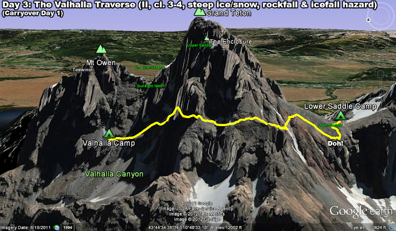
The Valhalla Traverse was the key to us achieving this ambitious linkup as we could make a complete loop from the Lower Saddle without any need to hike back out. It was a wonderful idea, but it was also ambitious. We had originally planned to do the Valhalla Traverse the same day as the Complete Exum Ridge (the guidebook said we only needed 3-4 hrs to do the traverse), then climb Serendipity Arete to the Grandstand in a long day, and then finish climbing over the North Ridge. This would mean we would spend 2.5 days and 2 nights doing the linkup.
However, conditions on the Exum slowed us up enough that we decided not to tempt fate with the Valhalla Traverse that day, so we left an entire day for it, on the worst weather day forecast for our trip. Since I was wary about any additional weather slowing us up, we decided to pack for 4 full days and 3 nights' worth of food and fuel just in case we were delayed a day. It was good we did this, since the storms on our first day, combined with the cold and windy weather on the days after made us take 4 days to do the linkup instead of 2.5!
For the record, it took us about 3 hours to do the traverse from the Lower Saddle to the West Gunsight Couloir. This traverse might be done faster with lighter packs, though it often might be slower as there is normally more snow and ice on the route. The Teton NPS maintains a good web blog on route conditions in the area, and they often include conditions on this traverse.

Visit on googleusercontent.com
The 4-Day Carryover Seen from Above
Visit on googleusercontent.com
The 4-Day Carryover Seen from the West
Visit on googleusercontent.com
Our path for the Valhalla Traverse, seen from the West

Visit on googleusercontent.com
The beginning of the Valhalla Traverse heading out from the Lower Saddle
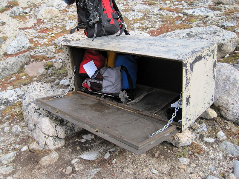
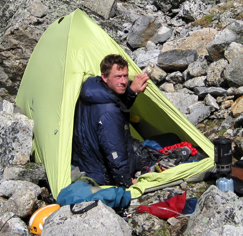
Steph and I woke early the next day, with gear packed for the multi-day carryover and the extra food, fuel, and luxuries packed separately to be left at the Lower Saddle as a cache. There was a food storage box that was convenient for this, to keep our gear dry and safe from varmints.
Visit on ggpht.com
Caching the gear that we're not taking over on the traverse. (by Steph Abegg)
Visit on ggpht.com
Leaving my crap behind. Don't worry, I packed it out in the end, and I left it underneath the locker instead of inside :-P (by Steph Abegg)

Visit on ggpht.com
Middle Teton North Ridge seen from the Lower Saddle.
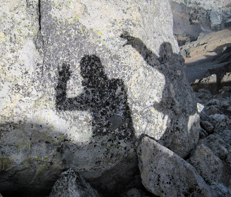
The terrain seemed to have dried out well from the storms the day before, and we had a playful, leisurely start to our day as we began the traverse.
Visit on ggpht.com
Shadow hand puppet attack. (by Steph Abegg)
Unfortunately we were also casual on following directions and thought we were supposed to aim much lower on the ridge on the horizon. We descended about 200 ft from the Lower Saddle before realizing that we should have ascended halfway to the Black Dike, and ultimately reach the skyline at approximately the same altitude at a large cairn visible from the Exum huts.
Doh!
We slogged back up the hill, angling for the top of the red rock rib that is the first feature on the traverse. We seemed to be making a habit out of starting off route each day . . .
We rounded the top of the red rock rib, and descended a chute of loose, red rock for about 200 ft before cutting across some little ridgelets. Occasionally there were cairns along the way to mark the route.
Visit on ggpht.com
Steph beginning the Valhalla Traverse. You end up on top of that gray shoulder ahead.

Visit on ggpht.com
First chute to ascend on the Valhalla Traverse.
Visit on ggpht.com
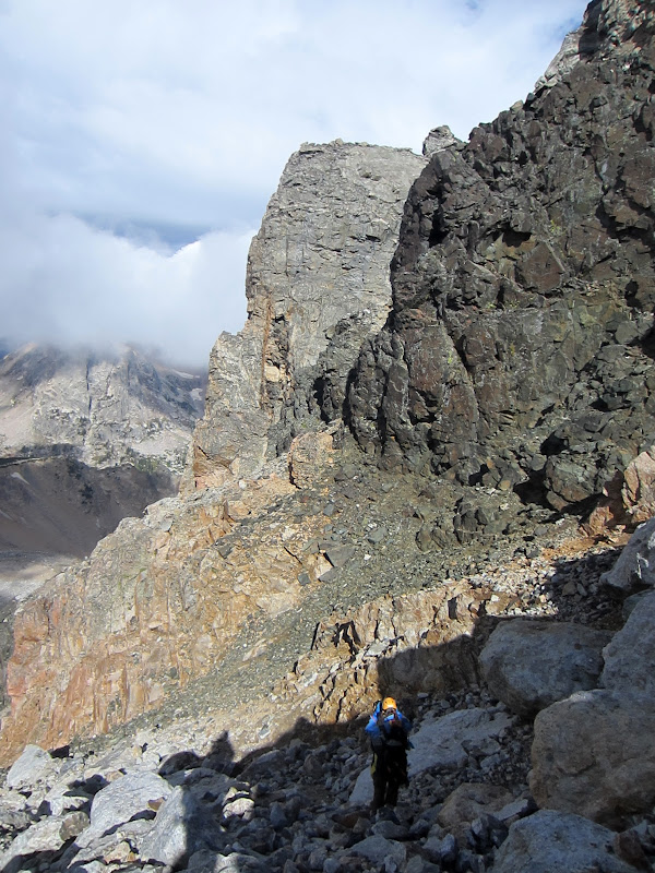
Looking back at the Lower Saddle.
Visit on ggpht.com
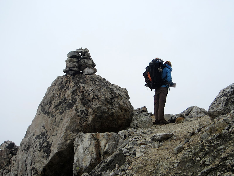
Steph routefinding at the big cairn. This cairn is visible from the Lower Saddle.
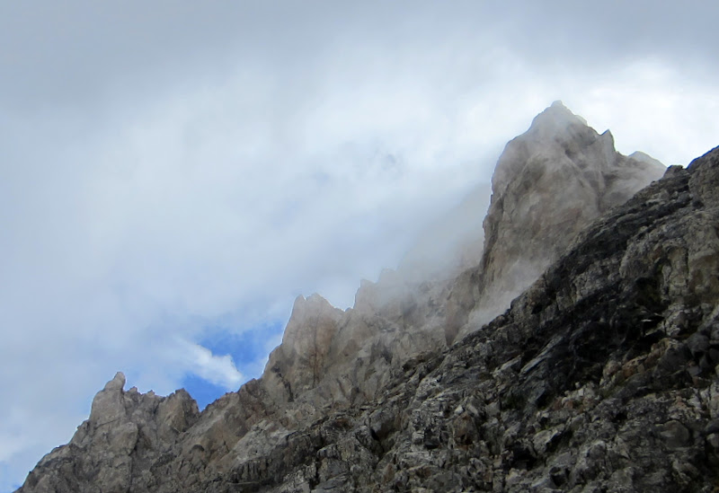
As we rounded the West Ridge of the Enclosure, we lost sight of the Lower Saddle and were treated to eerie views of the seldom seen side of the Grand Teton and Enclosure.

Visit on ggpht.com
The Enclosure in the clouds. (by Steph Abegg)
Visit on ggpht.com
The Enclosure in the clouds.
We traversed a long, broad, easy slope that usually holds snow for most of the year. By now it was completely melted out and made for easy class 2 travel. Since snow often persists late into the year on this traverse, there are bivy sites near the Northwest Ridge of the Enclosure where climbers can gather snow for water and get a head start on any of the routes climbing up the Enclosure.
Visit on ggpht.com
Steph on the broad, easy ledge traverse. You go down a bit, and then back up to the horizon near the large boulder.
Visit on ggpht.com
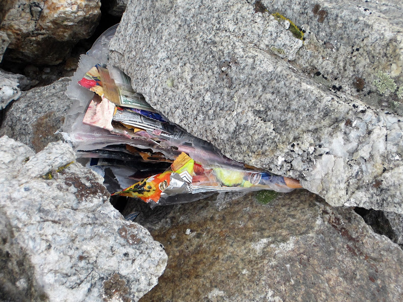
Climbers who do this: YOU SUCK!!
Unfortunately, we found a lot of trash at this nice bivy site. At least the climbers packed it all into a few bags and pinched it down in the rocks, but it still seemed very irresponsible. If you are strong enough to do climbs back here, you are strong enough to carry out your GU wrappers! We took some trash but there was too much for us to reasonably pack out.
Visit on ggpht.com
Enclosure Bivies.
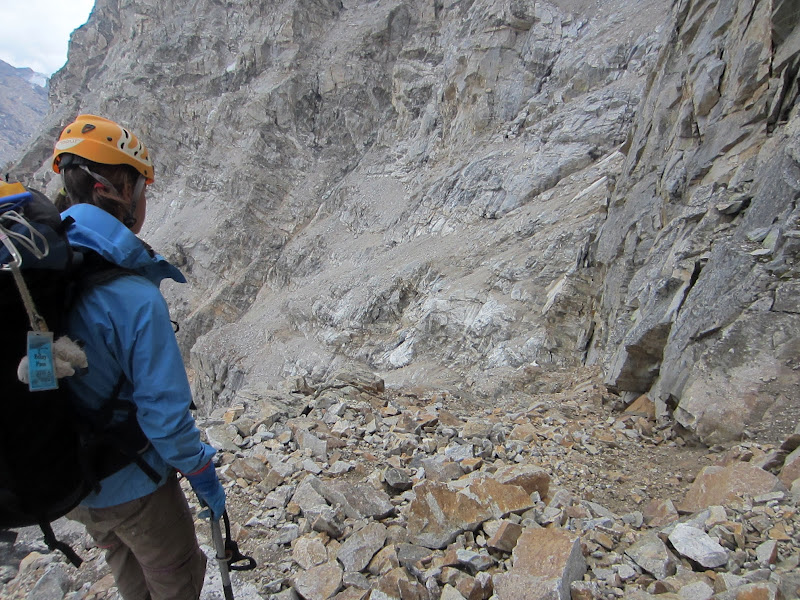
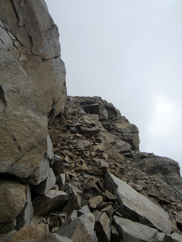
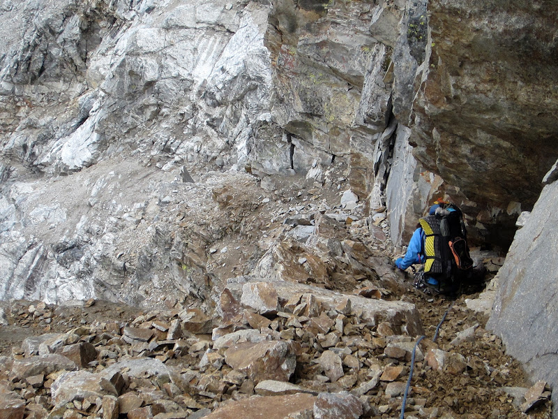
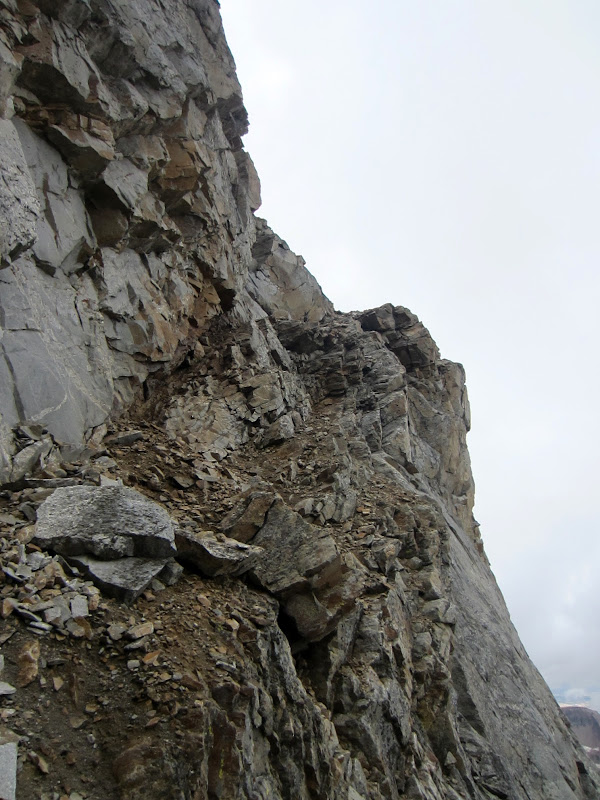
From here the route ascends a short class 2-3 step as it rounds the corner and narrows. The ledge gets much narrower, but is still an easy class 2 ledge that wraps around one more ridgelet before the final traverse and descent into Valhalla Canyon. This last section is the crux of the traverse and is much more serious than the rest of the traverse.
"The traverse becomes a very serious proposition from this point on."
Ortenburg & Jackson, A Climber's Guide to the Teton Range.
Visit on ggpht.com
The Crux of the Valhalla Traverse, seen from our camp across West Gunsight Chute, beneath Serendipity Arete
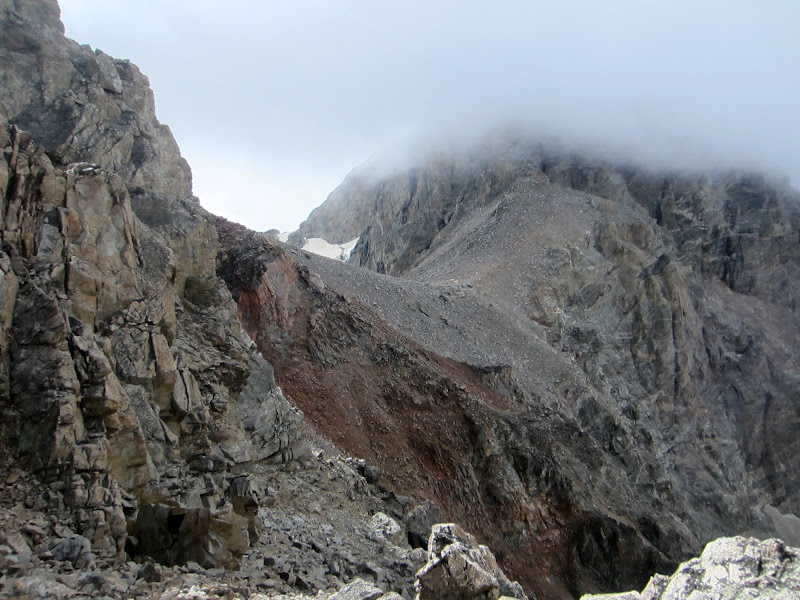
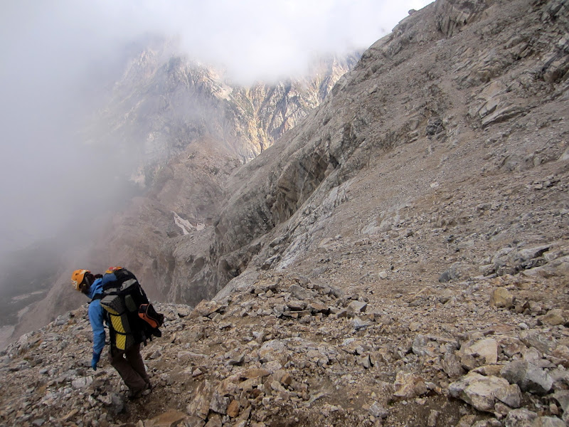
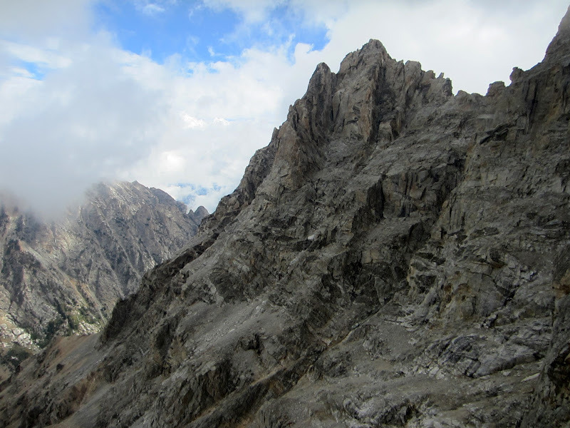
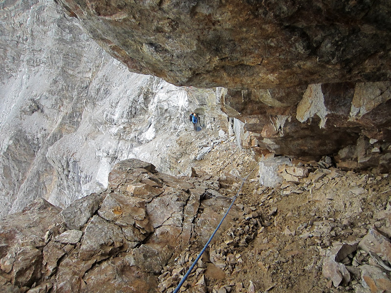
As we rounded the corner we were taken back by the sudden expansive views of Upper Valhalla Canyon, with Mt. Owen and it's long Serendipity Arete as well as the Grand Teton and it's rugged Grandstand towering up amidst the swirling clouds.
Visit on ggpht.com
Mt Owen and Serendipity Arete from the Valhalla Traverse.
The terrain also dropped away from us at a dizzying angle, and the entire escarpment seemed treacherously loose. Far ahead and below we could see the broader lower angle ledges beneath the grandstand, but there did not seem to be a feasible way to get there.
Visit on ggpht.com
Target ledges, so far away and below. As this corner is rounded, everything looks very exposed.
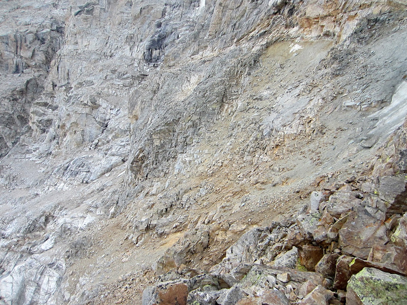
"From this small ridgelet a small bowl can be seen immediately down and to the east. (In late season the climber will encounter in this bowl curious, yellow, muddy sand with the texture of wet cement; in early or late season the bowl will contain snow or even water ice.)
If one wishes to gain access to Valhalla Canyon itself or the west face of the Grandstand for routes such as the North Ridge, West Face, and Northwest Chimney of the Grand Teton, climb carefully down into this bowl. "
Ortenburg & Jackson, A Climber's Guide to the Teton Range.
If one wishes to gain access to Valhalla Canyon itself or the west face of the Grandstand for routes such as the North Ridge, West Face, and Northwest Chimney of the Grand Teton, climb carefully down into this bowl. "
The late season description was spot on for us. As we descended into the bowl, we encountered a sad-mud-rock slurry that was a distinct yellow color and seemed very similar to wet cement. As Steph is a veteran of many loose North Cascade adventures, she was less apprehensive than me about descending into this steep exposed bowl. Where the terrain was too loose to downclimb without slipping, she just sat down to slow down and stabilize her sliding. It was a strange technique of half sliding on one's butt while also somewhat downclimbing with one's arms and legs.
Visit on ggpht.com
Steph on the cement slurry downclimb buttslide.
Once Steph was on more level ground and clear of rocks I would surely be sending down, I followed along, getting my butt and pack bottom smeared with yellow mud.
Visit on ggpht.com
Following the slurry cement section. (by Steph Abegg)
"At the bottom of the bowl a narrowing, scree-and-ice-covered ramp will be seen descending down and to the east. Continue (with great caution) down along this ramp to its lower end, where an expanse of ice or snow must be crossed to gain the shelves leading toward the Grandstand."
Ortenburg & Jackson, A Climber's Guide to the Teton Range.
The first part of this ramp looked OK, but we could already appreciate how sketchy this entire section would be with snow and ice.
Visit on ggpht.com
The ledge gets better, but begins to narrow.
Visit on ggpht.com
Looking back up.
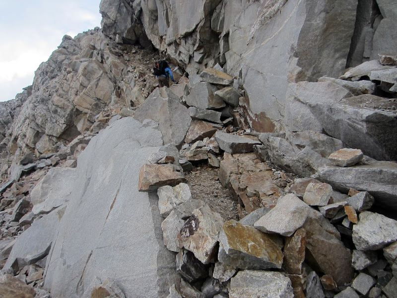
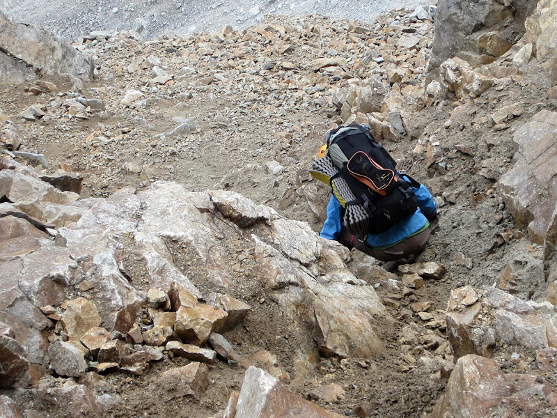
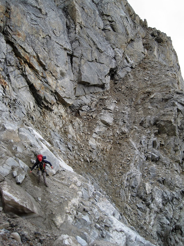
Eventually the ramp became quite serious as it narrowed to just a few feet on a sloping ramp-slot that seemed as if it would dump the unwary climber off the precipice to the side. This slab was covered with sand, scree, and fractured rock. Looking ahead I could see that there might be potential for some pro. At the very least I could see where a gear anchor could be made to belay the follower in to limit the consequences of falling on this crux. There was no anchor at our position, but there was a solid rock shaped well to be slung, so I slung the block and put Steph on belay. She downclimbed this slot (class 4?), placing a few solid pieces as she went. Although the guidebooks said "belay anchors and protection are nearly impossible to obtain", at least we were able to do so at the crux! I can only imagine how this slot would be when covered in ice and chock full of snow.
Visit on ggpht.com
Belaying Steph down the crux section. She placed some gear to protect my follow and belayed at the large crack beyond. This section was an awkward cl. 3-4, very loose, with fatal fall consequences. Apparently it normally has snow and ice on it.
Visit on ggpht.com
Following the crux downclimb.
Visit on ggpht.com
Looking back up the crux.
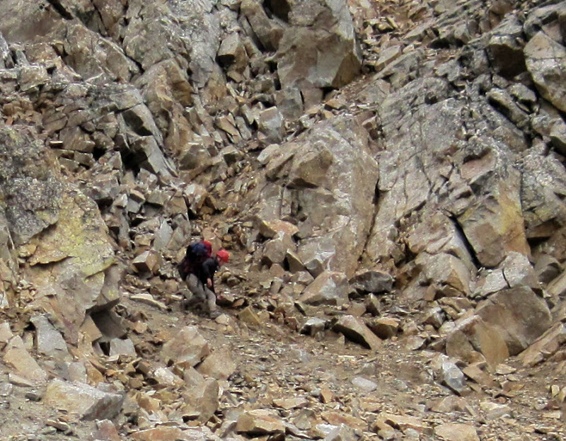
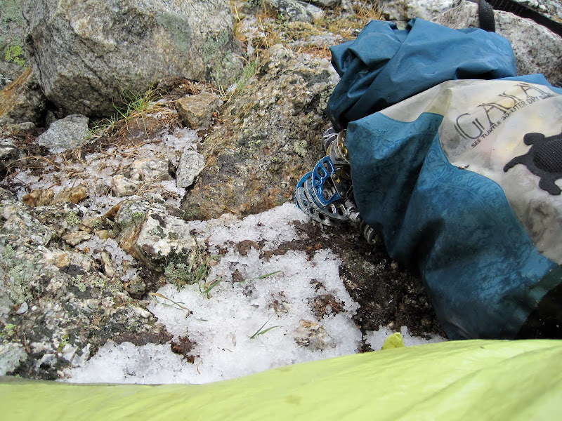
Below the slot the ledge stayed quite steep, but at least it widened such that a fall would send one down the ramp instead of off of it. Ahead we could see the remnant of the snowfield that always requires some gear to cross. We had brought crampons and ice tools on the carryover specifically for this section.

Visit on ggpht.com
Wider ledge after the crux, but still steep and loose. The ice crossing with the icefall hazard can be seen ahead.
"This snowfield (in late season this will be ice) is immediately beneath the Enclosure Ice Couloir and the fall line of the Black lce Couloir on the north side of the Upper Saddle. Beware of rockfall at this point. Cross as rapidly as possible to the benches directly west of the Grandstand, where the selected ascent route can be started."
Ortenburg & Jackson, A Climber's Guide to the Teton Range.
Once we reached the snow field remains, we could see that what remained was a sliver of ice about 10 feet across and about 50 degrees steep. The terrain we were on was also very steep and composed of loose rock and dirt. It seemed like it would be a major pain to put on crampons here for such a short crossing.
Visit on ggpht.com
Taking a break before the ice traverse. (by Steph Abegg)
I thought maybe we could just chop a few steps to quickly walk across and be done with the crossing. However, the ice was hard enough and the position awkward enough that it was difficult to chop steps very efficiently. Steph started looking for a way to climb the steeper rock above to where we could possibly just step over the ice. I expressed my doubts about going that way without being roped up, as it looked to be 4th class on extremely loose rock and we were already in steep terrain where falling would be very bad.
As I was expressing my doubts about Steph's strategy, a table-sized block of ice came tumbling down the narrow strip of ice! Well, after seeing that I agreed that it would be a bad idea to try the slow process of chopping steps. It also probably wouldn't be a good idea to rope up here, as stretching a rope across the debris chute now seemed like a bad idea.
Fortunately Steph found a way up that was reasonably solid if you were careful, and she was able to quickly step across the ice and run across the gully before stopping and waiting beneath the cover of the next set of tiered cliffs. I carefully climbed up and into position, during which time another large block of ice came falling down. Once I was in position, I stopped and listened to make sure nothing was coming down, and quickly stepped across and ran over to Steph as fast as I could.
That guidebook certainly put the conditions of this traverse mildly! Steph said she had been through worse, but that this traverse was still noteworthy in her experience. I sure was glad to be done with it and hope that I don't have to repeat it!
Visit on ggpht.com
Running away from the debris chute as fast as I can go. The Valhalla Traverse crux is the entire visible section behind. (by Steph Abegg)

Visit on ggpht.com
Looking back at the crux of the Valhalla Traverse after we were clear of the icefall hazard.
Once we were across the garbage chute, we made quick work traversing and descending towards the West Gunsight Couloir that divided the Grandstand from Mt. Owen in upper Valhalla Canyon.
Visit on ggpht.com
Serendipity Arete.
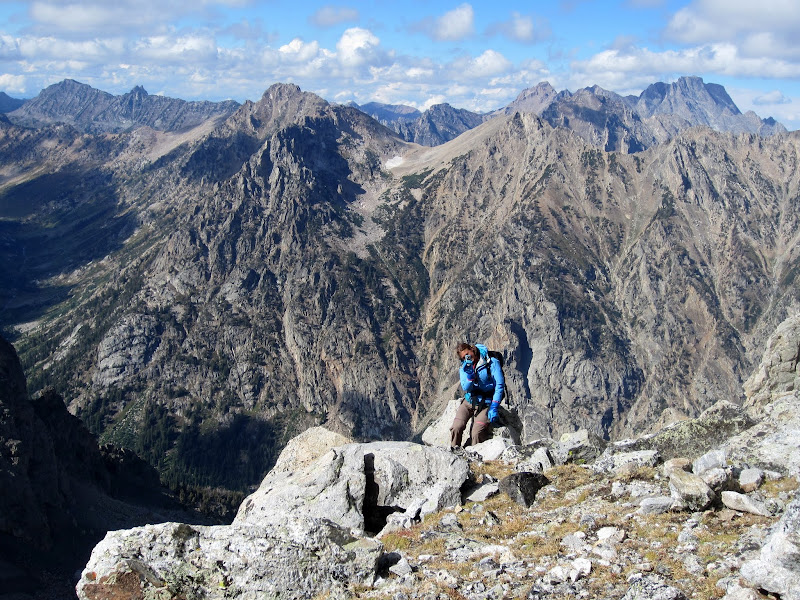
The West Couloir of Gunsight Notch turned out to have snow and running water even this late in the year after a dry winter. We took note of this, and I traversed across and up towards Serendipity Arete to look for a bivy while Steph investigated a line closer to the water source. We both found excellent bivies, and decided that the ones Steph found were on the West Ledges route and mine was more along the Serendipity Arete route.
Visit on ggpht.com
The Rabbit Ears, seen across Valhalla Canyon from camp
Steph was about to go get water next, but as the swirling clouds were starting to look more ominous, I suggested we get the tent set up first just in case it rained. No sooner had I said that than it began to rain. We hurriedly put up the tent as the intensity increased, and hopped inside to take cover. The rain came down hard enough that is started to soak through the membrane of the First Light tent. Hmmm . . .
Visit on ggpht.com
Upper Valhalla Canyon in the clouds.
Some minutes later the storm had passed and the sun was back out again. It seemed like we had lucked out with perfect timing on finishing the Valhalla Traverse! Steph went to gather water while I finished setting up camp and put some of our gear out on rocks to dry. Fortunately, while it looked like a bad day to be up high, it was warm and sunny at camp (for the moment).
Visit on ggpht.com
The Grandstand, the Grand Teton and the Enclosure in clearing weather. The Grand Teton is rising about 2,700' above us.
Visit on ggpht.com
The Grandstand and the Grand Teton in clearing weather.
[Click to View YouTube Video]Clouds blowing over the Enclosure.
[Click to View YouTube Video]Clouds blowing over the Grand Teton.
[Click to View YouTube Video]Clouds blowing over the Grand Teton. Also Valhalla Canyon panorama. The Grand Teton is rising about 2,700' above us.
After Steph came back with the water, the weather appeared to be turning again, so we hopped back into the tent to take cover.
Visit on ggpht.com
Storm #2 is rolling in.
Visit on ggpht.com
Peeking out during storm #2. (by Steph Abegg)
Visit on ggpht.com
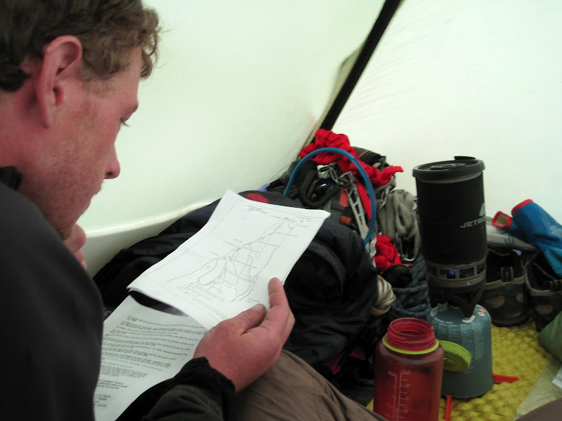
Reviewing the topo for Serendipity Arete during the storm. (by Steph Abegg)
This second storm was stronger than the first one. First the rain came hard and started to soak through the tent membrane again as the wind buffeted the tent and lightning struck the peaks above. Then the rain changed to hail, which hammered the walls of the tent, sending water spraying all over the interior of the tent. It was a good thing that we had left our down sleeping bags packed away! Seeing this potential problem, I was glad that I had a bivy sack liner for my bag. Steph and I decided that she could probably get some protection for her bag by spreading my rain poncho over it, and keeping it packed away until we were ready for bed.
Visit on ggpht.com
Remnants of Storm #2. (by Steph Abegg)
Visit on ggpht.com
A little soggy but drying out. (by Steph Abegg)
So the sun came back out again, and so did we! We laid gear back out to dry, and enjoyed our picturesque campsite, reading, relaxing, doing logic puzzles, and of course photography! One ongoing thing I was amused to find on this trip was that I was often taking photographs in Steph's direction as she was taking photographs, usually in my direction. It was rather funny to be inadvertently be playing a game of camera tag. This phenomenon kept occurring throughout the trip as we both seemed to be in sync with our oddly obsessive photo-taking habits.
Visit on ggpht.com
Photo tag with Steph.
Visit on ggpht.com
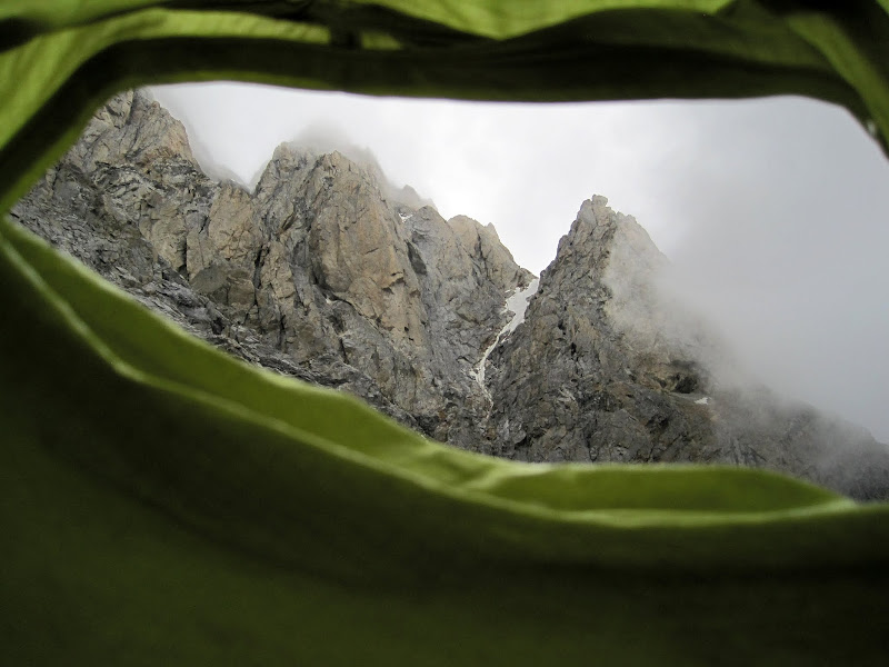
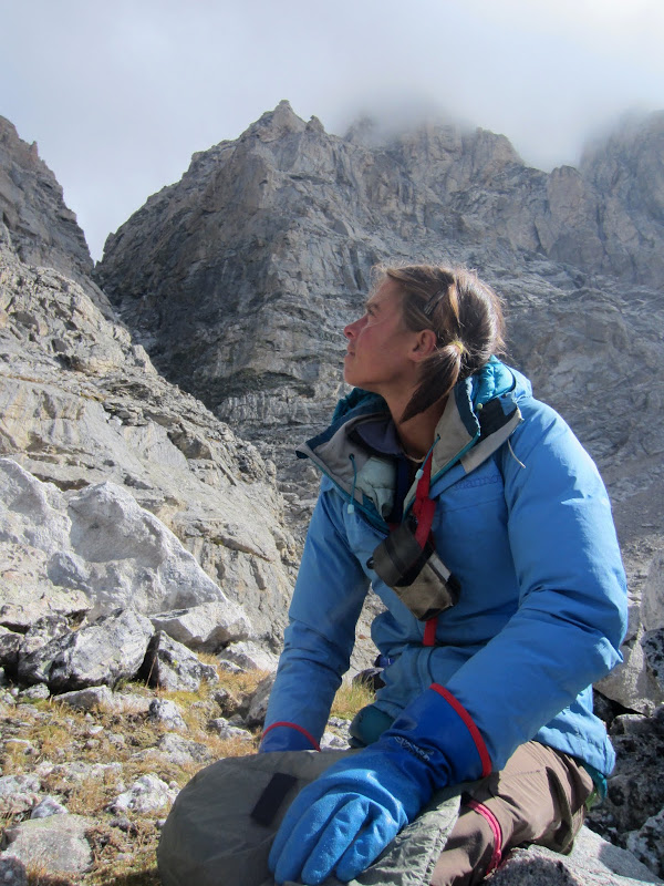
Steph looking over Serendipity Arete.
Visit on ggpht.com
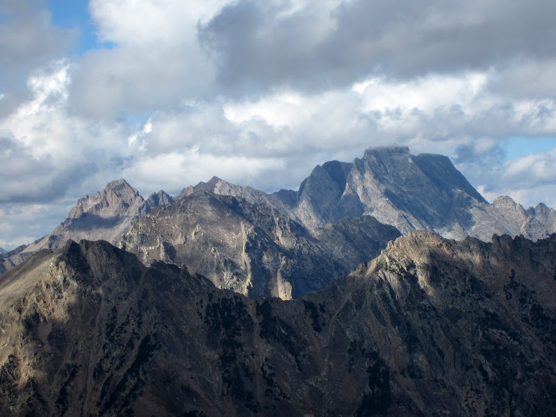
Mt Moran
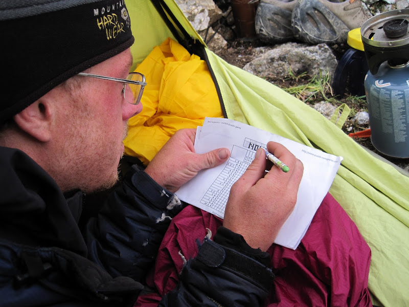
This day I took Steph up on her offer to try out one of her logic puzzles. While I still think I'd want a book for some breaks, I found her puzzles to be very fun and engaging, and the size-to-time entertainment ratio of these little games printed out on paper trounced that of books. I'll have to remember to bring some of these along in the future on climbs in lieu of books (or at least bring less reading material).
Visit on ggpht.com
Steph has introduced me to logic puzzles! They have got to be one of the better things to bring to pass time at camp. (by Steph Abegg)
Visit on ggpht.com
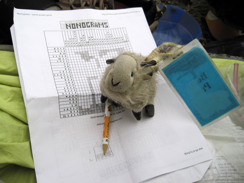
Billy completing his own little Nonogram. (by Steph Abegg)
Some more storms rolled through off and on, and we moved out lounging out of the tent and back inside several times. Meanwhile I was concerned about the weather for the coming days, but Steph was insistent that the latest forecast she saw said this should pass and the rest of the time for our carryover should have stable weather. Still, I did wonder how quickly the peaks above would dry out . . .
Visit on ggpht.com
Checking the latest weather conditions. (by Steph Abegg)

Visit on ggpht.com
More bad weather brewing.
Visit on ggpht.com
Upper Valhalla Canyon panorama from camp.
We got to sleep early that night so that we could pack up camp and start the approach to Serendipity Arete before sunrise. The approach looked to be long and difficult, and the climb itself would make for a long day.
Since we did get to sleep early, I did wake up at about 4:30 am to take some night photos while eating breakfast before we packed up camp.
Visit on ggpht.com
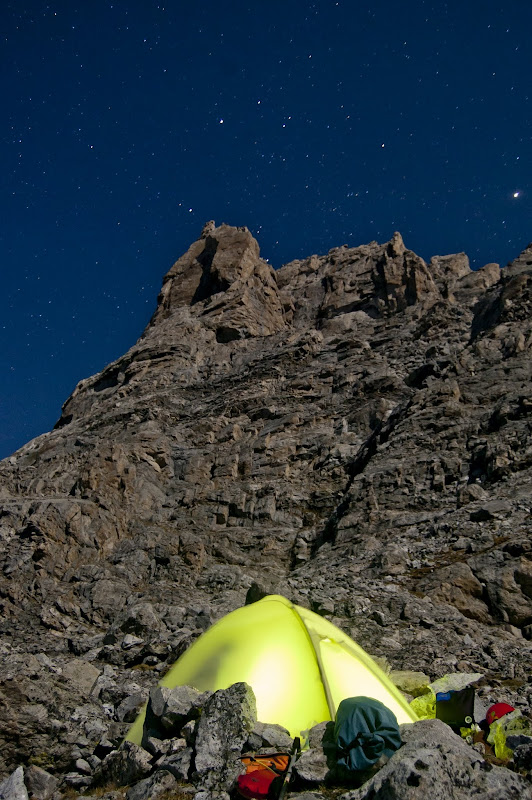
Tent below Serendipity Arete at night.
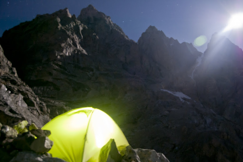
Visit on ggpht.com
Tent below the Grand Teton & Enclosure at night. The light flare is a full moon.
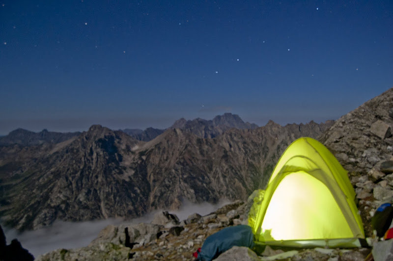
Visit on ggpht.com
Tent and cloud inversion in Cascade Canyon at night.
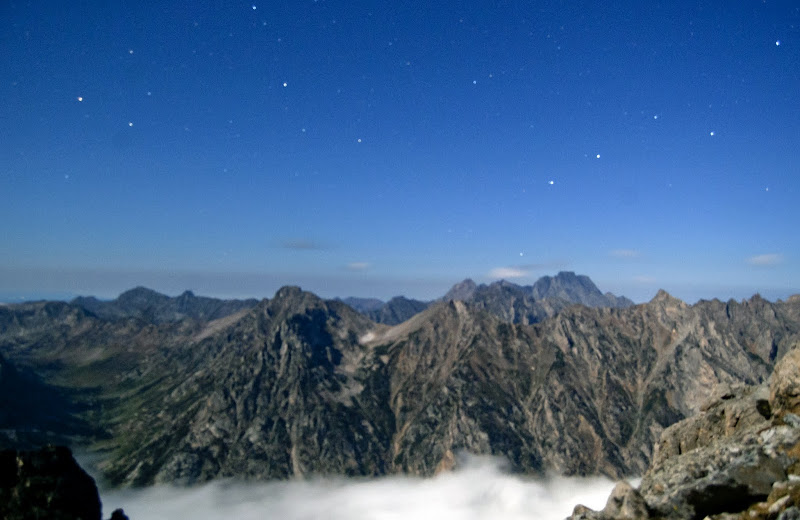
Visit on ggpht.com
Night inversion of clouds in Cascade Canyon.
Personal Website
Day 1: Garnet Canyon Approach and the North Ridge of Middle Teton (II, 5.6)
Day 2: Complete Exum Ridge of the Grand Teton (III, 5.7)
-
Day 4: Serendipity Arete of Mt Owen (IV, 5.9, 15P)(Carryover Day 2)
Day 5: Owen-Grandstand Traverse (II, 5.7, 3-5 rappels)(Carryover Day 3)
Day 6: North Ridge of the Grand Teton (Italian Cracks Variation)(IV, 5.7) (Carryover Day 4)
Day 7: Black Dike Traverse (II, cl. 3-4, moderate snow) and the Southwest Couloir of Mt Teewinot (II, cl. 4)(Carryout Day 1)
Day 8: Mt Teewinot via the Southwest Couloir (II, cl. 4) and East Face Descent (II, cl. 4)(Carryout Day 2)
Day 9: Southwest Ridge of Symmetry Spire (II, 5.7)