Trip Report
Sierra High Route
|
Thursday October 13, 2011 5:48pm
|
|
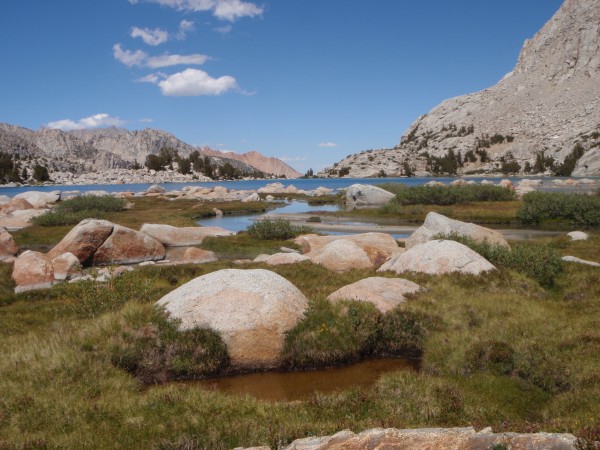
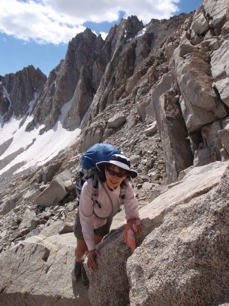
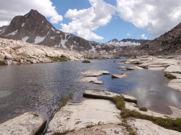
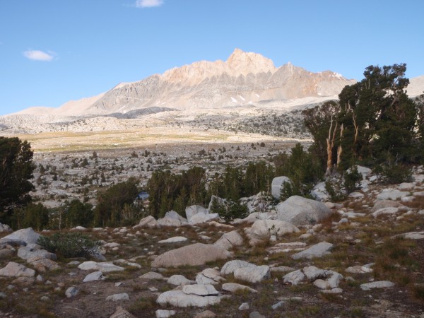
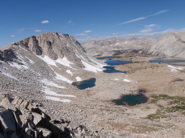
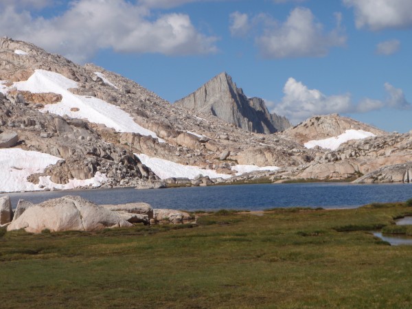
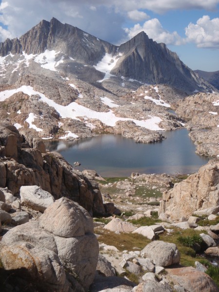
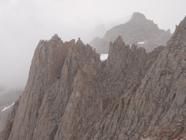
I had the pleasure of hiking in late summer another section of the Sierra High Route (as defined by Steve Roper). Our hike started up out of Sabrina Lake to Wallace Col, through Evolution Basin and over Snow-tongue Col above Evolution Valley. We traveled cross country through Humprey's Basin, down across the Pine Creek Pass Trail and up over a pass above Marian Lake. We then traveled pass a bunch of lakes with bear names, along Lake Italy and came over the col north of Bear Creek Spire. Awesome trip in the alpine enjoy the pictures:
Berg Heil!!!!!!!!!!!!!!!!!!!!
 Charlie D.
|
|
About the Author
Charlie D. is a trad climber from Western Slope, Tahoe Sierra. |
Comments
dee ee
Mountain climber
Of THIS World (Planet Earth)
|
|
|
|
Oct 13, 2011 - 06:04pm PT
|
Nice Charlie, how many days was that section?
The High Route is on my to do list.
|
|
Brandon-
climber
The Granite State.
|
|
|
|
Oct 13, 2011 - 06:05pm PT
|
Great looking trip. Mt Humphreys is on my short list when I get back that way. Lots of history.
Thanks!
|
|
jahil
Social climber
London, Paris, WV & CA
|
|
|
|
Oct 13, 2011 - 06:14pm PT
|
Very cool - The Seven Gables look like something worth climbing - must go and check the guide books ! Thanks for the pictures and TR.
steve
|
|
Ezra Ellis
Trad climber
North wet, and Da souf
|
|
|
|
Oct 13, 2011 - 06:53pm PT
|
Nice!
|
|
Zander
climber
|
|
|
|
Oct 13, 2011 - 08:02pm PT
|
Sweet. I have looked at doing that section so many times. Thanks for posting. Beautiful.
Zander
|
|
Fritz
Social climber
Choss Creek, ID
|
|
|
|
Oct 13, 2011 - 08:06pm PT
|
Great photos.
Add some more please.
We all love photos of the high Sierra.
|
|
Andrew F
Trad climber
Sunnyvale, CA
|
|
|
|
Oct 13, 2011 - 08:07pm PT
|
Awesome. I was planning on doing the full High Route this year, but got skeered and backed out after hearing reports of lots of late-season snow. Hopefully next year...
Andrew
|
|
GhoulweJ
Trad climber
El Dorado Hills, CA
|
|
|
|
Oct 13, 2011 - 08:28pm PT
|
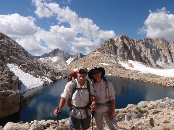
Charlie, nice report man. Way to go to both you and Nancy!
Youre my hero.
Jay
|
|
MB of the Central Valley
climber
kingsburg, CA
|
|
|
|
Oct 13, 2011 - 10:09pm PT
|
CD:
Thanks for the inspiration. See you in a few weeks!
MB
|
|
Norwegian
Trad climber
dancin on the tip of god's middle finger
|
|
|
|
Oct 13, 2011 - 10:15pm PT
|
what a long, strange trip its been.
|
|
Doug Robinson
Trad climber
Santa Cruz
|
|
|
|
Oct 13, 2011 - 11:44pm PT
|
Love that alpine zone!
|
|
Risk
Mountain climber
Marooned, 855 miles from Tuolumne Meadows
|
|
|
|
Oct 13, 2011 - 11:56pm PT
|
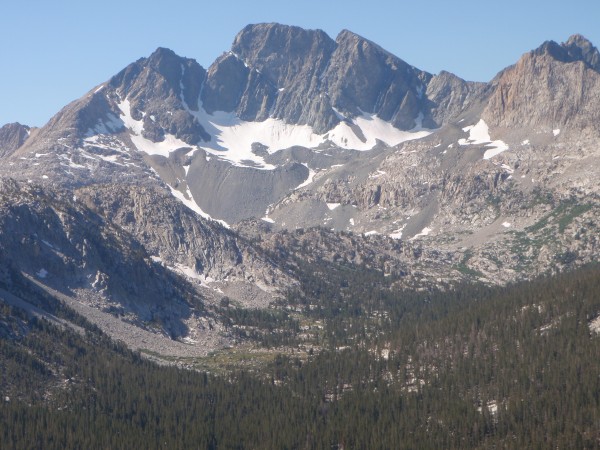
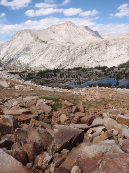
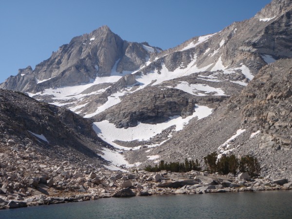
This is a really great report on section of the High Route I have barely nudged in a few places. Great shot of Goddard. Thanks much.
|
|
Charlie D.
Trad climber
Western Slope, Tahoe Sierra
|
|
|
Author's Reply
|
Oct 14, 2011 - 08:49am PT
|
Dee ee, we were out for 5 nights and 6 days of hiking. Most all the hiking is off trails so a 12 or 15 mile day feels more like a 20 mile day. The Sierra High Route is awesome, we did the section south of this one a couple years ago and will hit the northern sections in the year or two ahead.
|
|
Anxious Melancholy
Mountain climber
Between the Depths of Despair & Heights of Folly
|
|
|
|
Oct 14, 2011 - 10:32am PT
|
Where was the pic of Goddard taken from? (What aspect of the peak are we looking at, NW?) I haven't seen that view before, and am surprised to see so many trees in the foreground. Is that a telephoto?
Wait, wait, thats from the south side, right?
|
|
Charlie D.
Trad climber
Western Slope, Tahoe Sierra
|
|
|
Author's Reply
|
Oct 15, 2011 - 12:51am PT
|
AM, The telephoto of Goddard is from way across Evolution Valley looking southwest at the northeast aspect, hence the glacier remnant.
|
|
|
 |
|
Recent Trip Reports
- The Kohala Ditch Trail: 36ish hrs on foot... to and from the headwaters. [5 of 5]
May 31, 2019; 11:57pm
- A Winter Traverse of the California section of the PCT Part 8
May 31, 2019; 11:18pm
- Supertopo,A trip report for posterity
May 31, 2019; 11:00pm
- Balch Fest 2013. Two Days in and Around and On The Flake. The Official Trip Report
May 31, 2019; 10:57pm
- TR: My visit to the Canoe
May 31, 2019; 10:24pm
- Death, Alpine Climbing, The Shield on El Cap
May 31, 2019; 4:07pm
- Andy Nisbet (1953-2019)
May 31, 2019; 2:11pm
- Drama on Baboquivari Peak
May 31, 2019; 1:19pm
- Joffre + The Aemmer Couloir: ski descents come unexpected catharsis [part 2]
May 31, 2019; 7:45am
- Lost To The Sea, by Disaster Master
May 30, 2019; 5:36am
- My Up And Down Life, Disaster Master
May 29, 2019; 11:44pm
- Halibut Hats and Climbers-What Gives?
May 29, 2019; 7:24pm
- G Rubberfat Overhang-First Ascent 1961
May 29, 2019; 12:28pm
- Coonyard Pinnacle 50 Years Later
May 29, 2019; 12:24pm
- Great Pumpkin with Mr Kamps and McClinsky- 1971
May 29, 2019; 12:02pm
- View more trip reports >
|