Oct 22-23, 2011
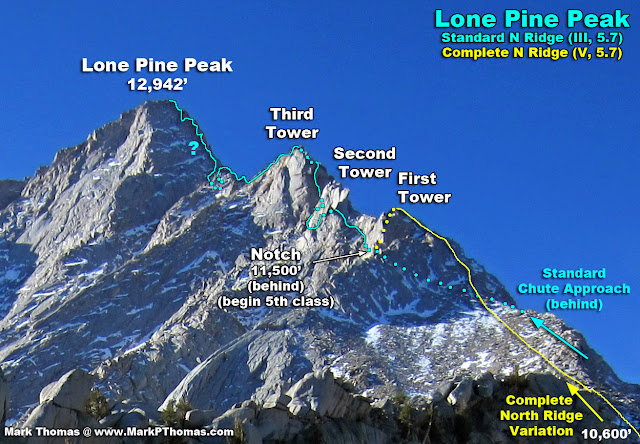
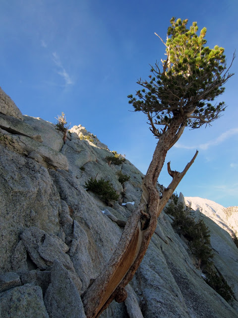
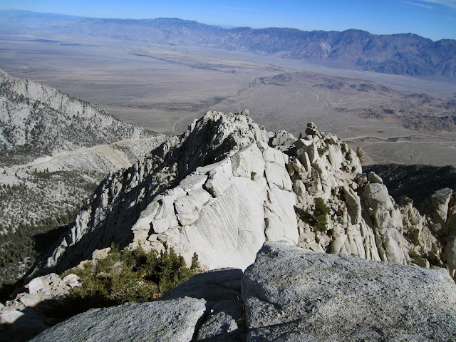
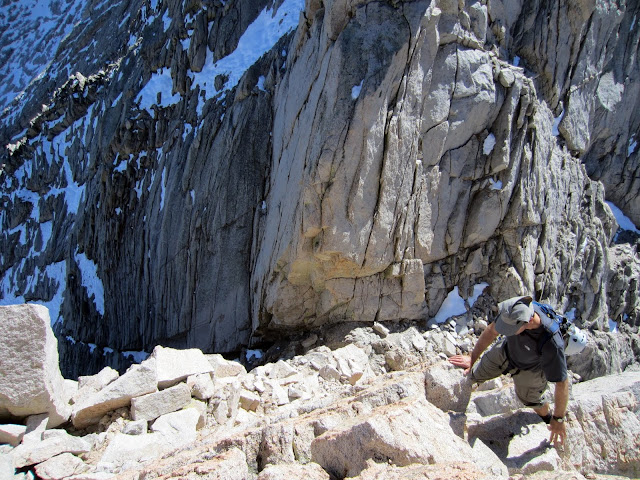
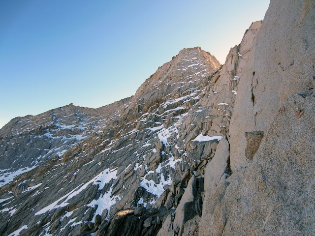
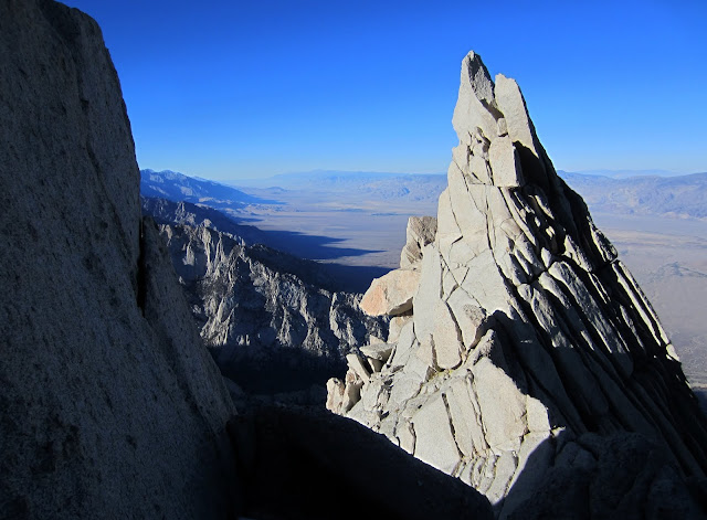
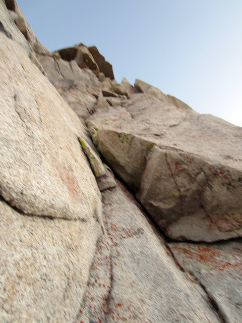
 Climbing through the flake on the 2nd Tower of the North Ridge of Lone Pine Peak Credit: PellucidWombat |
||
Last October, Stefan and I climbed the Complete North Ridge of Lone Pine Peak (CNRoLPP) (V, 5.7) over what turned out to be a 39 hour epic that never seemed to end due to snow, darkness, and fatigue. Somehow during the planning stages I had noted the route as a Grade IV climb, so although we were expecting a very long day, we brought along food & water & chose a start time assuming a Grade IV route. Add a recent early season snow storm to make the route more wintery, and getting lost on the descent, and you have a full value Type II Fun alpine climb!
Visit on googleusercontent.com
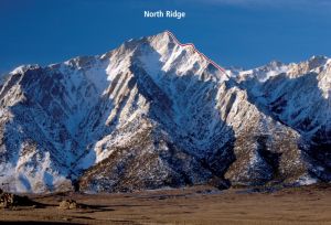
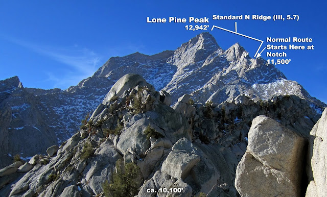
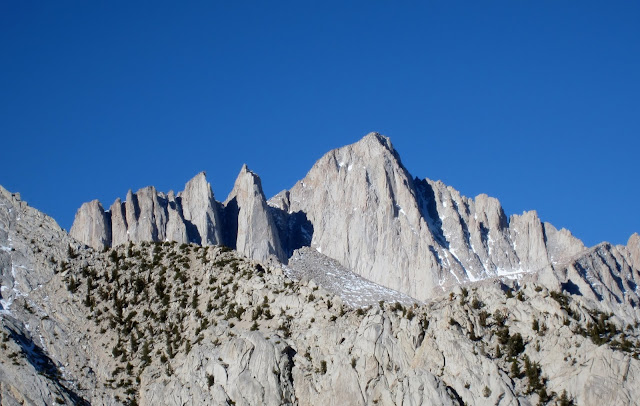
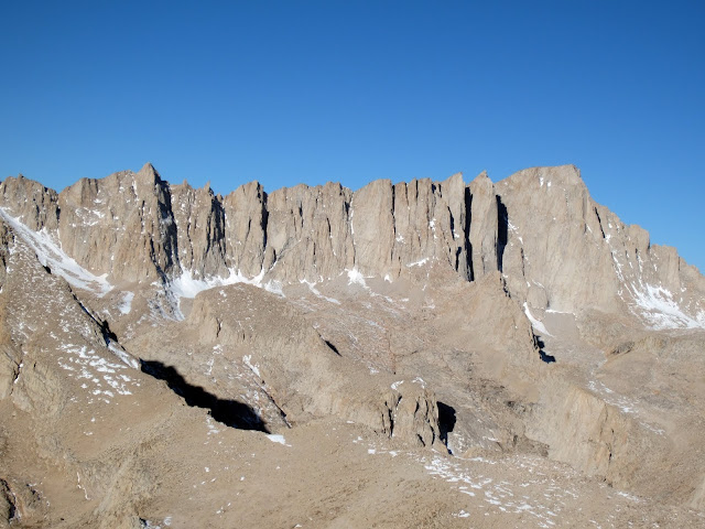
N & NE Ridges of Lone Pine Peak
The route starts at the Lone Pine Campround at 5,900' and follows the ridge to the summit at 12,942', gaining just over 7,000 ft. If you count the ups & downs on the climb then we easily did 8,000 ft of gain. About 4,000 ft and 1.6 miles of that was scrambling to technical climbing. You come out near Whitney Portal, so you need to plan on how to get back to your car or be ready for a long walk.
Visit on googleusercontent.com
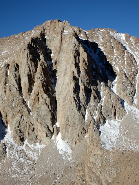
Close up of the upper North Ridge of Lone Pine Peak. I still cant tell where we went on the final wall.
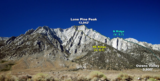
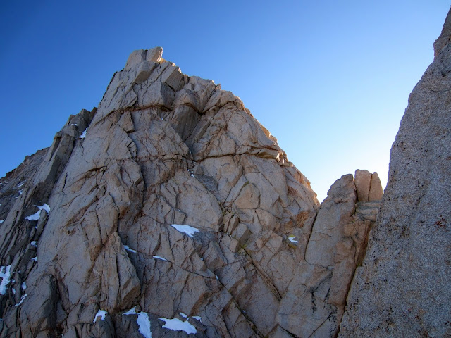
The upper section of the North Ridge is what most people climb. This is accessed as a round-trip outing from the Meyson Lake trailhead and a cl. 2-3 scramble up a chute to the west before it meets the main route at the Notch at 11,500, where the first section of 5th class is encountered. This is typically done as a full day outing car-to-car, with the route rated III 5.5-5.7 (it seems that no one has been able to find anything easier than 5.7 while staying anywhere near the ridge). Most of the route is cl. 4 to low 5th and is conducive to simul-climbing or soloing. The crux is the final 600 or so climb directly to the summit.
The Plan
Visit on googleusercontent.com
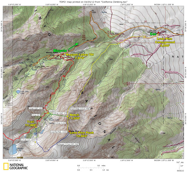
Topo map of our planned climb on the N Ridge of Lone Pine Peak
Stefan and I planned to climb the CNRoLPP in one continuous push from the valley floor. We each brought along about 3.5 liters of water and about 1,400 calories of snacks for the day (including breakfast). A bike was left hidden at the Meyson Lakes TH so that one of us could ride back down to the valley to fetch the car at the end of the climb. With forecast nighttime lows in the mid-20s and the likelihood of snow on the route from an early-season snow storm, we brought light gloves, puffy jackets and mid-weight boots.
Although the lower section of the ridge was terra incognita for us, we assumed it would mostly be 3rd class and fine to solo, so we planned to start at 5am, ideally reach the Notch by Noon at the latest, and solo or simul-climb most of the route. The descent looked to be straightforward according to the guidebooks and what we could find online, so we expected to descend in the dark on a straightforward route.
Hour 0 (5:30 am, 5.900) - Start
Visit on ggpht.com
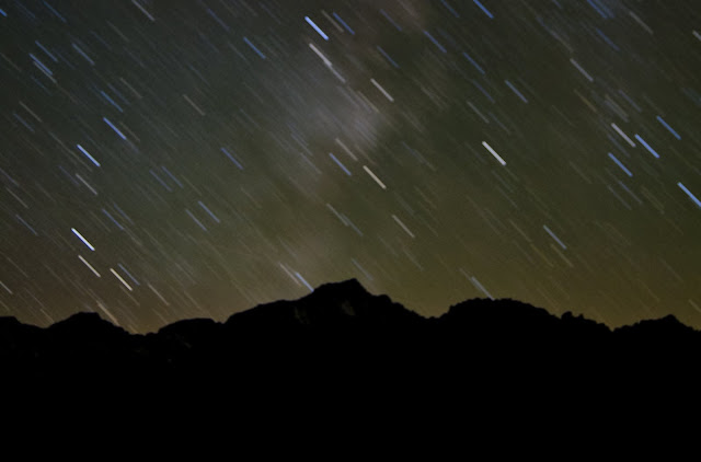
Lone Pine Peak seen from the Alabama Hills at night.
We slept out in the Alabama Hills, where I couldnt resist taking some night photos. By the time we had cached the bike & were ready to go, we starting about a half hour later than expected, but still in full darkness.
The lower section passed quickly as we hiked up a combination of dirt roads & trails, taking care not to take the wrong branch. This was followed by a couple thousand feet of sandy slogging that was more reminiscent of climbing up a powdery snow slope than a Fall climb! Fortunately the brush was easy enough to navigate around, so there really was no bushwhacking.
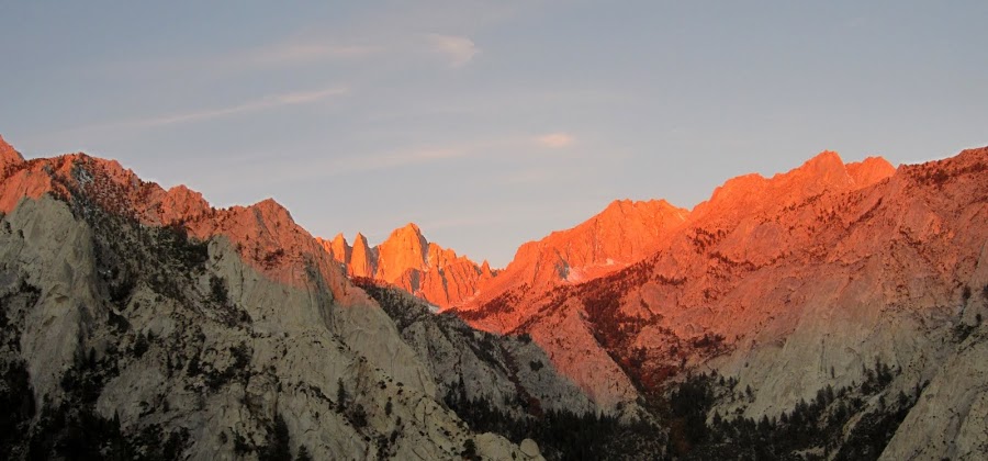
Hour 1.5 (7:05 am. 9,400) - Alpenglow on Whitney
Visit on ggpht.com
Mt Whitney from 9,400' on the North Ridge of Lone Pine Peak. We had already gained 3,500' but we still had a long ways to go!
We made pretty good time on a straightforward ascent from the valley floor, and the sun started to rise just as we started reaching the scrambling, and more importantly, the views!

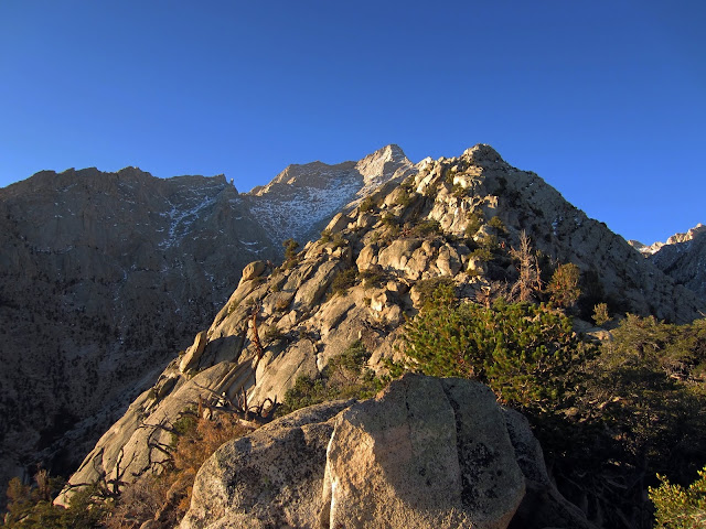
Visit on ggpht.com
Ca. 9,400' on the North Ridge of Lone Pine Peak. We had already gained 3,500' but we still had a long ways to go!
I had gained some distance on Stefan, so I hung out taking pictures and eating breakfast for about a half hour while I waited.
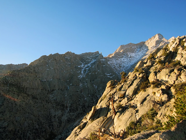
Visit on ggpht.com
Ca. 9,500' on the North Ridge of Lone Pine Peak. We had already gained 3,500' but we still had a long ways to go!
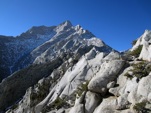
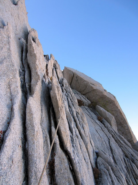
The ridge started out mostly as class 2 scrambling with the occasional bit of class 3-4. I ended up climbing some low 5th class to stay more directly on the ridge crest and out of the brush, but you could probably keep it cl. 4 if you wandered on the route more and did some bushwacking.
Visit on ggpht.com
The long NE Ridge of Lone Pine Pk (V 5.7) seen from the N Ridge of Lone Pine Pk (much easier V 5.7)
Visit on ggpht.com
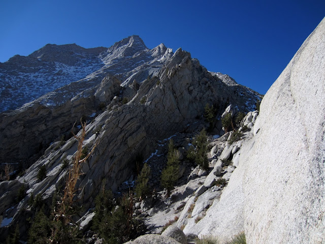
Typical ledge bypass scrambling on the lower N Ridge. A lot of cl. 2 with some cl. 3-4 cracks & slabs sprinkled here & there.
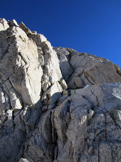
Eventually the ridge narrowed and the terrain got more interesting. Sheer granite walls dropped down a ways on both sides of the crest as the crest itself became 5th class in climbing with many gendarmes and exposed knife edges. Fortunately it was easy to keep the scrambling in the cl. 3-4 range by traversing a series of narrow ledges, mostly on the north side of the ridge crest.
Visit on ggpht.com
Typical scrambling on the lower N Ridge. A lot of cl. 2 with some cl. 3-4 cracks & slabs sprinkled here & there, and many impasses that forced us to drop down a bit on the left or right side of the crest.
Often the scrambling would be on slabs between ledges, normally traversing to an impasse, then ascending back up to the crest. From there wed either wander onto a ledge system on the south side or traverse out on another ledge on the north side. We could rarely stay right on the crest without the climbing becoming 5th class.
Visit on ggpht.com
Gaining ground on the N Ridge. We started down in the valley below near the road at 5:30 am.
Visit on ggpht.com
Our main ledge bypass petered out here so we stuck more to the crest.

Visit on ggpht.com
Shortcut
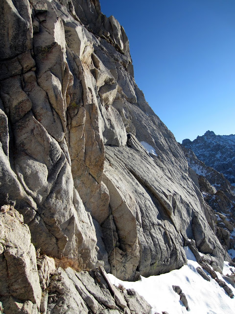
Here and there the rock was gritty and decomposing, but there were also good sections too.
Visit on googleusercontent.com
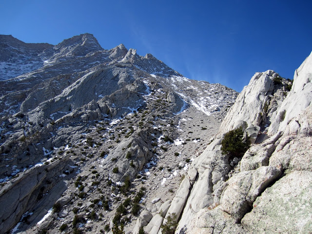
About 10,100' on the N Ridge, with a lot of ridge still left to go!
Although we had gained a lot of altitude quickly earlier in the day, this section of the ridge didnt gain much elevation and lasted for quite a while. Between the complex route finding and constant downclimbing, we climbed a lot more elevation here than expected, and moved more slowly than expected as we rarely stayed on the crest.
Visit on ggpht.com
About 10,100' on the N Ridge, with a lot of ridge still left to go. This next section didn't really gain any elevation (I bet we lost 200 ft or so bypassing a notch) but lasted for 0.3 mi of scrambling before we continued netting elevation.
Visit on ggpht.com
Nearing the major notch in the lower section of the North Ridge. You have to drop a ways down and to the left to bypass it on the E-SE side before climbing right back to the ridge crest.
As we neared the end of the flatter section of the ridge we neared a large notch. We had to traverse down into a chute and wasted time climbing back up to the notch as it turned out that way was impassable. So we had to drop down about 100, round a corner and then lose another 100 or so as we traversed across some of the chutes before heading back up.
As we neared the ridge we ended up out on a tapering ledge. Here Stefan chose to drop down about 50 ft or so and then climb back up to the ridge crest. To maintain a more direct line, I attempted to continue on the ledge as it tapered out into slab climbing but quickly found myself in 5th class terrain. Eventually I backed off, but this misjudgement in route finding also cost some time.
Visit on ggpht.com
Still at about 10,100 ft on the ridge. The regular North Ridge route starts at a notch just after the first major tower above (on the right. if you count the summit at the left & then 3 towers.)
Finally we were back on the ridge crest and for the next several hundred feet we had some nice cl. 3-4 scrambling right on the crest before it was absorbed into the slab & talus slope leading up the northern flanks of the First Tower.
Hour 6 (11:22 am, 10,200) - Reaching Talus Slope of the First Tower
Visit on ggpht.com
Looking down the N Ridge.
By the time we reached the north slopes it was nearly 11:30 and we still had about 1,000 ft or so of scrambling to reach the top of the First Tower, and I had hoped to be over it and in the notch by noon at the latest! Stefan was feeling tired and asked for a break here, while I was chomping at the bit to move fast over the easy terrain. He didnt quite realize how much climbing was still ahead, so pointed out how much we still had left to do despite the summit being much closer by this time.
We agreed on a half hour lunch break. So I ate, relaxed, and took some photos.
Visit on ggpht.com
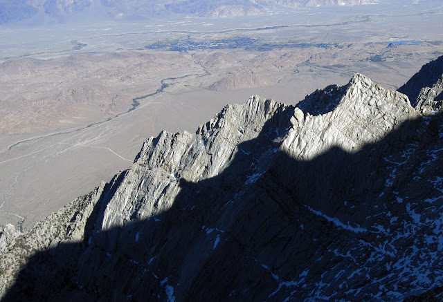
Mt Whitney from about 10,100' on the N Ridge.
Visit on ggpht.com
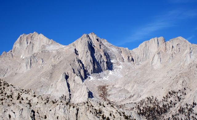
Mt Russell (left), Carillon Pk (center) & Cleaver Pk (right) from about 10,800 ft on the N Ridge.
Visit on ggpht.com
Mt Irvine & its sweet N Buttress (5.9ish I think)
After lunch I rushed up the slopes, which turned into some cl. 3 slabs and ledges near the top. About 15 minutes later Stefan caught up and we down climbed the easy 4th class (more like 3rd) into the Notch.
Visit on ggpht.com
Downclimbing into 1st notch where the standard North Ridge (III,5.5-5.7) starts.
From these closer views we could see that there was a lot more snow on the route than we had expected. So it looked like we would be pitching out the climb a lot more than expected!
Visit on ggpht.com
1st er 2nd tower :-) from non-er-1st tower. Clear?
Visit on ggpht.com
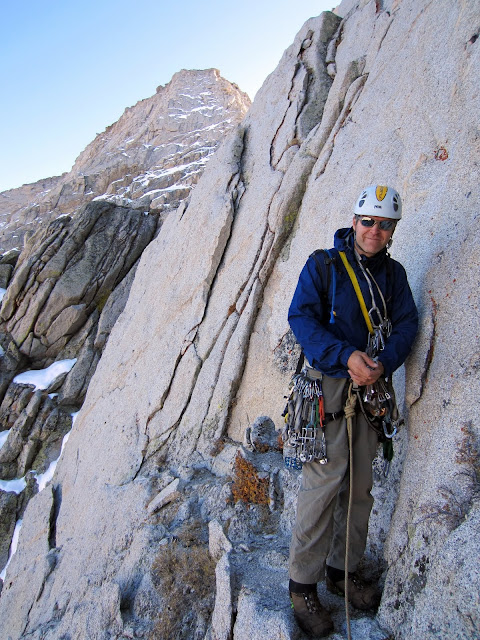
Stefan investigating the first 5th class bits. Either we don rock shoes or rope up. Seeing the snow on the slabs above as I descended, I suggested leaving the boots on & roping up.
Hour 8 (1:36 pm. 11,500) - Roping Up
Visit on ggpht.com
This was fun to lead in boots. A tad flaring but good enough. The thin snow & water ice on the slabs above got a bit more of my attention.
The groove was interesting to climb. It would be easy in climbing shoes, but in boots I was glad to have a rope. Difficulties soon eased, but as the route turned more slabby, the slabs were covered in snow, often with layers of ice beneath.

Visit on ggpht.com
Snowy & icy. Nice to lead this in boots although inevitably I'd have to stand in snow in my rock shoes.
I climbed carefully on the icy slabs, brushing away snow to find some small finger holds & a couple of pieces of pro. Thoughtful edging on the ice or packing down of snow gave me some feet to work with on the iciest stretches. Eventually I ran out of rope & belayed Stefan up.

Visit on ggpht.com
Fortunately the snow was deep enough and low angle enough that this part was easy.
Stefan was not as comfortable as I was on snow covered ice & rock, so he gave me the next lead through the Slot. He would take some of the harder rock leads later on.
Visit on ggpht.com
The summit is still a long ways away . . .
Although the climbing to the Slot looked even snowier, it was deep enough to make good footsteps and lower angle than the earlier section, so it was much easier despite things looking the other way around from the First Tower. So through the Slot I went to bypass the Second Tower, and then I down climbed steep flakes behind. There were a lot of ways to go here, and it wasnt obvious where the easiest line went. I down climbed about 80 ft and set up a belay as I ran out of rope.
Visit on ggpht.com
The 4th class downclimb behind the sharp flake while passing the first tower. I don't think I took the easiest way down.
I think the route down would have been easier by dropping directly down from the Slot and then traversing over, rather than the way I took, where I stayed high longer.
Visit on ggpht.com
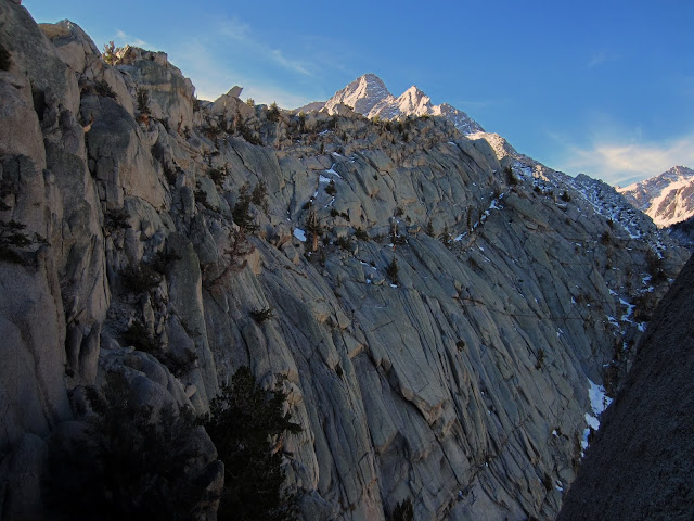
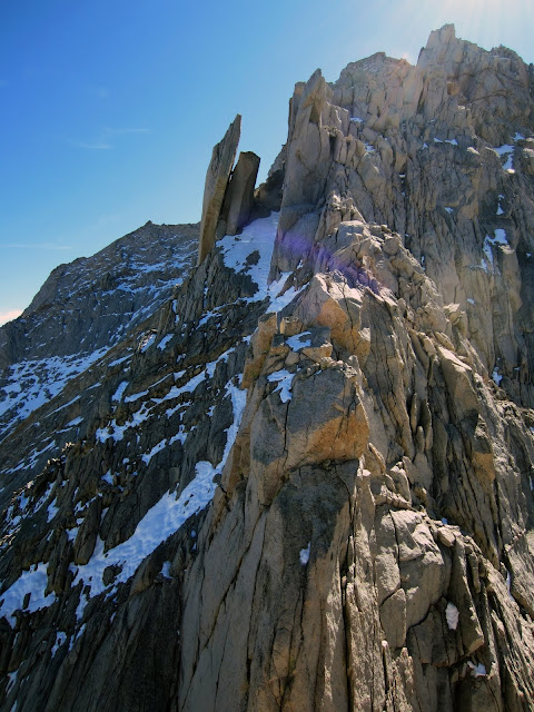
The never ending NE Ridge (V 5.7). Must be done as a free solo and with the first 3,000 ft slog done the day prior if you're to knock this one off in a day.
Hour 9.5 (3:16 PM, ca. 11,700) - Pitch 3
Visit on ggpht.com
Stefan getting ready to lead the third pitch. Difficulties eased up a lot here but because we were staying in boots to climb in the snow, we decided to pitch it out a bit before we started simul-climbing
So next Stefan led out, moving quickly as the day was getting late and we still had a long ways to go. The snow made the terrain tricky enough that we belayed the next pitch or so. If the rock were dry so that we could don rock shoes, we would have been fine soloing or simuling this section to the Third Tower.
Visit on ggpht.com
Looking back towards the 2nd tower on the N Ridge.
Finally the rock became more secure & bare and we started simul-climbing, but quickly reached the impasse of the Third Tower.
Visit on ggpht.com
The third tower that we thought was the 2nd tower (two different route descriptions number this differently)
We climbed up to the notch and traversed on a ledge to the west. The route descriptions all sounded like there was some sort of 5.7 lieback, maybe a 5.7 OW (that some parties never found), but all parties mentioned passing 1 or two ring pitons after ascending a corner some 50 to the west of the notch.
Visit on ggpht.com
Is this the 5.7 lieback?
The first corner looked way too steep & thin, and Stefan couldnt see any pitons.
Visit on ggpht.com
Not any of the 5.7 variations to the third tower described in the guidebooks or SP. Hrmm . . .
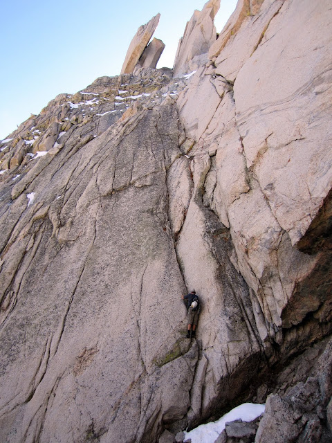
He led over about 100 ft or so to the west of the notch before finding a reasonable corner to ascend. He started part way up and and then backed down, as things were finally difficult enough to need rock shoes. Fortunately the rock here was dry!
Stefan put me on belay and I stemmed up a corner (about 5.5) and then traversed a ways on a slab with a thin undercling and around the corner (5.5). Still no pitons . . .
Visit on ggpht.com
This next bit was a bit roofy. Felt to me like 5.6-5.7 even in rock shoes. Then it got dark and it was even harder to tell where we were going.
The next corner was my lead. Here the route continued up steeply in a corner, with a small roof to surmount (5.6 or 5.7). Rope drag wore me down after the roof so I stopped a little short, perhaps halfway up the Third Tower, and belayed Stefan up to me as the sun set.
Hour 13 (6:30 pm, ca. 12,400) - Darkness
As the sun set, Stefan and I discussed our predicament. We still had a long ways to go to get to the summit and we were having trouble route finding even in the daylight. However, it was supposed to get well below freezing that night and we had nothing more than light gloves and a puffy jacket each, so bivvying would be VERY cold. Climbing would keep us warmer, so we decided to take our chances with getting lost in the dark, and kept going.
Stefan led out heading right from the ledge, and up another corner and eventually on to some sort of outside corner. I swung leads, continuing up the corner, then into a chute until rope drag stopped me somewhere just shy of the top. Stefan led off again, over the top of the Third Tower and along the ridge, at which point we simul-climbed until we reached the final headwall, perhaps over about 4 pitches worth of climbing.
Our route description stated there was 6-8 pitches of 4th and easy 5th class climbing directly to the summit register, so we expected to be past the crux of the climb by this point, and perhaps on terrain that we could quickly simul to the summit. These hopes were dashed as we reached the base of the headwall only to see a formidably steep & blank wall rising above, with massive routes overhead. Stefan tried traversing a bit to the right, where things quickly became very exposed and the going did not look feasible. There was a crack and what looked like lower angle terrain to the left, so we committed and chose that way.
We scrambled down left, wallowed through unconsolidated snow. Keep in mind that we were wearing rock shoes at this point, so this was VERY cold! Stefan led up the thin finger crack and disappeared around the corner. After what seemed like a very long time in the darkness, he pulled up slack and I followed. The crack felt pretty hard since by that time my hands & feet were numb from the snow and my muscles were rigid from the cold. I went around the corner, and then had to downclimb a ways and around the corner. Rope drag had stopped Stefan.
The rest of the night was a bit of a blur, although it seemed to never end. Each pitch seemed to be the same as the last: climb up an awkward chimney or OW, usually with sketchy or non-existent pro, often scraping out snow to find holds inside or pro placements. Reach the top, traverse around to avoid roofs, get cliffed out, downclimb until you have nearly reached your old altitude, and then around a corner and traverse to the base of the next chimney/OW, at which point rope drag becomes unmanageable and you have to stop. Make sure to climb through and stand in plenty of snow during this so that your fingers burn and your feet stay semi-numbed. Repeat ad infinitum.
I have no idea where our line went that night. All I know is that we were somewhere to the left of the crest, and the climbing seemed harder than easy 5th! Most of the wide pitches seemed harder than our crux pitches on the Third Tower. Rope drag kept pitches to about half a rope length, and between the wind, taught rope & being around corners, we could not communicate with each other, which cost us a lot of time. On several occasions I couldnt tell when I had hauled up slack to Stefan or if the rope caught up. I got in the habit of throwing together a Z-C system off the anchor with klemheist knots tied from climbing slings to haul through the rope drag.
Although climbing may have kept us somewhat warmer than finding a nice hole in the rock to bivy in, Im not sure exactly how much warmer we were, as I was very cold climbing through the snow with my thin gloves and climbing shoes, and standing in the snow at belays in the wind, usually half-hanging.
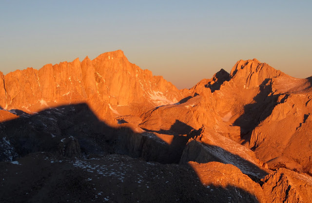
Hour 26 (7:12 am, 12,900) - Sunrise
Time flies when you're having fun. Somehow we still hadn't gotten much done.
At long last the earliest morning glow was starting to light things, and we were surprised to see where we were. The terrain dropped off steeply on all sides, and even in daylight we couldnt see where to go. We also had no idea where we were on the face. I stemmed up another corner, humped up over a ledge, and was blocked by another wall & roof. I managed to thread through a gap further west and finally ended up in a large alcove of cl. 3 blocks beneath - another large roof! I saw a cut in the roof and figured we should be able to break through around the corner in that. Rope drag stopped me about 100 ft short of the top.

Visit on ggpht.com
Sunrise 100 ft short of the summit.
At least the terrain was easier, it was getting lighter & warmer, and I was sure that the top was finally the top! Stefan climbed up to & past me and was soon on the summit, basking in the morning alpenglow.
Visit on ggpht.com
Sunrise 100' short of the summit. The major peaks in view (L-R) are Mt Whitney & Mt Russell.
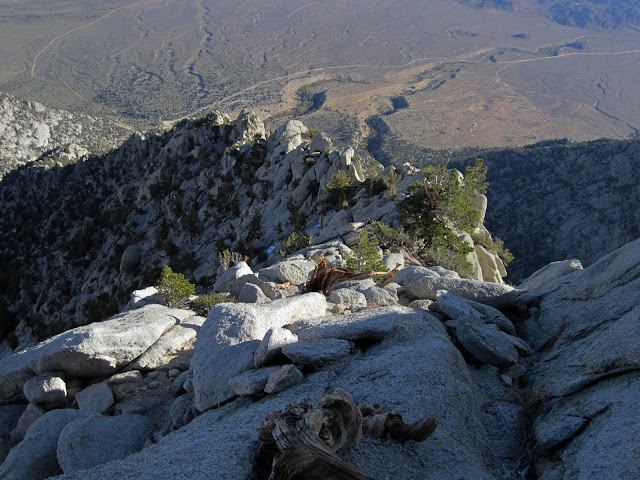
Hour 27 (8:38 am, 12,942) - Summit
Visit on ggpht.com
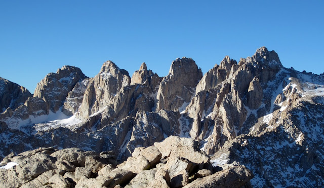
Comb Ridge, with LeConte Pk on the right. I'd like to traverse this someday. I've traversed the two right summits (Le Conte & Corcoran). This is between Tuttle Creek & Meyson Lake.
At last! We were on the summit. The way down should be easy, mindless walking and wed be back at the car before we knew it. Stefan and I were both exhausted from the long, cold night and were feeling the effects of our water & calorie deficits. We nibbled the last of our food and relaxed in the sun until we stopped shivering and our pant legs dried out.
So we started plodding down the sand & scree from the summit, relieved that our epic was nearly over and now all we had was a class 2-3 descent down the Northwest Slope and then a straightforward hike out.
Hour 27.5 - Descent
Our bad . . .
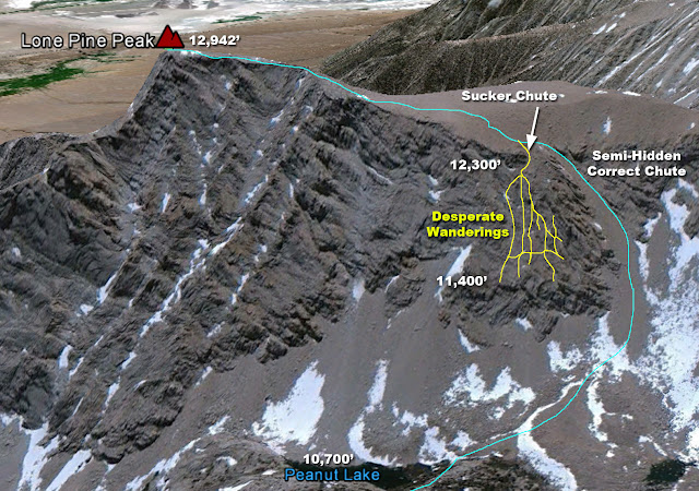
Visit on googleusercontent.com
An overview of where I spent the next 10 hours
So in our defense, the Northwest Slope is one of those lines that is easy to follow when ascending, but is trick to find from above if youve never been up it. Also, some of my info called it class 2 TO 3, so we were willing to accept a little bit of class 3 downclimbing. The sucker chute just before the correct chute looks reasonable and only cliffs out about 100-200 ft before the end, after you have down climbed about 900 ft of cl. 2-3 terrain. The route info also indicates that you take a turn down a chute at the low point in the ridge linking LPP to the Sierra crest, just before the ridge starts rising again.
So we made good time plodding down the climbers trail. As we neared the low point in the ridge, the trail traversed off to the right as it descended. Just before a patch of snow and a small rise on the right, the trail made a hard right turn towards a small notch formed by this rise. We noted that the trail was a bit more feint here, and the terrain dropped off more steeply than expected. We walked back up and didnt see the climbers trail heading anywhere else, so we figured the steps werent preserved as well lower down, and after looking closer found a reasonably class 3 (but exposed) downclimb into the chutes, which appeared to descend all the way to the lakes below.
Visit on ggpht.com
The Mt Whitney massif. Mt Muir is the left-most Pk and is counted as a separate 14er, yet none of the other +14000' spires on the ridge are. Hmmm . . .
There was a lot of snow on these shaded northern aspects, so we treaded lightly and tried to find the driest chute to descend, so at first we traversed skier's left. Downclimbing the mixed snow, scree & slab was precarious at times, but we lost elevation fast and were nearly at the lakes when the terrain dropped away below us!
Stefan and I were really dragging by this time, so we climbed slowly back up the chute to try to find another way down. We found another chute, capped with another cliff at the bottom. I started traversing on a ledge system over to the next chute, hoping that maybe it was more reasonable. Stefan, however, kept traversing along the edge of the cliff.
Im going to keep climbing down this way. It looks like it might go, Stefan said.
I still didnt like the look of it, and knowing that it was definitely off-route, I was not up for soloing down unknown 5th class terrain.
Stefan, I don’t know about forcing our way down that line. Im going to take a look around this corner first. Dont go too far away, I replied. I spent maybe 15-20 minutes rounding the corner, doing some very insecure downclimbing on powder snow covered rocks until I got cliffed out again. This cliff, however, looked like it could be rappelled with one rope and then was clear the rest of the way down.
I headed back over to where I last saw Stefan. He wasnt there. I shouted for him and there was no response. I ventured right up to the edge of the cliff and shouted down. There was no sign of him. It appeared to me that Stefan had continued down - with the rope.
Hours 30 to 35 - Alone
The uncertainty of completely leaving the area where I had last seen Stefan, and the extremely unpleasant prospect of climbing all the way back up to the plateau to start over again led me to go slightly insane: I started doing the same thing over and over again hoping for a different result. I would re-read the printouts of the route descent descriptions, trying to make sense of where we had gone wrong. Everything seemed to match, and yet not. I climbed back up a ways, traversed over, and climbed down another chute, only to be cliffed out. I did this several times, climbing up and down several hundred feet of mixed rock & snow for each attempt.
Visit on ggpht.com
The nice N Buttress of Mt Irvine (5.9ish I think)
I was feeling so tired I wanted to sleep. I was so thirsty that I started sucking on snow to help alleviate my cottonmouth. I was feeling mindless in the way I normally do when Ive bonked. And the sun was getting awfully far to the west in the sky. Had I really spend most of the day here?
I REALLY wanted to get out of here. I knew that I would likely have phone reception here, and I knew of some people who had done the descent, so I swallowed my pride and called out for a Lifeline for some hints.
It turned out that I didnt have the cell numbers of most of the people who I knew had been on the route. I did know one person, my friend Dirk, so I gave him a ring. After an awkward greeting and explaining that I was lost and exhausted on the side of the mountain with darkness approaching, Dirk gave me the comforting beta from his descent experience after climbing the NRoLPP:
We ended up getting cliffed out in a maze of chutes. Since it was late in the day we had to bivy and rappel out the next day.
Doh!
Dirk offered to get me the numbers for Whitney Portal and the Lone Pine ranger station since it was likely someone there knew the route. While I waited for the call back, I continued looking for a way out.
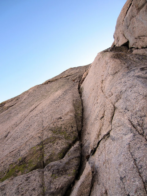
Things suddenly started seeming promising as I was finding a good ledge system that was cutting across all of the chutes that I had explored earlier. I was wrapping around a corner and could see what looked like possibly a lower angle scree chute to the west. Below me the chutes cliffed out and I started finding rappel anchors. If only I had the rope! I started encountering small sections of 5th class, but fortunately the rock was dry. Since the chute looked close, I figured it was worth pressing into this terrain.
Visit on ggpht.com
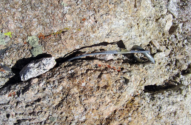
Not a rapp anchor I'd use! A little sketchy. I like how they wedged some stones in the crack to help keep the nut in place. I was having trouble finding my way down by this time.
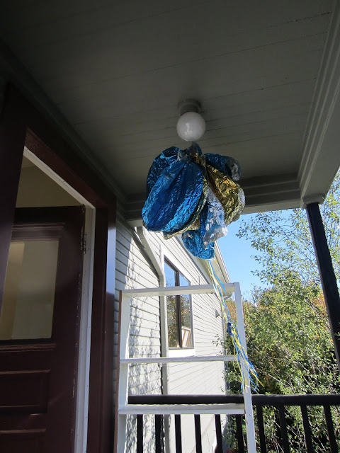
Same as before, I was cliffed out on all sides and had to reverse all of my work. In this daze of exploration I saw a large, brightly colored lump in the cliffs. Could this be a hallucination? Or did someone leave a climbing pack up there? I scrambled up through some 4th class to claim my prize - a gigantic popped squid balloon. Not quite what I was wanting, but being a good steward, I filled up about half of my pack with it to pack out. (Later on when I unfolded it, I think it was actually a flower . .. maybe?)
By this time Dirk had given me the numbers. I had already grudgingly called Whitney Portal, and the number turned out to be for some sort of hostel. I held out.
Hour 35-37 - Escape
Finally, as the sun was nearing the horizon, I called the ranger station.
This is the Inyo County Lone Pine ranger station, a woman replied.
Excuse me, but Im having a hard time finding my way down the standard route on Lone Pine Peak. Im getting pretty tired here and would really like to figure out where Ive gone wrong with my descent before it gets dark. Would there happen to be anyone in the station familiar with the route? I inquired.
Hahaha, no! Heheheh - CLICK.
GRRRRRRR!!!
I hung up on the ranger. Thats it! At last I had finally given up on these stupid chutes and spent the next half hour or so climbing all the way back up to the plateau. Sure enough, we had taken the worn trail down, which made a sharp turn at the snow patch. There were no prints in the snow so I walked back up the trail a ways, slowly, looking for any sign of a branching trail. There was none, so I walked down, looking carefully again. Still nothing.
Once I reached the snow patch I looked beyond it. I thought I saw a faint footprint there, so I headed roughly on that line to the left of the little highpoint to see what was over there. At first the slope dropped away the same as before, but as I approached the dropoff I saw that it rounded into a short little headwall and then a straightforward class 2 chute the rest of the way down!
I booked it down the chute and was quenching my thirst at the lakes just before sunset.
Hours 37-39 (8:30 pm) - Meyson Lakes Trailhead
I moved as fast as I could to find the trail. A misadventure through a muddy bog left me wet from the knees down, and I had a little bit of class 3 scrambling through some ledges to find the trail, but soon I was on easy street. I hiked out as fast as my rebuilt ACL would allow, hoping to maximize my trail distance before darkness slowed me down.
I called Stefans number and left a message telling him my time, location, and ETA. Soon after he called back to report that he had picked up the car via the bike shuttle and was waiting at the trailhead. Apparently he had found a 5.6 chimney that he had downclimbed to get out hours earlier. Well, at least he got the extra work of biking back to the car :-P
My time estimate was a bit off, and as it got dark I began to hallucinate (by this criteria this climb was rated amongst the top 4 most exhausting climbs I have ever done). I saw lights moving ahead of me on the trail, and at times they appeared to be moving towards me, and at times away. Was I catching up on someone? Were they on switchbacks below me? I couldnt tell. Every now and then I swore that I could hear the faint sound of music echoing through the trees and sometimes, a light below. Im pretty sure based on the topo map that there were no cabins in the Meyson Lakes fork out of Whitney Portal, so I think I badly needed my Orange Fanta soda and dinner.
So I enjoyed the entertainment as I huffed it back to the luxuries of shoeless lounging and a long awaited meal. Maybe next year I'll look back on this experience more fondly and try the longer NERoLPP?
Visit on ggpht.com
The balloon in its new home.
Notes
Below the notch of the standard route, the route is mostly class 2-3, with occasional class 4-5 bits that could potentially be bypassed with more tortuous wandering. Nice bivy spots abound on the lower ridge, but if you plan to do this route in a day, make sure to move fast or start extra early. You really can do most of the lower ridge in the dark with little concern for routefinding in the dark as long as youre willing to charge up 4th to low 5th class on occasionally gritty rock.
I had climbed the East Face of Mt Whitney car-to-car the month before and the technical climbing on this climb was MUCH harder. It really is a solid 5.7, or Whitneys East Face is more like 5.6, or our route was just plain bad :-P
There are a few easy things to consider to make sure you take the right descent:
1. If you have to scramble down ANYTHING 3rd class, you are descending too soon.
2. If you are gaining elevation again as you traverse the summit plateau, you have gone too far.
3. If you can mostly scree ski the route and it isn't even close to class 3, then you are taking the right chute.
Having these 3 points spelled out for me would have saved many hours of exploring all of the chutes NOT to take down! Pt. #2 was apparent to me, but 1 & 3 would have saved a lot of grief.
Links
Full photo album on Picasa
Personal Website