Trip Report
A Softman's Tour of the Bugs (photo intensive)
Sunday August 5, 2012 5:27pm
I had long desired a trip to the Bugaboos. Looking at images through the years, it seemed an impossibly cool place, and somewhere for a real climber. That was what kept me away for so long, as I am just a duffer, but my good friend Chris talked me into a trip. Chris is originally from Canada, and he has climbed all over up there, including a dozen trips to the Bugs. Chris had the original route book, and in looking through it, there did seem to be plenty of moderates, so we planned the trip.

We set the dates, and they were predicated on some dates that had Chris already in Canada on a family trip. We agreed to meet in Kelowna, BC, as Chris's family were flying out of there for home. Before he left, he packed his climbing and camping kit, and left it with me to transport to our rendezvous.

I went down the night before and packed all of our gear in Sierra (a pet name, but derived from the phoenetic designator for the letter 'S' in aviation. My first airplane had a call sign that ended in 'J', and the designator was Juliette, so through pure chance I have had the only two designators that are female names). I removed the back seats as we had a large volume of gear, but everything fit nicely, and I was set to go the following morning.

top left corner top right corner
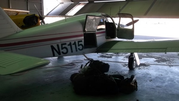
Getting Sierra packed and ready to go
Credit: bearbnz
bottom left corner bottom right corner

top left corner top right corner
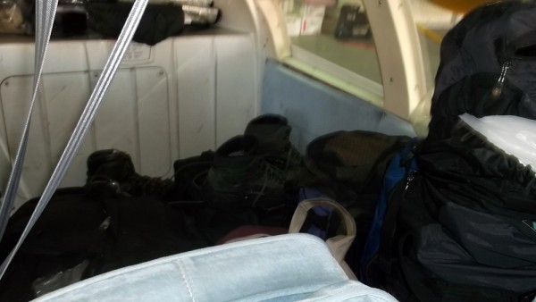
Still room for more, but any extra weight was not welcome.
Credit: bearbnz
bottom left corner bottom right corner


This day was destined to be a loooong day. I was wheels up from Bridgeport, CA at 4:50 am, and flew direct to Ephrata, WA for a fuel stop, and to activate my international flight plan. I averaged 143 knots (about 165 miles per hour) and was getting around 23 miles per gallon. Not too bad for 165 mph.

Canadian Customs was already expecting me, and I flew over the border and into Kelowna. I was a bit ahead of schedule, and Customs was not overly pleased, but they gave me an admission number, and I was free to move about the country.

I found Chris, and he had a little bit more gear to add to the load, and then we strapped in and headed toward Invermere, BC. There were quite a lot of cumulus buidups over the Monashees and Purcells, and we climbed up to 14,000' or so to stay on top, and those that were too tall we skirted around.

top left corner top right corner
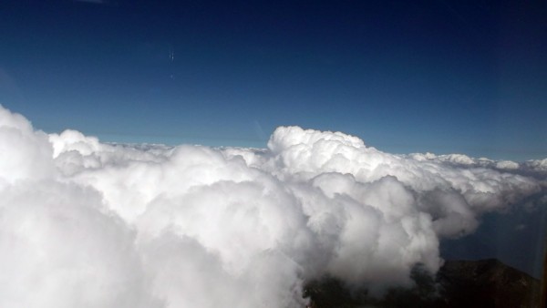
Cruising past the buildups at around 14,000 feet.
Credit: bearbnz
bottom left corner bottom right corner

top left corner top right corner
Often it was open over the valleys, the buildups were more confined to...
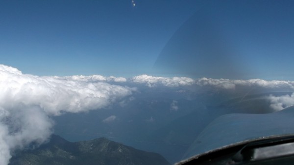
Often it was open over the valleys, the buildups were more confined to ridge and mountain tops.
Credit: bearbnz
bottom left corner bottom right corner

It took a little more than an hour to get to Invermere (Chris said that if we would have driven it probably would have been 5 hours), and it was a quick descent from 14,000' to 2,820' to land at Invermere.

top left corner top right corner
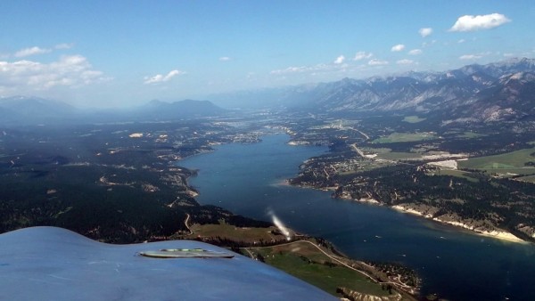
On descent into Invermere, BC
Credit: bearbnz
bottom left corner bottom right corner

top left corner top right corner
Sierra tied down on the ramp at Invermere, sorting our gear and packin...
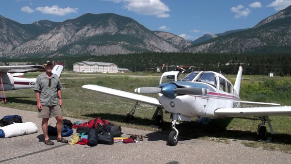
Sierra tied down on the ramp at Invermere, sorting our gear and packing prior to picking up our rental car.
Credit: bearbnz
bottom left corner bottom right corner

We had one little hardware issue with Sierra, and we walked over to Canadian Tire to pick up a few parts to remedy it. Then we loaded our packs and set them aside so we could walk 2 or so miles to the car rental. They rented us an Accord with a cracked windshield, and we drove back to the airport, picked up our gear, and headed for the hills.

At this point it had already been somewhat of a long day for me, here it was noon, and I was already 700 nm (805 sm) from home, but we still had a lot to do. We drove north past Radium Hot Springs (home of the Radium Release Hitch for you SAR folks), and turned west at Brisco, BC. From here it is 50 kilometers to the Bugs parking area, all on potholed dirt/mud logging roads.

top left corner top right corner
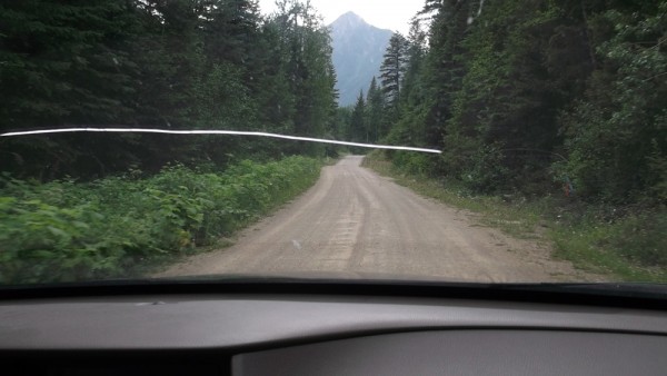
50 km seems far on a dirt/mud road...
Credit: bearbnz
bottom left corner bottom right corner

We finally arrived at the trailhead, and the sight of all of the vehicles wrapped in chicken wire is humorous. Chris tells me that there is a serious problem with porcupines, that they like to eat your brake lines and radiator hoses, neither of which would be good 50 km out a dirt road. Every vehicle was wrapped, and we dutifully wrapped ours as well before we left.

top left corner top right corner
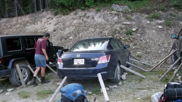
Porcupine-proofing our car.
Credit: bearbnz
bottom left corner bottom right corner

top left corner top right corner
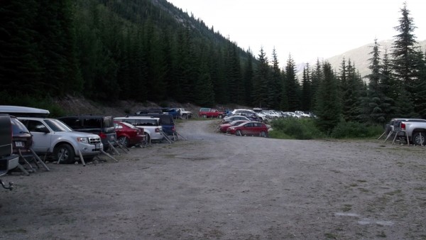
Full lot, but even more full when we were on our way out.
Credit: bearbnz
bottom left corner bottom right corner

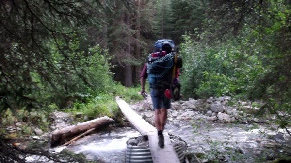
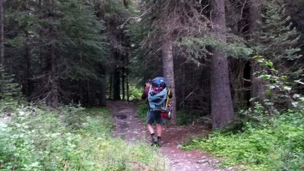
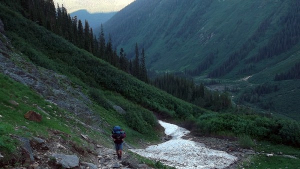
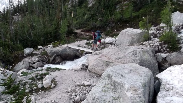
The approach hike is pretty short, the route book says you can see the Kain Hut from the parking lot, but I could not see it. The trail starts as a nice hike through thick trees, but soon steepens considerably.

top left corner top right corner
The trail is mellow for the first 1/4 mile, not so much thereafter....
The trail is mellow for the first 1/4 mile, not so much thereafter.
Credit: bearbnz
bottom left corner bottom right corner

top left corner top right corner
Credit: bearbnz
bottom left corner bottom right corner

top left corner top right corner
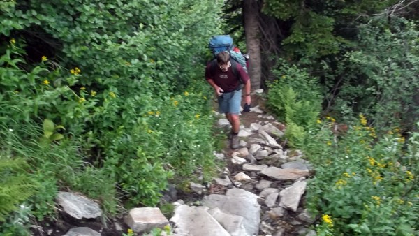
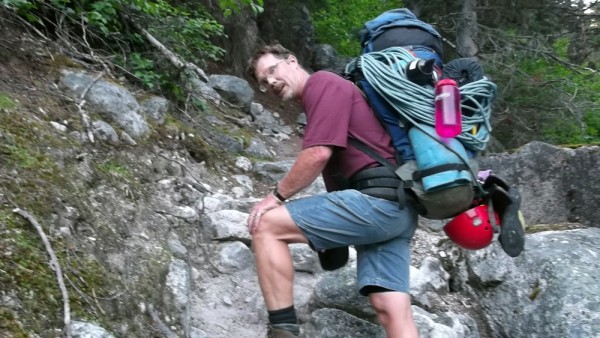
Chris working hard with a heavy pack.
Credit: bearbnz
bottom left corner bottom right corner

top left corner top right corner
Credit: bearbnz
bottom left corner bottom right corner

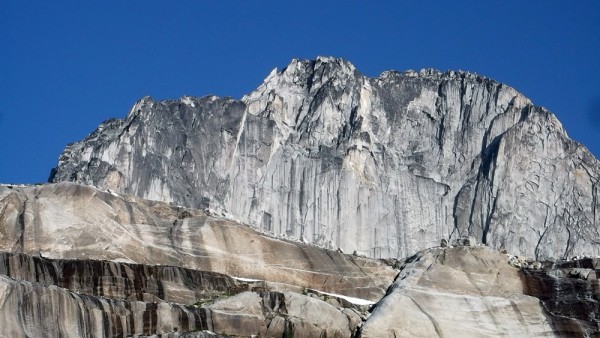
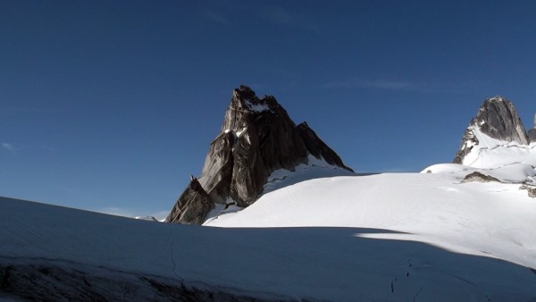
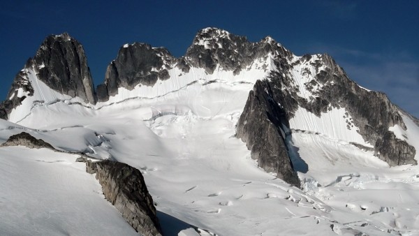
The scenery soon changed to an alpine view, with active glaciers, and the Bugaboo area itself finally coming in to view.

top left corner top right corner
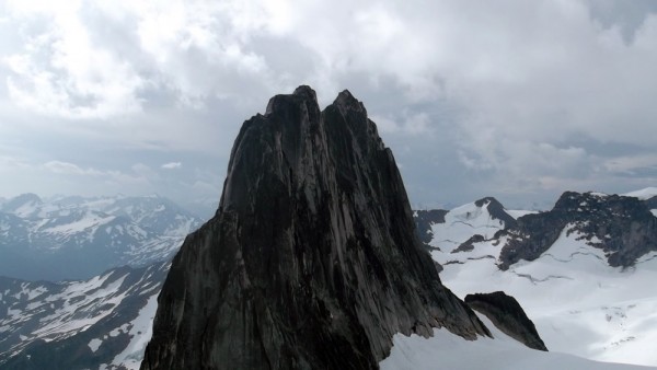
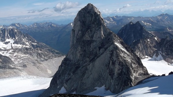
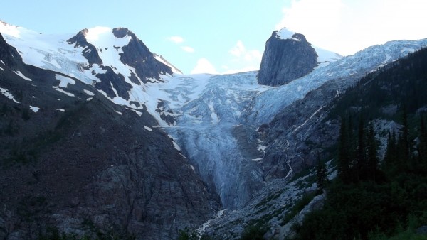
The Hounds Tooth and the Bugaboo Glacier
Credit: bearbnz
bottom left corner bottom right corner

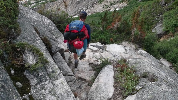
But the trail remained steep, steep, steep.

top left corner top right corner
Credit: bearbnz
bottom left corner bottom right corner

top left corner top right corner
One of the steeper portions of the trail...
Credit: bearbnz
bottom left corner bottom right corner

top left corner top right corner
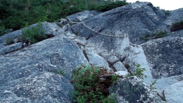
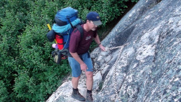
Some nice handrails on the exposed sections of the trail
Credit: bearbnz
bottom left corner bottom right corner

top left corner top right corner
Credit: bearbnz
bottom left corner bottom right corner

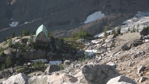
Finally, after a couple of hours grunting up the trail, we were drawing close to the Kain Hut.

top left corner top right corner
Credit: bearbnz
bottom left corner bottom right corner

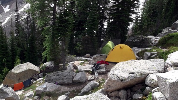
We secured our campsite at the hut, and headed *DOWN* on the other side of the hut to Boulder Campground. We descended 200' and took the first available campsite we came to. We arrived around 10 pm and set up camp. I could barely wait to crawl into my bag, I was exhausted after being on the go since 3:30 am. It was lucky that the daylight sticks around so long this far north.

top left corner top right corner
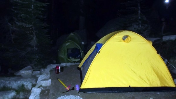
Just getting dark at 11 pm
Credit: bearbnz
bottom left corner bottom right corner

Things looked much brighter the next morning.

top left corner top right corner
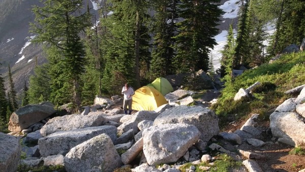
Our campsite at Boulder Camp
Credit: bearbnz
bottom left corner bottom right corner

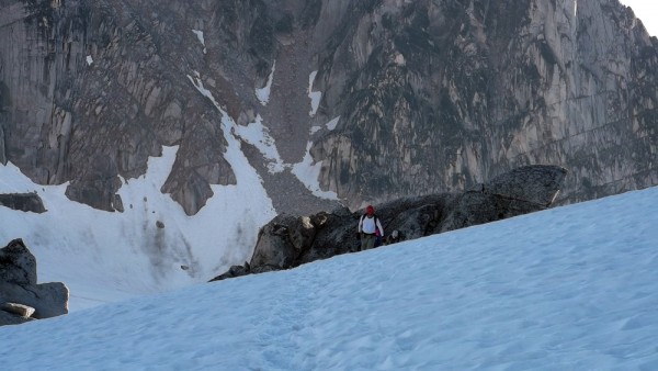
The previous day had been so long that I was kinda half expecting a rest day, but Chris was not. He was knocking on the tent door at 6 am, urging me to action to 'beat the weather'. We loaded up our gear, and started out, first climbing back past the Kain Hut, then continuing on toward Applebee Camp and Bugaboo-Snowpatch Col.

top left corner top right corner
Looking back down at the Kain Hut
Credit: bearbnz
bottom left corner bottom right corner

top left corner top right corner
Looking the other direction at Bugaboo Spire
Credit: bearbnz
bottom left corner bottom right corner

top left corner top right corner
Climbers ahead of us in the Bugaboo-Snowpatch Col
Credit: bearbnz
bottom left corner bottom right corner

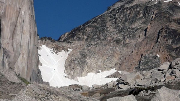
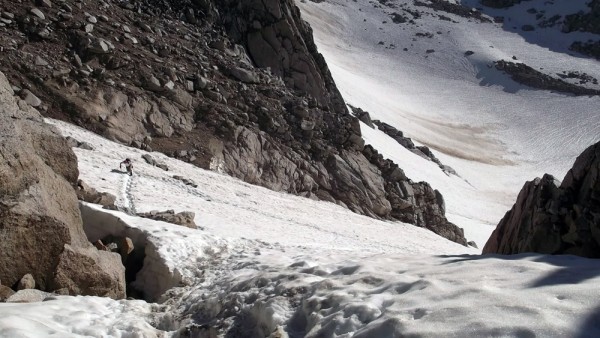
The col was in good condition, with the bergschrund mostly covered, and nice set of steps kicked in. We had brought axes, but not crampons, so this worked out well.

top left corner top right corner
Looking down the col
Credit: bearbnz
bottom left corner bottom right corner

top left corner top right corner
Some real climbers on the Sunshine (5.10c/d)route on Snowpatch...
Some real climbers on the Sunshine (5.10c/d)route on Snowpatch Spire
Credit: bearbnz
bottom left corner bottom right corner

top left corner top right corner
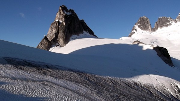
The view of Pigeon Spire from the top of Bugaboo-Snowpatch Col
Credit: bearbnz
bottom left corner bottom right corner

top left corner top right corner
And the Howsers
And the Howsers
Credit: bearbnz
bottom left corner bottom right corner

top left corner top right corner
And Snowpatch
And Snowpatch
Credit: bearbnz
bottom left corner bottom right corner

top left corner top right corner
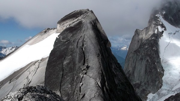
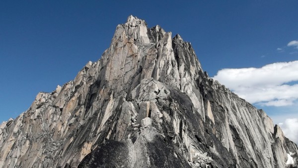
The ridgeline on Bugaboo Spire
Credit: bearbnz
bottom left corner bottom right corner

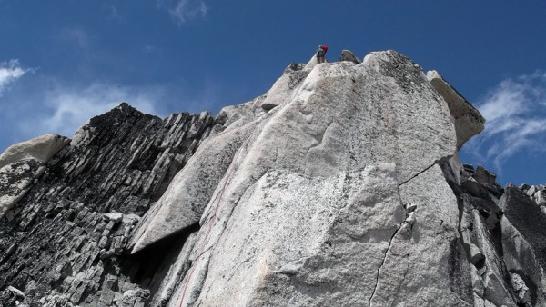
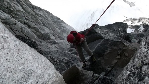
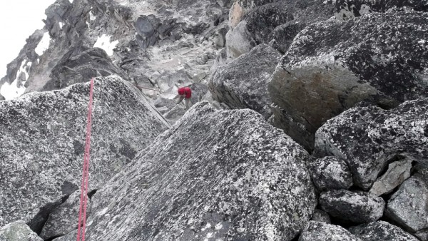
We headed up the south-west ridge of Bugaboo Spire, our intent to climb the Kain Route, reported to be a quality alpine ridge. As we scrambled up to the start of the 'climbing', several parties that were ahead of us were coming down as they felt the weather was threatening. We kept telling each other we would just 'take a look', and we arrived at the rope-up and decided to give it a go.

top left corner top right corner
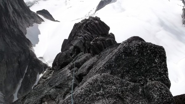
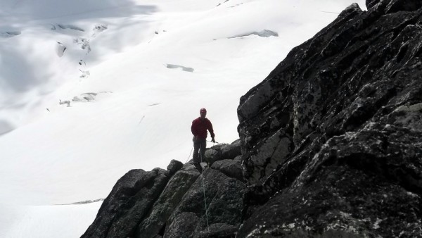
Simul-climbing along the Kain Route
Credit: bearbnz
bottom left corner bottom right corner

top left corner top right corner
Credit: bearbnz
bottom left corner bottom right corner

top left corner top right corner
Credit: bearbnz
bottom left corner bottom right corner

The weather held, and we topped out, sat for a few minutes, and then started the raps.

top left corner top right corner
Looking down the first rap
Credit: bearbnz
bottom left corner bottom right corner

top left corner top right corner
Chris descending on the first rap
Credit: bearbnz
bottom left corner bottom right corner

top left corner top right corner
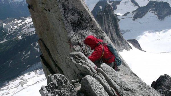
Chris setting up rap 2
Credit: bearbnz
bottom left corner bottom right corner

top left corner top right corner
This rap had a bit more pucker factor
Credit: bearbnz
bottom left corner bottom right corner

top left corner top right corner
Rapping past the rope-eating crack
Credit: bearbnz
bottom left corner bottom right corner

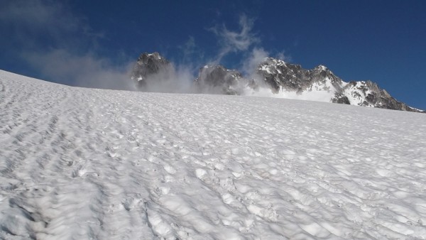
After finishing the series of raps, we scrambled down the ridge under increasingly threatening skies, down the col, and back to camp, where it promptly started to rain. We ducked into our tents, made some dinner, and crashed. We woke to nice clear skies, but I was still spent after back-to-back grueling days, and we agreed on a rest day.

top left corner top right corner
Enjoying the clear morning, and drying some gear
Credit: bearbnz
bottom left corner bottom right corner

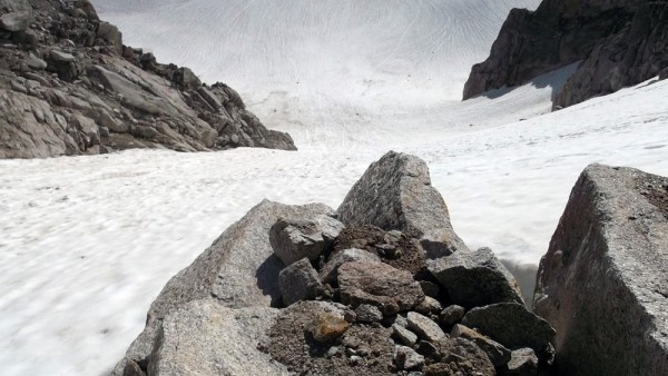
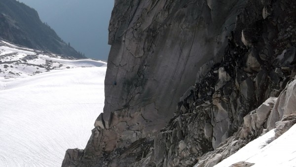
Being the finely-tuned athletes that we are, we could not afford a full down day, so we hiked over to the toe of the Bugaboo Glacier to poke around. We don't have anything like this in the Sierra where I spend most of my climbing time, so I was fascinated by this very active glacier.

top left corner top right corner
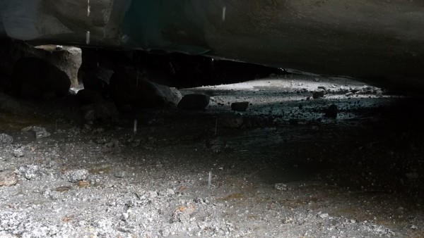
Crawling around under the glacier
Credit: bearbnz
bottom left corner bottom right corner

We touristed our way around the glacier for a while, then headed back to camp, just in time for some more rain, this time a bit more vigorous.

top left corner top right corner
Still hard to believe that these single-wall tents actually will work...
Still hard to believe that these single-wall tents actually will work
Credit: bearbnz
bottom left corner bottom right corner

top left corner top right corner
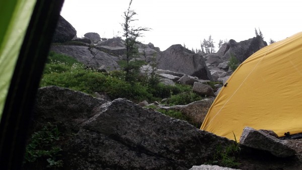
Looking out through the vestibule at the pounding rain
Credit: bearbnz
bottom left corner bottom right corner

The weather looked good the next morning, and we headed back up toward the Bugaboo-Snowpatch Col on our way to Pigeon Spire.

top left corner top right corner
Back up the Bugaboo-Snowpatch Col
Credit: bearbnz
bottom left corner bottom right corner

top left corner top right corner
Chris nearing the top of the col
Credit: bearbnz
bottom left corner bottom right corner

top left corner top right corner
Our intended destination, along the right skyline
Credit: bearbnz
bottom left corner bottom right corner

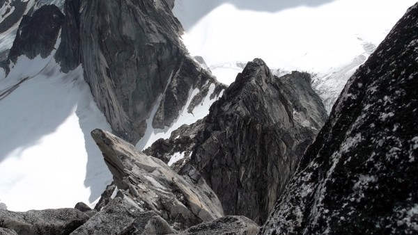
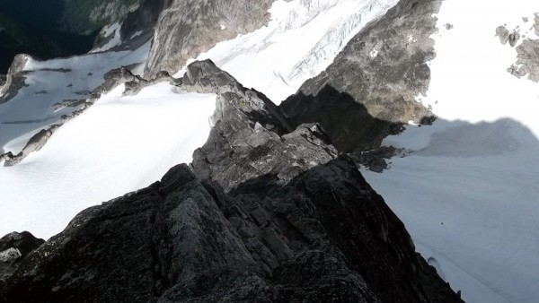
Above the col, we stepped onto the Vowell Glacier, which had obvious open crevasses, and an open bergschrund near Pigeon Spire.

top left corner top right corner
Just above the col on our way to Pigeon Spire
Credit: bearbnz
bottom left corner bottom right corner

top left corner top right corner
Looking up at the Howsers, this is most likely the closest I will ever...
Looking up at the Howsers, this is most likely the closest I will ever get to the Howsers, those are for real climbers
Credit: bearbnz
bottom left corner bottom right corner

There was quite a crowd on Pigeon, but Chris was confident that we could pass, so we started out. At the first belay, a Japanese team of two invited us to go ahead, so we did.

top left corner top right corner
Simul-climbing low along the route
Credit: bearbnz
bottom left corner bottom right corner

We simul-climbed up and down and across, and managed to pass several more parties, but there were always more ahead of us.

top left corner top right corner
The most fun, most exposed section of the route
Credit: bearbnz
bottom left corner bottom right corner

top left corner top right corner
Looking over at Bugaboo Spire from high on the route.  We climbed just...
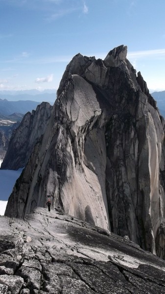
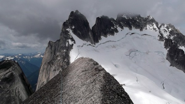
Looking over at Bugaboo Spire from high on the route. We climbed just inside the right skyline two days prior
Credit: bearbnz
bottom left corner bottom right corner

top left corner top right corner
This section was exposed, but easy, and we managed to overcome the urg...
This section was exposed, but easy, and we managed to overcome the urge to crawl across
Credit: bearbnz
bottom left corner bottom right corner

top left corner top right corner
Chris and I on top of Pigeon, we had it to ourselves, at least tempora...
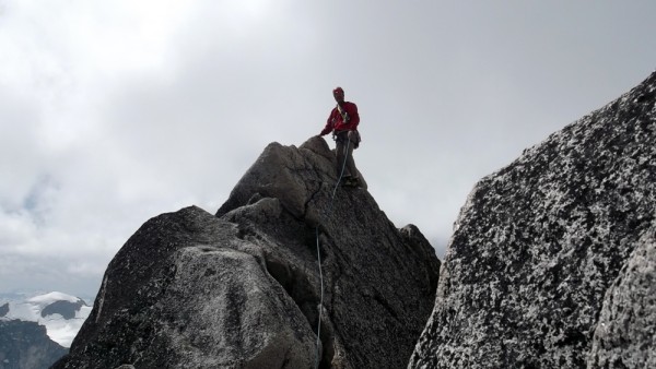
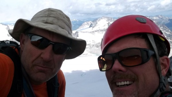
Chris and I on top of Pigeon, we had it to ourselves, at least temporarily, despite the crowded route
Credit: bearbnz
bottom left corner bottom right corner

top left corner top right corner
Exposed, but easy
Exposed, but easy
Credit: bearbnz
bottom left corner bottom right corner

The descent from Pigeon has two raps at the top, and then a downclimb for the rest of the route, so we simul-downclimbed as well. We headed back to camp, it rained, we went to sleep. In the morning it was time to bid adieu to the Bugs, and we packed up and headed down.

top left corner top right corner
Starting down the steep trail.  I like steep downhill less than steep ...
Starting down the steep trail. I like steep downhill less than steep uphill, my knees just don't like it
Credit: bearbnz
bottom left corner bottom right corner

top left corner top right corner
Still steep
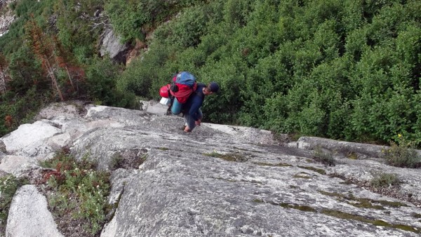
Still steep
Credit: bearbnz
bottom left corner bottom right corner

top left corner top right corner
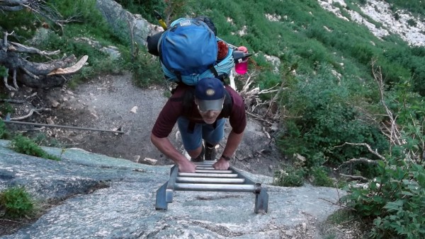
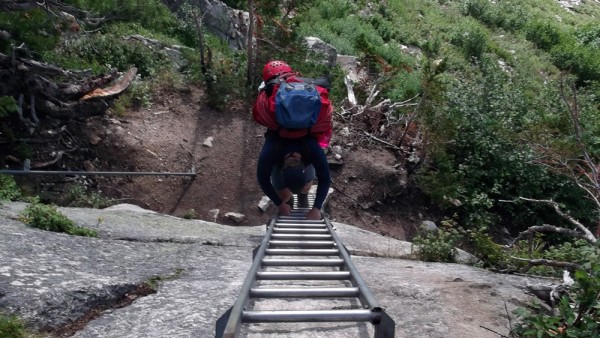
Down the ladder and all the way out
Credit: bearbnz
bottom left corner bottom right corner

We drove back to Invermere, spent the night, and flew out at first light. Our first stop was in Oroville, WA to clear customs and refuel. We then flew direct non-stop from Oroville to Bridgeport in just a shade over 5 hours as we picked up a bit of a headwind part way into our journey. Still, an airplane is an amazing tool, how else could I sleep in my own bed, travel to Kelowna, and Invermere, then drive and walk to Bugaboo Provincial Park, and be camping next to the glacier just under Bugaboo Spire all in the same day, and during daylight hours?

If you have been thinking of going to the Bugs, stop thinking and start doing, it is well worth it. Thanks to my friend Chris for his prior knowledge that was invaluable, and for being an all-around good guy. The only downside to the trip is all of the other fine-looking peaks we flew over and lusted after that we may now have to visit. My to-do list grows ever longer...

  Trip Report Views: 3,048
bearbnz
About the Author
bearbnz is a trad climber from the East Side, California.

Comments
Ghost

climber
A long way from where I started
  Aug 5, 2012 - 05:36pm PT
Damn. Sure wish I'd been able to catch a ride with you to a few places I've visited. 165 mph is pretty good.
Ezra Ellis

Trad climber
North wet, and Da souf
  Aug 5, 2012 - 06:03pm PT
VERRY nice, thanks!
Bowser

Social climber
Durango CO
  Aug 5, 2012 - 06:09pm PT
Yes, You are REAL climbers. Way to go guys and great photos.

TB
deepnet

Boulder climber
San Diego
  Aug 5, 2012 - 06:22pm PT
Wow! Loved it!


I now have a fear of porcupines
jopay

climber
so.il
  Aug 5, 2012 - 06:22pm PT
Very nice report, thanks for posting, also nice plane I'm thinking Piper or maybe a Mooney?
bearbnz

Trad climber
East Side, California
Author's Reply  Aug 5, 2012 - 06:36pm PT
Yes, Piper Arrow, she is going in the paint shop on September 15, she will soon be looking good.
Grippa

Trad climber
Salt Lake City, UT
  Aug 5, 2012 - 07:04pm PT
Awesome TR! Thank you for the inspiration!
10b4me

Social climber
Lida Junction
  Aug 5, 2012 - 07:51pm PT
I always wanted to climb in the Bugs, but steep downhills kill my knees.
Crimpergirl

Sport climber
Boulder, Colorado!
  Aug 5, 2012 - 07:59pm PT
Nice. I'd not looked at this thinking it was a post with a lot of photos of insects - close ups of things I don't want to see. Doh! Glad I took the chance. Great stuff!
Tarbuster

climber
right here, right now
  Aug 5, 2012 - 08:40pm PT
Nice picture tour BBnz!
BASE104

Social climber
An Oil Field
  Aug 5, 2012 - 08:46pm PT
A buddy of mine is a doc with a practice in Canmore and one down in the U.S.

He was climbing one of the classic Bugaboo routes on Sunday, and on the decent, a sofa sized block slid over his legs, nigh crushing them.

He took care of it with available materials, being a doc, but he told me that even though he didn't scream for a rescue, climbers came over from other routes and helped him to the glacier, where a helicopter did show up and give him a five minute ride to town. It turns out that no bones were broken, but his ACL and MCL were torn to shreds on one leg. The other had a massive gash.

He was amazed at the generosity of climbers.
SeanH

Trad climber
SLC
  Aug 5, 2012 - 08:47pm PT
Nice TR. If you ever plan on going back, that plane big enough for a couple extra people? :P
em kn0t

Trad climber
isle of wyde
  Aug 6, 2012 - 12:22am PT
nice! you make call yourself a softman but it sounds like you're getting it done in style.
Sierra Ledge Rat

Mountain climber
Old and Broken Down in Appalachia
  Aug 6, 2012 - 08:46am PT
Awesome. More pics from under the glacier, please.
Zander

climber
  Aug 6, 2012 - 10:29am PT
Very nice! Thanks for posting.
Z
FRUMY

Trad climber
Bishop,CA
  Aug 6, 2012 - 11:10am PT
TFPU
msiddens

Trad climber
  Aug 6, 2012 - 11:49am PT
That's for the post!
Seamstress

Trad climber
Yacolt, WA
  Aug 6, 2012 - 12:57pm PT
Fabulous. Inspring soft people everywhere.
le_bruce

climber
Oakland, CA
  Aug 6, 2012 - 01:34pm PT
The Bugs - seems like a place that's too good to be true. So beautiful, so much clean granite, such amazing formations. With every new pic of the place I see, the hook is set deeper.

Thanks bearbnz, grrrreat TR.

Do you ever have any qualms flying single-engine over terrain like that? And a request: post an epilogue pic of Sierra after she gets her new coat!
rhyang

climber
SJC
  Aug 6, 2012 - 09:15pm PT
Sweet ! I keep meaning to visit the area ..
Dirka

Trad climber
Hustle City
  Aug 6, 2012 - 10:38pm PT
AWESOME!
pvalchev

Social climber
Truckee, CA
  Aug 7, 2012 - 01:00am PT
This is fantastic, thanks for sharing. Love the idea of flying around in a little plane by yourself... way too cool. How much gear can you comfortably carry, out of curiosity - with two people and full fuel?
SeanH

Trad climber
SLC
  Aug 7, 2012 - 06:25am PT
le_bruce - Too good to be true? I think that will always be the Sierras, when you factor in weather. I suspect there's a reason Peter Croft made Bishop his home, and it wasn't Mule Days...
le_bruce

climber
Oakland, CA
  Aug 7, 2012 - 01:12pm PT
Amen, SeanH.
jahil

Social climber
London, Paris, WV & CA
  Aug 7, 2012 - 07:20pm PT
Wow, great trip report, I'm putting this on the list of places to go. Thanks for putting this up - great pictures!

steve
neebee

Social climber
calif/texas
  Aug 7, 2012 - 11:25pm PT
hey there say, bearbnz.... wow, WHAT a neat report... lots to read, too... sorry, i could not wait for all the pics... i bet they are all great!!!...

thanks again, so very much!
bearbnz

Trad climber
East Side, California
Author's Reply  Aug 16, 2012 - 10:34am PT
BASE104: We saw the helo come in, and we had heard it was a broken leg. The day before we arrive the helo was up there to pick up someone who had a dislocated shoulder that was caused by falling into a crevasse.

le_bruce: Yes, I am sometimes nervous about flying over terrain with so few landing spots. From 14,000' we had a pretty long glide opportunity if the engine failed (glide ratio is around 8:1 with the landing gear retracted, half that with the gear hanging out). According to the statistics, I should never have another engine failure as I lost a cylinder (the head of the exhaust valve fell off in the cylinder and beat up the piston pretty bad before it was finally spit out) on a night flight in Mexico, and I had another failure taking off from Bettles, AK, about 30 miles north of the Arctic Circle. So statistically, I should be exempt from further incidents. I will post up an image when Sierra gets out of the shop as per your request.

pavalchev: Sierra's useful load is 1,060 pounds, but fuel must be included in that useful load as fuel is generally very useful. Sierra burns 8-9 gallons per hour, so I can plan the fuel load accordingly. As far as taking off anywhere near max weight, I prefer a low-altitude airport with a long runway, and cool temperatures. With both of us on board, with all of our gear, and enough fuel to get somewhere, we were around 300 pounds under gross which is fairly comfortable. I was a little nervous getting out of Invermere as the runway is kinda short, but the elevation is 2,800 feet, so there is still lots of power available.

To everyone else, thanks for all of the positive comments, and I hope you all take the opportunity to go see this place, and climb there too.
Go