Discussion Topic |
|
This thread has been locked |
| Messages 1 - 62 of total 62 in this topic |
 MisterE
Trad climber
Canoga Porn, CA
|
|
|
Topic Author's Original Post - Aug 24, 2009 - 07:18pm PT
|
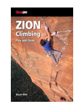
In the New Sedona guide.
I am 5 topos and ~4 working hours from finishing the photoshop work on all of them.
I recieved these topos as copies, pencil scrawls, works of art, and everything in between from 10 different sources, traced them for consistency on a light table, scanned them, and cleaned them up with photoshop.
Here's just one example of the process, this one took 6 hours.
Before:
After:
Additional statistics:
700 routes in 35 different areas, several of these have up to 5 sub-areas.
UNHOLY!!!
Seriously getting close now folks.
Thanks to Justthemaid for being a psyched editor, cuz I am totally burnt out on the sheets.
Must...keep...going...so...close...
|
|
nature
climber
Tucson, AZ
|
|
|
Aug 24, 2009 - 07:22pm PT
|
keep up the good work, E... It's worth it. We missed you out at Winslow.
I mentioned to Dave but I also want to mention it to you. I think some of the dogs that joined us on so many of our trips, in particular Winslow, deserve a mention. Cora, Yoda, Summit, Aussie, Patsy Cline... you get the picture.
|
|
drljefe
climber
Old Pueblo, AZ
|
|
|
Aug 24, 2009 - 07:23pm PT
|
Now you and Skip get your valley asses back here to do some crimbimg, ok?
Keep it up- those topos better work!!!
|
|
klk
Trad climber
cali
|
|
|
Aug 24, 2009 - 07:26pm PT
|
i have no idea if they're functional, but i really like yr. maps and block printing.
that slightly askew block printing looks vaguely tami-ish.
|
|
Studly
Trad climber
WA
|
|
|
Aug 24, 2009 - 07:37pm PT
|
Right on, very nice topos in the grand old handdrawn tradition.
|
|
nature
climber
Tucson, AZ
|
|
|
Aug 24, 2009 - 07:38pm PT
|
I'm 100% certain these topo's will be very functional.
|
|
Nate D
climber
San Francisco
|
|
|
Aug 24, 2009 - 07:48pm PT
|
cool. Love hand drawn topos. Don't know squat about the guide or these areas, but I do have a lot of experience with maps, and IMHO North should ideally always be pointed north. Seems to help for some reason. :)
|
|
Clint Cummins
Trad climber
SF Bay area, CA
|
|
|
Aug 24, 2009 - 08:01pm PT
|
Looks good! Although I think the Before photo is not the rough sketch - it looks like a retraced version.
Topo cleanup is usually a huge project in time and effort!
And I think Nate meant to say North should be pointed *up*, which I agree with.
(Maybe a suggestion for a future edition, after you finish this one and get a lot of time off for remotivation).
|
|
Redwreck
Social climber
Echo Parque, Los Angeles, CA
|
|
|
Aug 24, 2009 - 08:13pm PT
|
Wow, looking good there. Excellent work!
|
|
klk
Trad climber
cali
|
|
|
Aug 24, 2009 - 08:17pm PT
|
IMHO North should ideally always be pointed north. Seems to help for some reason. :)
yeah, for the big overview maps. but if you did that with this example, the trail would be pointing down.
wouldn't bother me, but the gym climbers will be screwed. they'll be off to deliverance territory, with 48 HRS and lawsuits to follow.
|
|
steelmnkey
climber
Vision man...ya gotta have vision...
|
|
|
Aug 24, 2009 - 09:01pm PT
|
Very nice E! Like that style.
Can't wait to see it!!
|
|
MisterE
Trad climber
Canoga Porn, CA
|
|
|
Topic Author's Reply - Aug 24, 2009 - 09:35pm PT
|
Thought I might throw out some of the keeper area cover pages again:
Crap! I gotta finish this!
Lates!
|
|
goatboy smellz
climber
लघिमा, co
|
|
|
Aug 24, 2009 - 09:41pm PT
|
Looking good, do I need to send JTM one of these to help you make the deadline?
|
|
SteveW
Trad climber
The state of confusion
|
|
|
Aug 24, 2009 - 10:08pm PT
|
Shoot, E, I wuz hopin' it'd be INTO THE WIDE. . .
hee hee hee. . .
|
|
MisterE
Trad climber
Canoga Porn, CA
|
|
|
Topic Author's Reply - Aug 24, 2009 - 10:12pm PT
|
The deadline is the start of Sedona climbing season - November.
Edit: that's the deadline because that's the soonest it's going to come out! 8}
|
|
mark miller
Social climber
Reno
|
|
|
Aug 24, 2009 - 10:16pm PT
|
Nice work E. Is The"barn" gonna "Burn" on the eastside on Holloween?
|
|
TGT
Social climber
So Cal
|
|
|
Aug 24, 2009 - 10:36pm PT
|
but the gym climbers will be screwed. they'll be off to deliverance territory,
And that's a bad thing?
North should be up, consistently. If the detail maps are oriented differently from the overview maps, that can get really confusing. Seen it done in other guide books and it lead to some "WTF?" moments.
|
|
Curt
Boulder climber
Gilbert, AZ
|
|
|
Aug 24, 2009 - 11:02pm PT
|
Another vote for north pointing up on any map.
Curt
|
|
MisterE
Trad climber
Canoga Porn, CA
|
|
|
Topic Author's Reply - Aug 24, 2009 - 11:05pm PT
|
TGT: I appreciate your perspective.
It ain't happening this round, can we move on?
|
|
BlackGeorge
Social climber
Utah
|
|
|
Aug 25, 2009 - 09:33am PT
|
Good. Some have been waiting years for a new Northern AZ guide.
|
|
BlackGeorge
Social climber
Utah
|
|
|
Aug 25, 2009 - 09:35am PT
|
Bad. Maps that are not oriented correctly and hopefully Bloom/Wolfe will not make the same mistakes as Castles in the sand: backward photos, wrong FA info, and poor directions.
|
|
mtnyoung
Trad climber
Twain Harte, California
|
|
|
Aug 25, 2009 - 10:36am PT
|
Very impressive work. Your hand drawings look informal, but crisp. I especially like the photo-overlay introduction pages. Seems that you've got tremendous love and passion for this place. Inspires me to wish for a few extra lifetimes - so much to explore, not enough years. I think I'll buy a copy whether I'll get there ever or not.
Thanks.
|
|
MisterE
Trad climber
Canoga Porn, CA
|
|
|
Topic Author's Reply - Aug 25, 2009 - 10:58am PT
|
Thanks for the props.
I should note that, because of the length of the approaches on many maps, we would have to shrink them down as to be almost illegible to "orient them correctly" on a 6" X 9" page.
So we oriented them to fit on the page.
|
|
Jaybro
Social climber
Wolf City, Wyoming
|
|
|
Aug 25, 2009 - 11:14am PT
|
I really love this shyt!
Jay-haveclimbedinsedonainaugust-bro
|
|
klk
Trad climber
cali
|
|
|
Aug 25, 2009 - 12:16pm PT
|
Thought I might throw out some of the keeper area cover pages again
The font on the area pages is pretty Windham Hill for my taste. But that's probably appropriate for Sedona and the power vector tours and all.
|
|
pedge
Trad climber
SW
|
|
|
Aug 25, 2009 - 01:07pm PT
|
I know its controversial for Sedona, but what about GPS coordinates? Not that I don't love getting all scratched up thrutching through the bush as much as anyone, but for the partners with nice legs, so they don't have to wear old baggie ugly pants every time we go out to find a new area (new to us).
|
|
mtnyoung
Trad climber
Twain Harte, California
|
|
|
Aug 25, 2009 - 01:22pm PT
|
The guy's working his ass off trying to finish the book. And we want more content, more specifics, more of his time and sweat. I have a respectful suggestion. Let's let him finish it; finish hours and hours of thankless labor. Yeah, I know, its not all thankless, I bet he's enjoyed the work and the product that is resulting, but maybe let's help a little instead of nitpicking.
You want GPS coordinates? Great idea, that could be very helpful. So go get them yourself and post them for public benefit.
Sorry to sound snotty, but no-one posting here seems to be thankful for all the work this guy is putting in for the benifit of the climbing public (and we don't really think the guy is going to make money on this do we - is anyone here that naive?).
|
|
drljefe
climber
Old Pueblo, AZ
|
|
|
Aug 25, 2009 - 01:26pm PT
|
I am very appreciative of E's work. Thank you thank you thank you.
Now, about profits...... E?
those topos better work.
|
|
mucci
Trad climber
The pitch of Bagalaar above you
|
|
|
Aug 25, 2009 - 01:35pm PT
|
Much respect to the man who opts for timeless hand-drawn topos.
Your keeping the spirit alive my friend!
I'll buy one
Mucci
|
|
mtnyoung
Trad climber
Twain Harte, California
|
|
|
Aug 25, 2009 - 01:37pm PT
|
Also timeless is well done sarcasm. Nice, Mike.
|
|
MisterE
Trad climber
Canoga Porn, CA
|
|
|
Topic Author's Reply - Aug 25, 2009 - 02:59pm PT
|
OMFG! I am rolling over here - thanks Mike.
|
|
steelmnkey
climber
Vision man...ya gotta have vision...
|
|
|
Aug 25, 2009 - 03:08pm PT
|
Hey, mine are all hand drawn. Right up until they get on the computer and get redrawn. Makes it much easier to turn and edit them so that north is up. :-)
(just kidding E - git 'er done!)
|
|
Clint Cummins
Trad climber
SF Bay area, CA
|
|
|
Aug 25, 2009 - 04:18pm PT
|
Here's a rotated version; this one still fits on a page.
When I'm just looking at the book, it's nice to have North up.
When I'm actually using the map, I'll rotate it to my direction
of travel to see if I can ID the landmarks along the path.
So your method of rotating the map to match the initial direction
of travel is good, since there is lots of text on the map.
I thought it might be fun to see if the text rotation could be
taken one step further, to match multiple directions of travel on the approach.
So I played around with rotating the text to match the 3 directions on the approach.
Maybe too "busy", though, and not nice for casual reading.
version with North up
version in "book" orientation (no text upsidedown = better)
I suppose the text is backwards for the descent, but maybe the map is not used so intensively at that point.
One other thing I modified was to remove as many arrows as possible.
No way could I hang in there to clean up 101 maps! Good work on the project.
|
|
MisterE
Trad climber
Canoga Porn, CA
|
|
|
Topic Author's Reply - Aug 26, 2009 - 03:28pm PT
|
Done. The final number is 106.
Going out to celebrate with a fine Mexican lunch!
|
|
Nate D
climber
San Francisco
|
|
|
Aug 26, 2009 - 03:57pm PT
|
Good work E!
Interesting experiment Clint - but really peculiar and unfamiliar at first glance, and thereby confusing to most users, I would think.
|
|
steelmnkey
climber
Vision man...ya gotta have vision...
|
|
|
Aug 26, 2009 - 04:09pm PT
|
I was thinking more about this last night and realized that I'm doing the same thing on a guide I've been working on for years. The maps are aligned as a climber would "enter" the area. Most people (even climbers) don't seem to know which way north is most of the time, so I think it will make more sense to them to have the map aligned as they're viewing the area. If the maps were aligned to north, they would have to "turn the map in their head" to make sense of anything.
For overall maps (eg. those used to drive to the parking spot), I can see sticking to the "north is up" rule so that the map makes sense in terms of standard road maps, but after that, I think it depends. Just my $0.02.
|
|
pedge
Trad climber
SW
|
|
|
Aug 26, 2009 - 04:15pm PT
|
I know that no one gets rich off of it, but publishing guides to climbing areas is a sacrifice and public service?
Asking for things you might appreciate in a product, like GPS coordinates, is somehow critical and a failure to appreciate the work of self sacrificing guidebook authors? Some people pay just to find out what potential customers might actually want so that the competition doesnt come out with something more desirable soon after.
GPS use is evil or worse for the environment or other peoples experience than using paper maps or tromping down multiple access trails though fragile Sedona soil on steep slopes approaching routes? The nice thing about the painstakingly well drawn topos is that they get you to the start of the route on one consistent approach. Sometimes this can be augmented with GPS readings. Its not evil or even very scary and less intrusive than cairns.
Asking for anything more in what someone is selling you shows a lack of gratitude?
Super topo people are nice generally, but some of you are really kind of crazy.
|
|
TKingsbury
Trad climber
MT
|
|
|
Aug 26, 2009 - 04:40pm PT
|
Nice work E!
Your updates give me strength to keep scrapping away at my own project...
Here to you and yours,
Cheers!
Tom
|
|
steelmnkey
climber
Vision man...ya gotta have vision...
|
|
|
Aug 26, 2009 - 04:42pm PT
|
Pedge wrote:
"I know that no one gets rich off of it, but publishing guides to climbing areas is a sacrifice and public service?"
Not trying to be combative here, but it pretty much has been in my experience.
If I'm lucky, I've managed to maybe just break even on the guidebooks I've done, when considering gas, time, processing film (pre-digital), supplies, etc. Add in the fact that you're out there drawing maps and topos, taking photos, getting GPS coordinates, etc. when you could be off climbing your own tick list at other areas and it's a slam dunk.
There's another way to think about it... Erik and Dave are maybe within a couple months of wrestling the Sedona info to the ground so it can be put together into a book and everyone steps in and basically says "Hey guys, why don't you get in your car and head out to EVERY location in the guide, hike on into the place again and get GPS coordinates for us."
Very much a "donation" to the climbing community in my opinion, which is okay. Most guidebook authors I know do it because they love it, not because they'll get rich or famous.
|
|
bc
climber
Prescott, AZ
|
|
|
Aug 26, 2009 - 04:45pm PT
|
Can't wait. I know how much time such an undertaking can take. Way to go! I'm with Steelmonkey about orienting the map so that it makes sense to climbers entering an area. Most climbers could care less about north unless it means shade or cold! I've included north arrows on the maps in guides I've done, but it didn't always have to point to the top of the book. You can always just turn the book to "face" north if you want to. Keep it up!
|
|
mtnyoung
Trad climber
Twain Harte, California
|
|
|
Aug 26, 2009 - 04:59pm PT
|
Pedge: Steelmnky said it great:
"There's another way to think about it... Erik and Dave are maybe within a couple months of wrestling the Sedona info to the ground so it can be put together into a book and everyone steps in and basically says "Hey guys, why don't you get in your car and head out to EVERY location in the guide, hike on into the place again and get GPS coordinates for us."
It's not so much about ingratitude as about maybe understanding. Your earlier post seems to show a distinct lack of understanding of what this guy has put into this project. And that does sound ungrateful.
It appears that MisterE is getting the basics really right. Extras? Well, maybe they'd be nice and maybe he's giving all the time and energy he has.
Although I don't use it, I think GPS is useful, and that it can be extremely helpful (I'm putting GPS into the being-assembled Sonora Pass Highway Second Edition). And you've given great specifc reasons why it would be helpful in that area. But this late in the process its probably a totally, utterly unrealistic suggestion.
So, you've got a nice idea. Why don't you start a public data base for that area's GPS? You don't even have to "get in your car and head out to EVERY location in the guide, hike on into the place again and get GPS coordinates," but instead just put in data on an ongoing basis. Others could contribute too.
Help the guy with his seemingly stellar effort, make it better. Instead of saying what it lacks.
|
|
steelmnkey
climber
Vision man...ya gotta have vision...
|
|
|
Aug 26, 2009 - 05:10pm PT
|
mtnyoung said:
"It's not so much about ingratitude as about maybe understanding."
Absolutely. Not declaring anyone offensive here, just tossing out my own experience with this sort of deal.
As an aside, I've debated collecting GPS info and putting it in guides I've done, but in the end, I have a hard time seeing that info as all that useful (I could be wrong, but I can't see ever personally using a GPS to navigate to a crag I'm trying to get to). The maps should be more than enough to get people to the right crags without too much fanfare.
|
|
Clint Cummins
Trad climber
SF Bay area, CA
|
|
|
Aug 26, 2009 - 05:45pm PT
|
My son has a GPS I can borrow, but usually I don't want to carry the extra weight.
Here are 2 examples where I have heard a GPS was useful:
1. Rich Goldstone used a GPS to find his way back to the car, on the flat/bushy desert floor in the dark after doing a climb at Red Rocks.
2. Somebody did the hike to Snake Dike, but was unsure exactly where the climb started. They saw many people hiking up the slope below, and needed to find it and get started right away! So they punched in the GPS coordinates from the supertopo guide. Bingo, right to the start.
A GPS could be useful for navigating a maze of logging roads, maybe in Southern Yosemite?
It could also be useful in the Pickets, to locate key points, like the place to cross the Barrier, or exactly where the trail starts for Access Creek. But it may be against the traditional navigation challenge to use a GPS there.
|
|
MisterE
Trad climber
Canoga Porn, CA
|
|
|
Topic Author's Reply - Aug 26, 2009 - 05:56pm PT
|
The Brins Mesa map I posted here is a good example of what Greg said - you want to look down the trail to where you are going, not where North is. This is true of a lot of Sedona Climbing. The directions are "vaguely southeast", because the washes wander a lot around hills, traversing sandstone formations, etc. The concern here is more with visual references.
I could totally see way-pointing difficult approaches, but that will have to wait for another edition. I don't even have a GPS.
This guidebook is the first comprehensive update in over 20 years, so we have had a long road.
Thanks for the props. It's going to be a really good guide - I can feel it.
|
|
Mighty Hiker
Social climber
Vancouver, B.C.
|
|
|
Aug 26, 2009 - 06:07pm PT
|
The shortest distance between two points in rough country is rarely a straight line, making GPS navigation a challenge.
If there 101, will one feature a Dalmatian?
|
|
nature
climber
Tucson, AZ
|
|
|
Aug 26, 2009 - 06:07pm PT
|
I don't feel north pointing to the top of the book is that important. Does the map make sense when you are standing at the parking lot looking for the climb. That's what you want. You can always turn the book the right way if you want to orient the map.
One question - do the maps have a scale? D'oh!
The real trick in making a map that works for people is being able to take a step back and look at the map from a noobs point of view. If you are overly familiar with the area (which you are since you are the author) you have to realize what might make perfect sense to you is totally confusing to someone who is visiting the area for the first time.
Squeezing the Lemmon is a pretty good example of that. It makes sense after you are familiar with the various places but it's agrivating the first time you go to an area. And that's one book where scale really would help.
Oh... and don't forget to include magnetic declination! :-P
I appreciate their work very much. I better... some of it was mine!
|
|
Clint Cummins
Trad climber
SF Bay area, CA
|
|
|
Aug 26, 2009 - 06:09pm PT
|
Doug,
The map does have a reasonable scale of sorts - the "time" scale in its text. I do appreciate a map which is "to scale", i.e. longer on the map means longer distance on the ground.
-
This might work as a compromise - in normal "book" orientation, but with North on a major axis.
|
|
mtnyoung
Trad climber
Twain Harte, California
|
|
|
Aug 26, 2009 - 06:27pm PT
|
The real trick too is thinking and trying hard. I prefer north at the top, but the maps I make don't always have it straight up either (for various reasons). I see a thought out alternative here in orienting the map to the direction the user will be hiking.
Even though I've never used it, I'm putting GPS in the Sonora Pass book for two reasons: 1. Here the climbing crags are spread over an areas of 60 miles by 10 or so miles and GPS used in conjunction with Google maps, or other programs, or just used to confirm that you're close might be helpful (perhaps that could be true in Sedona too?), and, critically, 2. Because we got to it at the start of the (second edition) project, and we won't have to go back and get big amounts of data for an almost finished book.
But GPS doesn't seem like basic stuff, an item without which the book would be deficient.
|
|
Chinchen
climber
Flagstaff?
|
|
|
Aug 26, 2009 - 07:03pm PT
|
You rule Erik!
|
|
BlackGeorge
Social climber
Utah
|
|
|
Aug 27, 2009 - 03:04pm PT
|
Soooooooooooo
How much are these new guides going to cost??
|
|
Larry
Trad climber
Bisbee
|
|
Bump.
When, already?!
|
|
Jaybro
Social climber
Wolf City, Wyoming
|
|
When can Larry buy me one?
|
|
MisterE
Trad climber
Canoga Bark! CA
|
|
|
Topic Author's Reply - Oct 9, 2009 - 06:34pm PT
|
We are shooting for November/December. Cost will be probably $30-$34 depending on guide size and pages. Going to Boltgrl for conversion next week!
Thanks for the input again, Don. I really like the way you mix up your guides, we are really shooting for that balance, as well.
And, Doug: Skip has never been to most of these areas and is helping me A LOT with the guide, so she's got that "Noob Eye for the Guide Guy". Plus, she is a strong critic of some guidebooks, so I get the benefit of that as well. Heh.
|
|
Larry
Trad climber
Bisbee
|
|
Maybe not, Jay, at those prices.
Shared custody, perhaps?
|
|
rgold
Trad climber
Poughkeepsie, NY
|
|
Another instance of GPS utility for Clint's List: Finding the right spot at the top for climbs that are rapped into from above. Many cliff tops lack the kinds of distinguishing features that would make it possible to describe such locations.
|
|
kole
climber
|
|
|
Oct 12, 2009 - 03:27am PT
|
Man, I wish I had that map a few years ago. I remember heading left for Tomahawk where it sais "hill". There's some bad plants on the back side of that hill.
About the whole North is up controversy, something looks a little funny about the north arrow. Unless I'm really disoriented (which wouldn't be the first time), doesn't that map make it look like you're hiking south on Brins Mesa Trail? I just checked google earth to jog my memory and I think the trail goes basically east, with a little drift to the south. I think the road is going north there.
I say keep the orientation like it is, that map would get me right there. But fix the north arrow if you agree that it's wrong.
I can't wait for the guide! I'm living now where the rocks don't crumble, and they're all a boring shade of grey. And I just had a baby so even those rocks seem unreachable. I really need some good reading to bring me back to those happy Sedona days!
|
|
MisterE
Social climber
Across Town From Easy Street
|
|
|
Topic Author's Reply - Dec 7, 2009 - 10:55pm PT
|
Update bump: David and I are psyched to review the rough draft of the new Sedona Climbers Guidebook between Christmas and New Years! Shouldn't be too long after that until the release date!
Thanks for your work, Boltgrl! You rock!
|
|
Hummerchine
Trad climber
East Wenatchee, WA
|
|
What am I missing here? There must be some sort of computer glitch or sandbag...the "before" and "after" photos that I am seeing appear to be identical! Granted, I have not been staring at it much longer than a few minutes...but the only difference I can see on my computer is one additional line below where it says "Seasonal Pools/Slickrock", below the trees. What the heck?
|
|
MisterE
Social climber
Across Town From Easy Street
|
|
|
Topic Author's Reply - Dec 8, 2009 - 12:01am PT
|
The difference between the before and after? 6-7 hours of photoshop.
Maybe I have a more discerning eye, or maybe just zooming in too much on my fixes.
All will be revealed soon, foolish or not.
|
|
MisterE
Social climber
Across Town From Easy Street
|
|
|
Topic Author's Reply - Dec 28, 2009 - 12:06pm PT
|
Just got word that the book will be over 300 pages...get to see the rough draft tonight. I'll try and snap some shots and post 'em up in the next few days.
Super psyched!
|
|
Melissa
Gym climber
berkeley, ca
|
|
|
Dec 28, 2009 - 01:12pm PT
|
Like.
Now I will have access to 300 pages of soft, beautiful climbs that I'm too scared to actually do instead of 30. ;-)
|
|
| Messages 1 - 62 of total 62 in this topic |
|
SuperTopo on the Web
|