Trip Report
Valhalla, I am coming!
|
Sunday August 21, 2011 11:03am
|
|
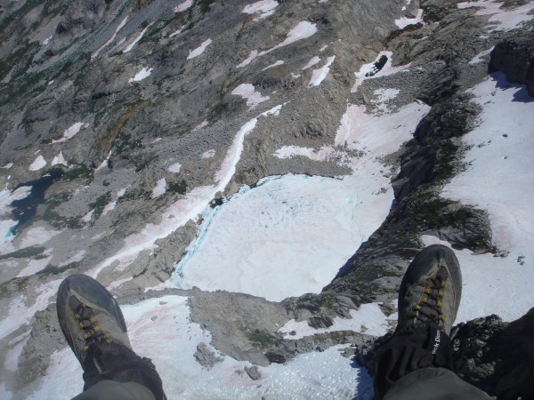
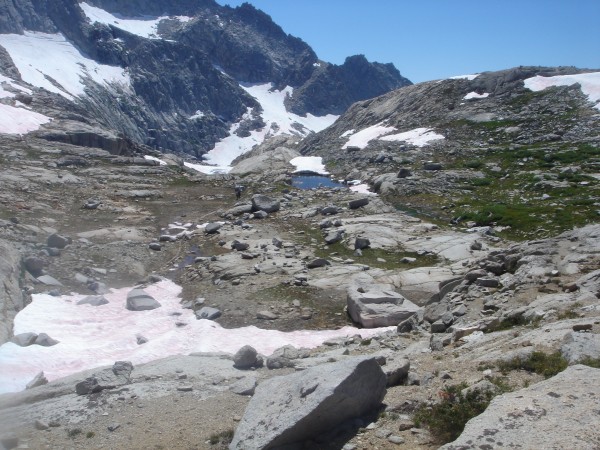
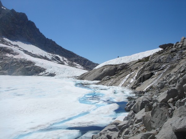
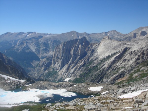
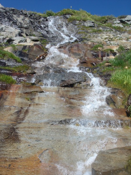
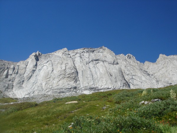
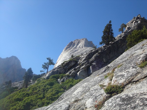
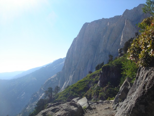
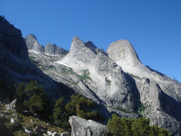
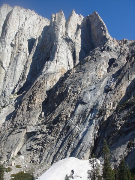
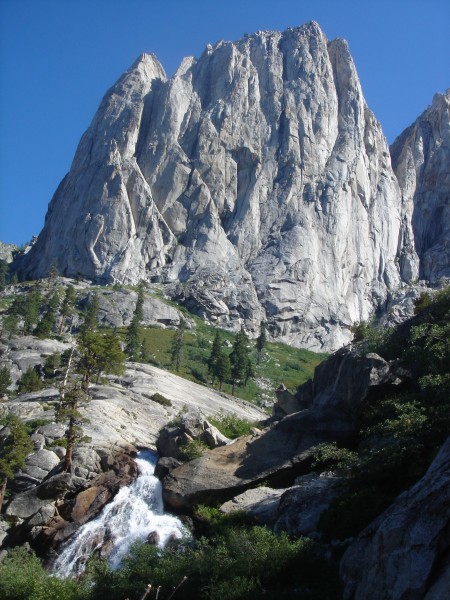
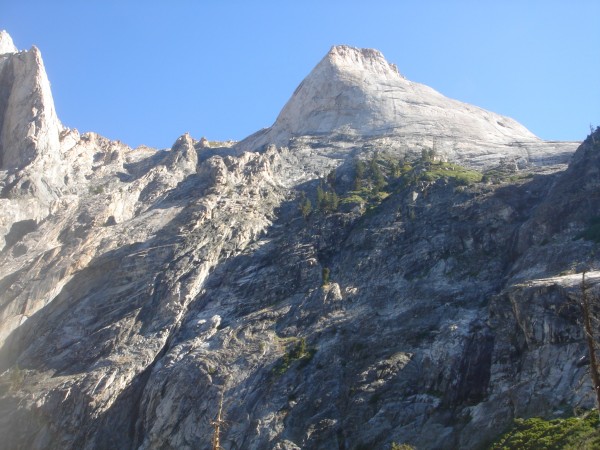
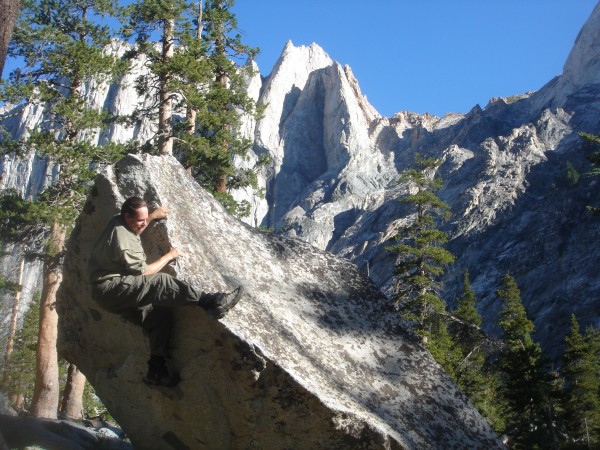
Sequoia National Park: Angel Wings are located in a Valley known as Valhalla.
-Lyrics from Led Zepplin III, Immigrant Song
Note:you can play the song in the background in a separate window with this link while you look at the pictures: http://www.youtube.com/watch?v=tCvMKcNJCAY
//We come from the land of the ice and snow,
From the midnight sun where the hot springs flow.//
//The hammer of the gods will drive our ships to new lands,
To fight the horde, singing and crying: Valhalla, I am coming!//
On we sweep with threshing oar, Our only goal will be the western shore.
//How soft your fields so green, can whisper tales of gore,
Of how we calmed the tides of war. We are your overlords.//
//So now you'd better stop and rebuild all your ruins,
For peace and trust can win the day despite of all your losing.//
Aaahhhhaaaaaaaaaaa - Ah!
No roped climbing done on this trip. Got the area scoped out pretty well though. Anyone planing a trip, feel free to contact me for trail info, camping etc. Looking forward to getting back up there with you someday.
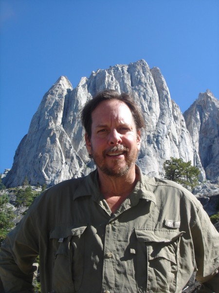
 Spider Savage
|
|
About the Author
Spider Savage is a mountain climber from SoCal. |
Comments
mike m
Trad climber
black hills
|
|
|
|
Aug 21, 2011 - 11:05am PT
|
Nice pictures. I need to go there some day.
|
|
The Lisa
Trad climber
Da Bronx, NY
|
|
|
|
Aug 21, 2011 - 11:12am PT
|
What an amazing place! Thank you for sharing such lovely photos. I love the Immigrant Song narrative too - one of my fave songs.
|
|
drljefe
climber
El Presidio San Augustin del Tucson
|
|
|
|
Aug 21, 2011 - 11:16am PT
|
Beautiful country.
Great photos!
Nice share.
Unfortunately, Immigrant Song is the ONE
Led Zeppelin song I can say I truly despise.
Bummer for me.
|
|
JEleazarian
Trad climber
Fresno CA
|
|
|
|
Aug 22, 2011 - 01:22am PT
|
Wow! one of my favorite places with the background of some of my favorite music. Beautiful pics.
Thanks much.
John
|
|
Josh Nash
Social climber
riverbank ca
|
|
|
|
Aug 22, 2011 - 01:31am PT
|
Way to get out. There is just way too much rock out there...
|
|
Jennie
Trad climber
Elk Creek, Idaho
|
|
|
|
Aug 22, 2011 - 01:38am PT
|
Outstanding photos!
|
|
Reilly
Mountain climber
The Other Monrovia- CA
|
|
|
|
Aug 22, 2011 - 02:08am PT
|
So how did you managae to commence this trip at the top of Boy Scout Pk?
Did you get beamed down?
|
|
Mungeclimber
Trad climber
Nothing creative to say
|
|
|
|
Aug 22, 2011 - 02:18am PT
|
dig the music connect
|
|
enjoimx
Trad climber
Yosemite
|
|
|
|
Aug 22, 2011 - 04:09am PT
|
This is amazing! Thanks for the post. Lots of climbing possibility here!!!
|
|
Roxy
Trad climber
CA Central Coast
|
|
|
|
Aug 22, 2011 - 08:58am PT
|
the background music was rad!
that place was even more so....
thanks for sharing,
|
|
neversummer
climber
30 mins. from suicide USA
|
|
|
|
Aug 22, 2011 - 10:06am PT
|
Bitchin'
|
|
Charlie D.
Trad climber
Western Slope, Tahoe Sierra
|
|
|
|
Aug 22, 2011 - 10:08am PT
|
What a beautiful place, thanks!
|
|
stilltrying
Trad climber
washington indiana
|
|
|
|
Aug 22, 2011 - 10:14am PT
|
Awesome. Thanks for the report.
|
|
Jingy
climber
Random Nobody
|
|
|
|
Aug 22, 2011 - 10:30am PT
|
Nice photographicsness!!!
|
|
squishy
Mountain climber
|
|
|
|
Aug 22, 2011 - 10:34am PT
|
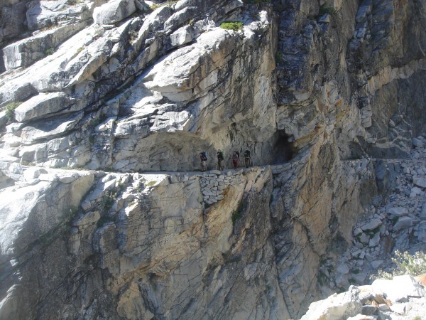
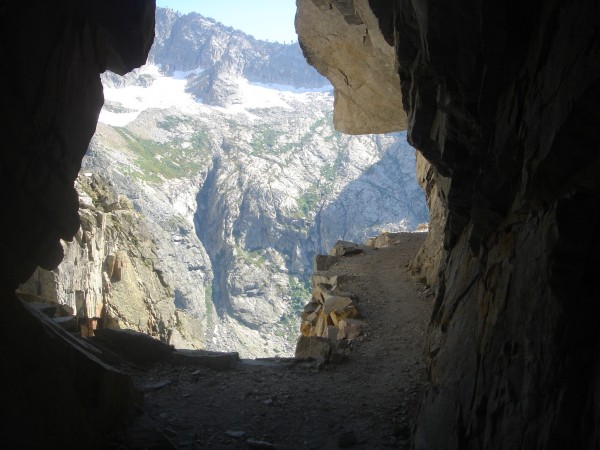
nice TR, I love the looks of that trail, gotta go check it out...
|
|
Spider Savage
Mountain climber
The shaggy fringe of Los Angeles
|
|
|
Author's Reply
|
Aug 22, 2011 - 10:44am PT
|
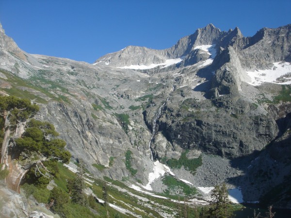
Reilly raises a good question: "How did I start the trip from the top of Eagle Scout Peak." The answer is yes, I was beamed in from Mineral King via 5 days or romping through various, peaks, passes, lakes and meadows (18 miles). The direct route brings you in from Crescent Meadow at Giant Forest. However, there are others, longer but beautiful approaches from Mineral King can go as short as 20 miles.
|
|
Gary
Social climber
Desolation Basin, Calif.
|
|
|
|
Aug 22, 2011 - 11:18am PT
|
Spider, did you go over Black Rock Pass? If so, what was the snow like there?
|
|
le_bruce
climber
Oakland, CA
|
|
|
|
Aug 22, 2011 - 02:27pm PT
|
The granite... the endless granite... (dazed, wide-eyed)
|
|
Fritz
Social climber
Choss Creek, ID
|
|
|
|
Aug 22, 2011 - 02:37pm PT
|
Aaahhhhaaaaaaaaaaa - Ah!
Damn nice country Spider.
Thanks for sharing the photos.
|
|
Captain...or Skully
climber
Boise, ID
|
|
|
|
Aug 22, 2011 - 02:44pm PT
|
Man, I hadn't realized how much I miss it there. Groove, Spider.
|
|
Gal
Trad climber
going big air to fakie
|
|
|
|
Aug 22, 2011 - 02:47pm PT
|
That looks fantastic!
|
|
donini
Trad climber
Ouray, Colorado
|
|
|
|
Aug 22, 2011 - 03:23pm PT
|
Have belay device, will travel- sign me up for next year!
|
|
Send
Trad climber
Central Sierra
|
|
|
|
Aug 22, 2011 - 04:20pm PT
|
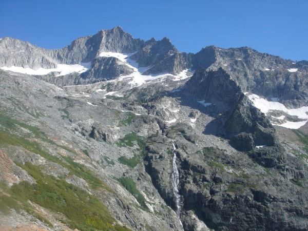
Awesome pics Spider. Cool to see Precipice Lake ice & snow covered from the summit. I slept on top of Eagle Scout Peak back in 2004. Ill never forget the low clouds in the Big Arroyo and that pink light on Black Kaweah.
Plus, I was just in that area too a couple weeks ago. Went in and out from Crescent Meadow. Went for some fly-fishing but mostly checked out the Hamilton Towers. Wow what an area.
|
|
survival
Big Wall climber
Terrapin Station
|
|
|
|
Aug 22, 2011 - 04:23pm PT
|
Awesome! Thanks Spider!!
|
|
Captain...or Skully
climber
Boise, ID
|
|
|
|
Aug 22, 2011 - 04:26pm PT
|
I've never gone beyond Angel Wings, man. How close to the Black Tower(I think that's its name; it looked green to me)does the trail go? It's before the Kaweah Gap.
We heard & saw a LOT of rockfall off that sucker. Every day.
Yer gonna die!
Loved your TR, Spider. Glorious!!!
|
|
Spider Savage
Mountain climber
The shaggy fringe of Los Angeles
|
|
|
Author's Reply
|
Aug 22, 2011 - 04:32pm PT
|
The black tower is the S buttress of Mt Stewart. Access via the Kaweah Gap. 800+ ft of pure evil black choss, the extra chunky kind. SICK! Let's go climb it.
|
|
Captain...or Skully
climber
Boise, ID
|
|
|
|
Aug 22, 2011 - 04:48pm PT
|
Dude, there's so much rockfall off that thing that I'm amazed it's still there.
I'll climb up there again, but not on THAT! That's Death on a stick, man!
Whoa.
|
|
Brandon-
climber
The Granite State.
|
|
|
|
Aug 22, 2011 - 05:24pm PT
|
That's an amazing amount of rock in one area. I need to get back to Cali. Thanks for sharing dude.
|
|
Captain...or Skully
climber
Boise, ID
|
|
|
|
Aug 22, 2011 - 06:16pm PT
|
FA's as far as one can see. Amazing rock, too.
|
|
Ezra Ellis
Trad climber
North wet, and Da souf
|
|
|
|
Aug 22, 2011 - 09:24pm PT
|
Sweet pics spider, reminds me of my trip to the wind river cirque of the towers last week!
|
|
Spider Savage
Mountain climber
The shaggy fringe of Los Angeles
|
|
|
Author's Reply
|
Aug 24, 2011 - 10:54am PT
|
Chris - For now, what you see is what you get. I would estimate that there are some very large clean free lines in there. The Secor guide rates most of the lines with partial aid. I don't see why there would not be many clean multi-pitch, including moderates.
For most people it will be a 2 day approach so you need a long stretch of time to get there.
I recommend a Supertopian expedition right after Facelift as the ideal time. Cooler days, the Sierra is perfect mid autumn. No mosquitoes, no competition for permits.
Go for it dude! It's your Destiny! Aaaaaaaaahhhhhhhhhaaaaa Ah!
|
|
slobmonster
Trad climber
SF (via NH & CO)
|
|
|
|
Aug 24, 2011 - 10:59am PT
|
Been reading up on this spot for a few years... and your photos confirm my suspicions! Thanks
|
|
Spider Savage
Mountain climber
The shaggy fringe of Los Angeles
|
|
|
Author's Reply
|
Jul 12, 2013 - 07:19pm PT
|
Bumping the sweetness. Some folks asking about this area lately.
|
|
splitclimber
climber
Sonoma County
|
|
|
|
Jul 12, 2013 - 07:26pm PT
|
so sweet.
any info on the best approach to Hamilton dome. looks like a sketchy schwack.
|
|
Radish
Trad climber
SeKi, California
|
|
|
|
Jul 12, 2013 - 08:01pm PT
|
Its a really dry year for snow this summer! So dry that the Bearpaw Camp is closed! The place that has the 5 star dinners right below Angel Wings. They ran out of water early on in the season........Nice Trip Report! Also...alittle off topic....Tell 'Hadala I am coming' I think the song says. In the late 60's there used to be a travel show with one of the hosts named Hadala who was an extremely beautiful boxxosum blond. I think this is who they meant in the song, it kind of makes sense?? Anybody??
|
|
lars johansen
Trad climber
West Marin, CA
|
|
|
|
Jul 12, 2013 - 08:15pm PT
|
Very nice. Brought back a lot of memories. TFPU
lars
|
|
donini
Trad climber
Ouray, Colorado
|
|
|
|
Jul 12, 2013 - 08:20pm PT
|
Don't you Cali folk ever get bored with those cloudless skies?
|
|
kunlun_shan
Mountain climber
SF, CA
|
|
|
|
Jul 12, 2013 - 11:29pm PT
|
^ Radish, was concerned to read about the low snow year - I hear you. We ski toured the High Route late April this year and there sure were some rocky sections.
I just checked on Bearpaw Camp and it looks like they are open. Only a few nights available, though $413 for one night in a tent cabin is a bit steep. Glad that comes with dinner!
|
|
Radish
Trad climber
SeKi, California
|
|
|
|
Jul 12, 2013 - 08:29pm PT
|
Kunlun..........I stand corrected about Bearpaw. They were real concerned about it in May and said it wouldn't open. Cool that it is! the price probably pays for them bringin water up. The Kaweah River is the lowest it has been in a long time, hopefully it won't dry up. It looks like late August around here.
|
|
Kalimon
Social climber
Ridgway, CO
|
|
|
|
Jul 12, 2013 - 08:31pm PT
|
Glad someone bumped this . . . The Range of Light indeed! Nice photos and thank you Savage for sharing them. I miss hat country when I see that rock.
|
|
|
 |
|
Recent Trip Reports
- The Kohala Ditch Trail: 36ish hrs on foot... to and from the headwaters. [5 of 5]
May 31, 2019; 11:57pm
- A Winter Traverse of the California section of the PCT Part 8
May 31, 2019; 11:18pm
- Supertopo,A trip report for posterity
May 31, 2019; 11:00pm
- Balch Fest 2013. Two Days in and Around and On The Flake. The Official Trip Report
May 31, 2019; 10:57pm
- TR: My visit to the Canoe
May 31, 2019; 10:24pm
- Death, Alpine Climbing, The Shield on El Cap
May 31, 2019; 4:07pm
- Andy Nisbet (1953-2019)
May 31, 2019; 2:11pm
- Drama on Baboquivari Peak
May 31, 2019; 1:19pm
- Joffre + The Aemmer Couloir: ski descents come unexpected catharsis [part 2]
May 31, 2019; 7:45am
- Lost To The Sea, by Disaster Master
May 30, 2019; 5:36am
- My Up And Down Life, Disaster Master
May 29, 2019; 11:44pm
- Halibut Hats and Climbers-What Gives?
May 29, 2019; 7:24pm
- G Rubberfat Overhang-First Ascent 1961
May 29, 2019; 12:28pm
- Coonyard Pinnacle 50 Years Later
May 29, 2019; 12:24pm
- Great Pumpkin with Mr Kamps and McClinsky- 1971
May 29, 2019; 12:02pm
- View more trip reports >
|