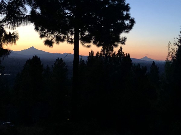
 Mt. Jefferson on the left, Hood on the right. Credit: Charlie D. |
||
I reached for my cell phone to text my California climbing buddy Clarke who grew up in Eugene and proposed the idea of standing on top of the Big White Bloody Bastard. There was no coaxing necessary, Clarke is one of those transplanted Oregonians who pines for his Cascade home range. He immediately accepted and declared we should climb from the south in order to better enjoy a future evening martini (or marmaxie) with the entire route in view. I declared him our guide and picked a date that coincided with his family reunion near Bend.
I first grew suspicious of his route choice having read accounts of long slogs and hideously loose scree but Clarke being one whose position only hardens with time declared it the right choice. I asked about climbing gear and heard, tennis shoes with crampons is all that is needed in the Oregon Cascades along with some snow pickets. He went on to say a light rope would be good enough.
Easy done, I pulled my flexible light weight aluminum ski mountaineering crampons out to test fit them on my approach shoes and threw my one snow picket in the back of the truck along with my rap cord and a few slings and off I went to Bend. Arriving at the Pamelia Lake trail head I asked Clarke where his snow pickets were, in my garage and that we wouldnt be needing mine anyway.
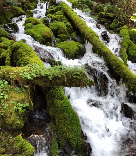
The Mt. Jefferson Wilderness Area is spectacular. You start out at 3,000 ft. in an old growth forest with an understory of Rhododendrons, ferns and moss covering everything and travel thru a host of wonderful environments as you gain elevation.
 Credit: Charlie D. |
||
Clarke suggested a longer approach route up the lakes upper drainage and then onto the Pacific Crest Trail. I heard tales of his days with his dad, a U of O professor and member of the Obsidians, a fraternal mountaineering club of Eugene like the Mazamas of Portland and Mountaineers of Seattle. It was therapeutic for Clarke having lost his dad a few years ago as he recounted the many days spent in the open with him and friends hiking and climbing in the Cascades. It was a most enjoyable hike up to our base camp at Shale Lake with a modest elevation gain of some 3,000 ft.
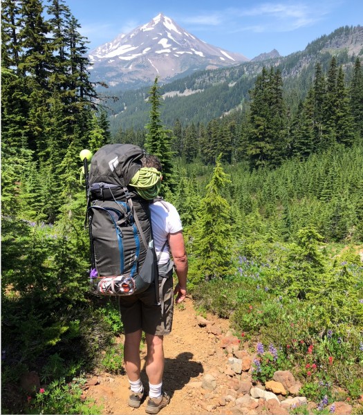 Mt. Jefferson from the south Credit: Charlie D. |
||
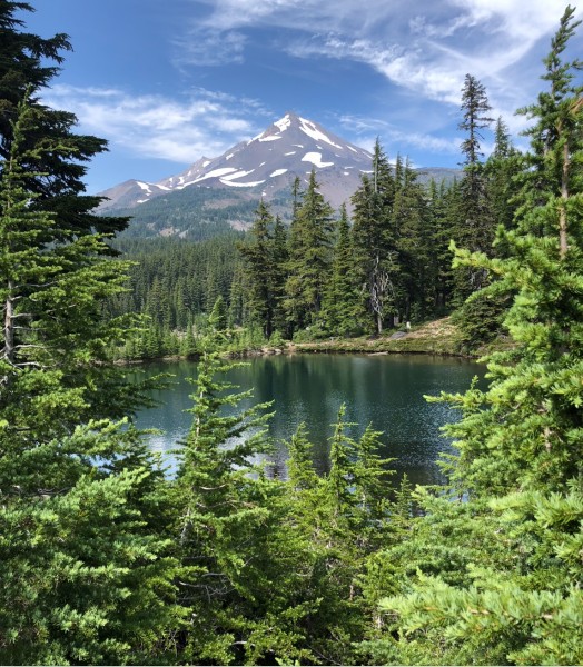 Shale Lake Credit: Charlie D. |
||
I was soon to see that bringing a tent was one of my better decisions as the evening approached base camp became mosquito hell. The unbelievable assault began with swarms of the pests buzzing about our bodies. After dinner I retreated quickly to my two man tent which Clarke declined claiming men over 50 snore all night and hed be fine with this 100% deet. Clarke in the morning claimed the mosquitos werent landing with his deet but their wind on his face was a bit annoying validating my decision on a tent.
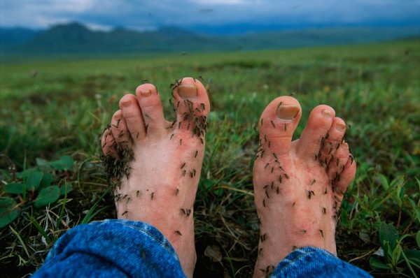 Borrowed from the internet Credit: Charlie D. |
||
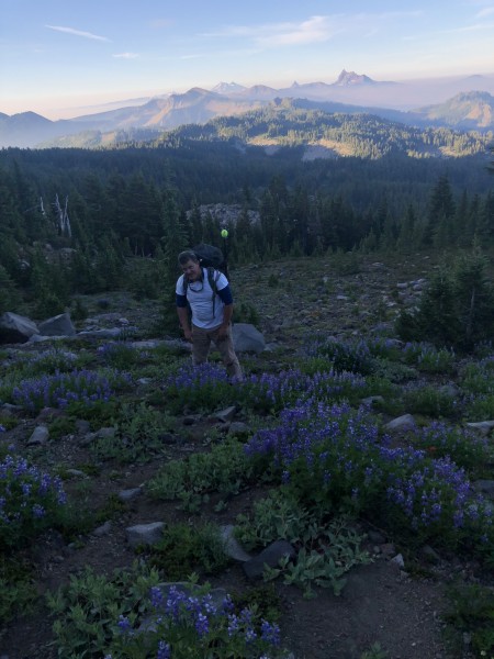
We got up and out of camp before the next biblical onslaught fueled by our Peets coffee and oatmeal and soon gained the south ridge. I must say the krumholtz of the Jefferson Wilderness is stunning beautiful with acres of lupin, heather, paintbrush and other flowers in full bloom between groves of stunted pine and hemlocks trees dressed with creeping junipers at their feet - simply beautiful.
 Credit: Charlie D. |
||
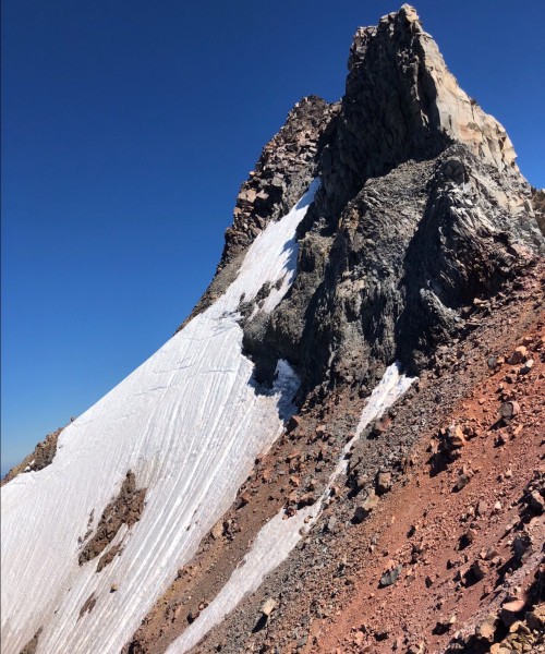
I must also say the south ridge of the Bloody Bastard is near or at the angle of repose. One only has to stick a foot into it to make it move. Ive climbed only one volcano, Mt. Shasta and that was on skis with the choss covered in snow. I couldnt believe how loose it all was, Clarke of course was in his element loudly declaring as his father would say, how sweet it is!!! I quickly learned climbing on the larger stones proved to be more efficient but realized danger lurked as those large pieces of volcanic vomit sat on nothing but sands and gravels.
Not wanting to be a disgrace to the Obsidians (being a U of O Duck myself) I continued up contemplating being crushed beneath a piece of basalt as a better and more honorable conclusion than being run over by a Buick. Not surprising I took a micro-wave size boulder to the right shin which fortunately had only a few feet of forward momentum, ouch. After several thousand feet of scree we saw three climbers descending above us. The party, a guide and his two clients had turned around at the Red Shoulder. We soon were told that my approach shoes and Clarkes tennis shoes were not ideal despite our crampons for the upper snow/ice field with its highly consequential terrain below. We continued up to see for ourselves and concluded that we had no way to protect the traverse with Clarkes perfectly good long snow pickets in his garage, dang!!!
 Credit: Charlie D. |
||
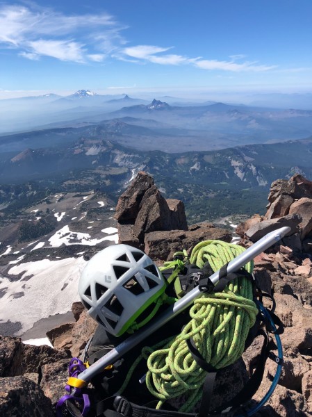 Credit: Charlie D. |
||
Oh well, turn around time which meant the 4,000 ft descent back to base camp and then another 3,000 ft to the car for what would be a classic suffer-fest. Arriving back at our base camp we ate lunch and took a quick swim before heading on down in record heat that afternoon. That last few miles worked us like rented mules and seemed the longest walk of my life. When the car finally appeared we quickly cast our packs aside and opened the Otter Box for a cold brew. Sitting there silently on the tail gate as the ale did its magic Clarke opened the conversation wondering if our long time friend Dean in Eugene would be mad we didnt call him. I pulled off my approach shoes and declared nonsense, if he had any sense hed thank us.
 Credit: Charlie D. |
||
Heres to you Clarke and to your dad and the Obsidians, how sweet it is!!!!!!!! Indeed, such fond memories we generate in the mountains, eh?
Berg Heil,
Charlie D.
/e/signature/