The final plan was to meet with two climbing buddies (John and Mike) from the states who happened to be in Europe at the same time and climb the Cosmiques arete on Saturday, the 3 Monts on Sunday and then get on a rock route on Monday at the Pyramid du Tacul. Then John and I would watch the tour on Tuesday before heading back to work on Wednesday.
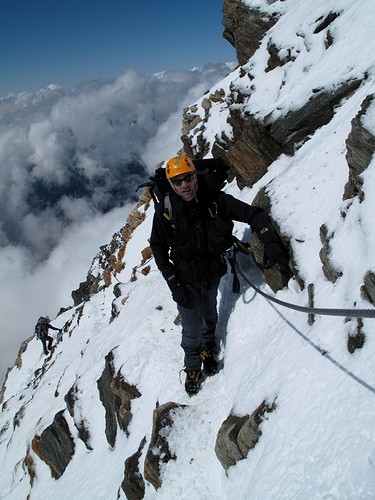
Leaving work in full sun and clear skies on Friday and driving toward increasingly ominous skies and eventually stormy Chamonix did not bode well for the original plan. Nevertheless, we got up and rolling on Saturday morning with the idea to head up for the Cosmiques arete. The Aguille du Midi station was under 60cm of fresh snow so the first run up was delayed an hour while they cleared the bulk of it. In town, it was still raining. 60cm of fresh snow over top of a crusty headwall to start the 3 Monts route did not sound like the best idea due to heavy avalanche danger but we thought we would go up and have a look.
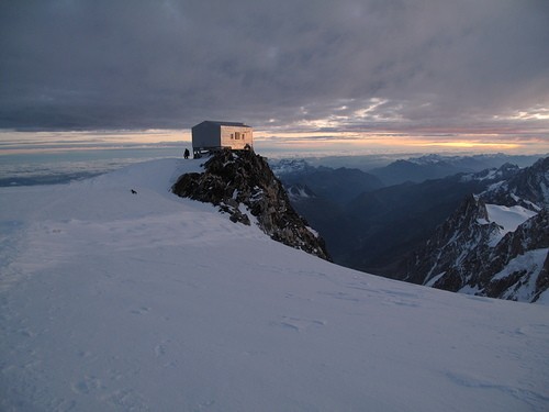
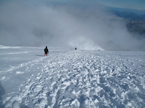
Exiting the cable car we made several false starts onto the ridge in howling winds and blowing spindrift before we decided to head inside and wait it out a few hours to see if the weather improved. It did, but very marginally and we again put on our crampons and headed down the first ridge leading to the plateau du tacul. Here is what we found:
[Click to View Linked Image]
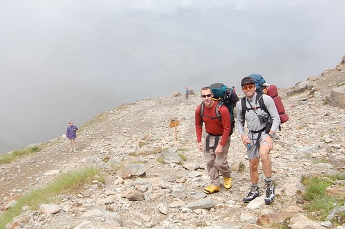
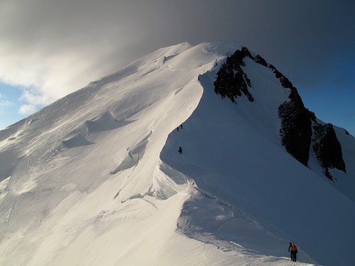
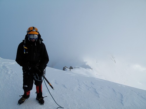
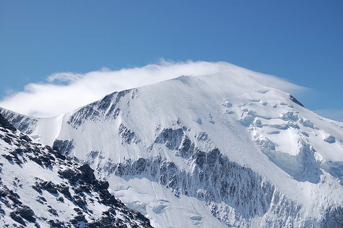
This is not exactly the ideal for the mixed rock and snow on the Cosmiques (John and Mike at the base of the first ridge):
[Click to View Linked Image]
Deciding that the original plan was not going to happen based on the new snow and the continued high winds forecasted, we switched plans to the Gouter route and headed down to change out gear and head to Les Houches to spend the night before heading up on the cable car to the cog railway and eventually to the start of the approach.
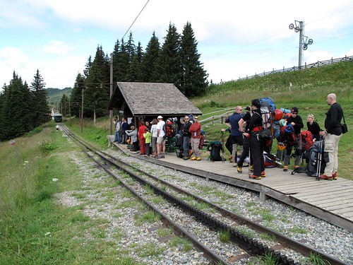
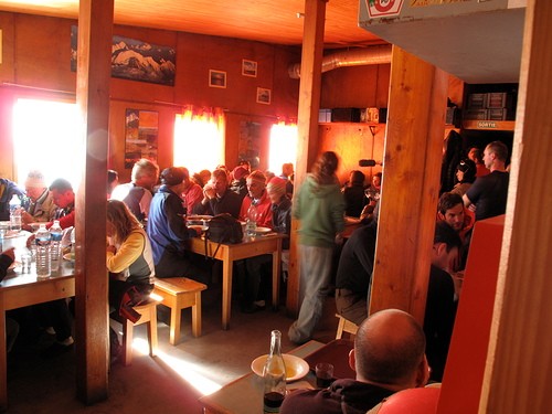
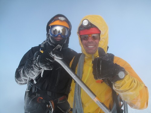
Sundary turned out to be a pretty nice, albeit windy, day. The cog railway is a beautiful ride up a valley on the western flanc of Mt Blanc. At the station we met some really nice Italians who had the same plans as us and had been foiled a few times in the past on the route. Here we are awaiting the coming train:
 |
||
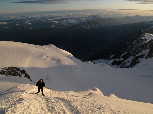
Mike and I walking up to the fresh snowline at about 2000m during the approach which climbs 4600 ft to the Gouter hut.
 |
||
Chilling out (literally) en route to the headwall guarding the Tete Rous hut.
 |
||
John climbing toward the Tete Rous hut
 |
||
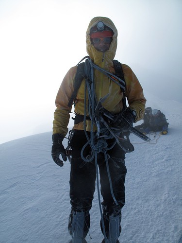
After you pass the Tete Rous hut, there is a long ridge climb to the Gouter Hut which is fitted with via ferrata cabling that was in the lee of the wind (luckily) but which also was constantly a bowling alley of falling ice chunks and small spindrift slides from the fresh, wind scoured snow.
 |
||
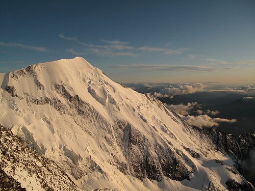
After about 4.5 hours, we were at the hut - amazing views of the Western alps and north into the foothills towards Grenoble (lots of spectacular paragliding sites were calling!)
 |
||
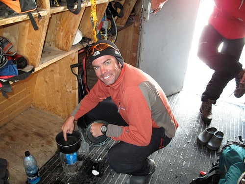
Re-stocking the H20 supplies in the hut.
 |
||
John enjoying his first alpine hut 4 course meal.
 |
||
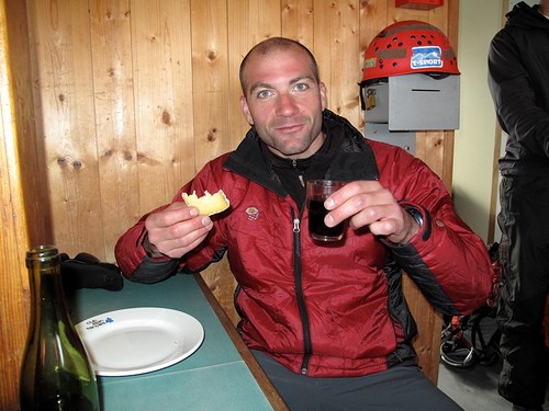
There is such a great vibe in the huts - everyone is super friendly and trying to piece together conversations in whatever common language you have is great.
 |
||
The sunset was great - super clear thanks partly to the winds. The wind was forecast for 60-70kms on the summit the next morning but with the clear skies, it seemed that it might be manageable - particularly given the less technical nature of the climbing on the Gouter route.
 |
||
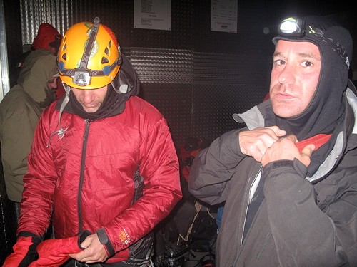
We woke up for the 2am breakfast of coffee, bread and jam, and more coffee. There were many climbers who had arrived late at night scattered all over the main room of the hut - some of whom were not so happy to be rousted out of their spots so that people could eat. There was a great old French guide who took it as his job to get everyone up and out of the room. After eating quickly, we went out into the wind and put on crampons to start up the route at about 2:40am.
 |
||
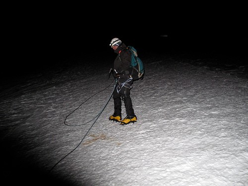
The wind was pretty relentless - John was doing a great job on the routefinding. Normally, it is pretty straightforward this time of year but the track was gone due to the new snow and 3-4 days of strong wind. The wind was pretty consistent around 50kmh and most decided not to climb. You basically had to pull your hood over the windward side of your face and use one eye to look ahead - a bit diorienting in the darkness and swirling snow. There was a group ahead of us and probably 10 or so other parties behind us. By about 4:45 we made it to the Vallot emergency hut at 4300m or so and decided it would be a good idea to take a break from the wind and wait for some sun since we were well ahead of the advertised times for the route. The other group ahead of us had done the same and were now taking a nap with the same idea of waiting for some sun. John was working on warming his hands up and we just relaxed for about 40mins before we saw the first amazing rays of the sun creeping over the Aguille du Midi.
 |
||
We left the bivouac around 5:45 and had some great views of the upper portion of the route. With about 500m to go, it seemed pretty possible to summit as long as we were willing to suffer a bit om the wind and snow.
 |
||
Mike is a pretty strong rock climber but has limited alpine experience and the wind was starting to get to him. About 100m above the hut we had a VERY quick assessment of the situation and he wanted to go down. With no danger of crevasses, he unroped from John and I and heading back to wait in the Vallot Bivuoac. John and I pressed forwad to the base of the final 300m ridge leading to the summit. There was an amazing view of the shadow of the summit with the cloud trail off the top. All around the ridge huge cloud tendrils were spilling over from the West but luckily it was just strong and steady - very little gusting.
 |
||
There is a short section where you traverse inside of a large bulge on the ridge - this offered an amazing lee from the wind where it went down to about 10-20kms!!!
 |
||
In this next photo, very close to the summit, you can see where the cloud is condensing as the winds came in from the West (left in the photo) and pushed up and over the ridge we were climbing on. At this point we were alternating between periods of full sun and full whiteout depending on where the cloud was forming and dissipating.
 |
||
Just before the summit, the clouds started to form all over and then the whole mtn was engulfed for a long period. This was taken as our last clear sun shot while we watched the cloud just push toward us at 60kms!
 |
||
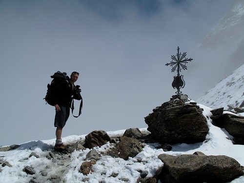
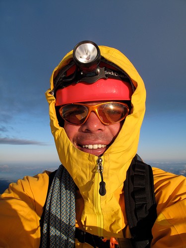
John on the summit with the cloud really coming on now.
 |
||
We very quickly got covered in rime ice from all the moisture but were stocked to be on top.
 |
||
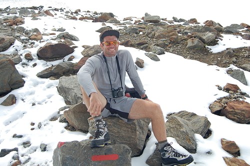
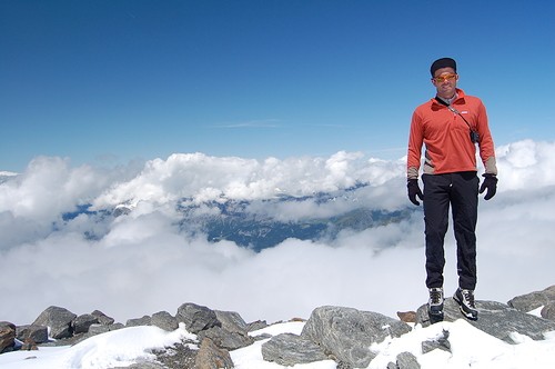
Mid summer on Mt Blanc
 |
||
 |
||
We quickly headed back down and were soon just above the Vallot hut again and below the clouds
 |
||
We re-grouped with Mike and then also found the Italians we met the previous day warming up. They were debating leaving for the top and we chatted about it. In the mean time, a Russian party was fiercely debating what their plan was to be (I think - I know no Russian). One guy clearly wanted to go to the top and the group leader did not. At one point, the head dude was literally screaming at him and then it was decided that the guy who wanted to go to the top with the Italians! I bid them "In boca Luppo" (in the mouth of whales) which means good luck and they set off and we headed down. The summit was still enveloped in a cloud at that point.
 |
||
We made it back to the hut, had some much needed food and water and started to head down the via ferrata ridge in beautiful conditions.
 |
||
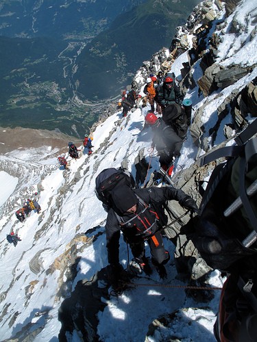
The route was swarming with people on thier way up which was a bit unnerving when you are trying to move quickly and unroped. Lots of unbashful reached around and through the roped up parties.
 |
||
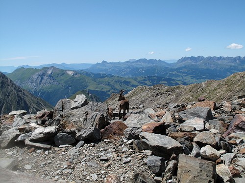
Most of the fresh snow was now melted below the Tete Rous hut now and the Ibex were out and about.
 |
||
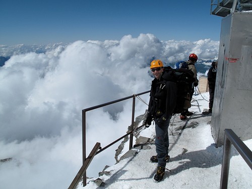
The descent is actually really long. From the top, it is 8000ft of descending down to the train stop. We made it to the station just a few minutes before the depature of a train (saving up to an hour of waiting around) and were stoked to not only have made the summit but also to be in nice weather!
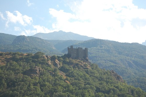
At the bottom, we packed and sorted gear and then Mike bid us fairwell since he had to get back to work in Germany. John and I met up with a friend in Cham for a bit and then headed off through the tunnel and back into Italia. John was pretty impressed with all the castles in the Aosta valley
 |
||
We stopped for a pizza and to get some beta on the Tour de France route in Pre St Didier and decided we would watch the climb to the petit St Bernard pass which is the transition from Italy back into France. After pitching a tent for the night part of the way up the hill, we awoke to a pretty bleak sky and decided to go to Courmayeur for some breakfast. The clouds broke and it was perfect weathe to just hang out, drink some beers and watch the festivities of the tour.
 |
||
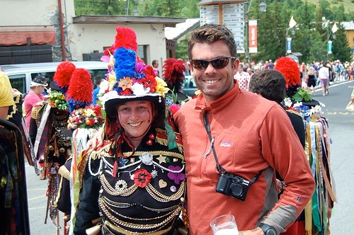
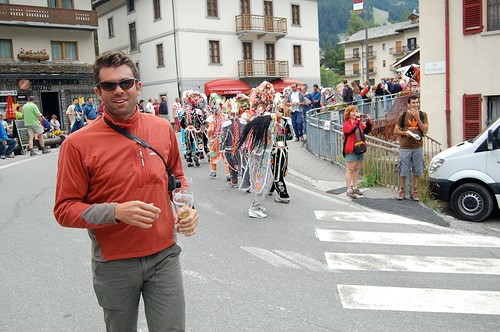
There were a bunch of great local parades in La Thiule - particularly the dancers with all of the bells on.
 |
||
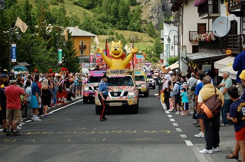
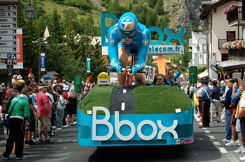
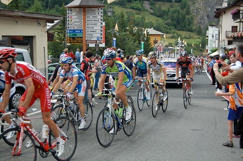
While watching some bike races might be a bit boring, this was pretty amazing. The atmosphere was fantastic - everyone partying, team cars riding by throwing out all sorts of schwag and perfect weather.
 |
||
 |
||
 |
||
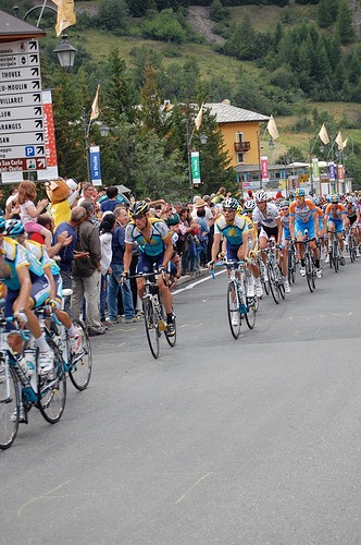
Lance came by with most of his team in the second group of riders. He had one team mate in the first group of about ten but he put on an attack just after passing us and Lance cought up to the leaders. Watching these guys ride uphill at that pace during a 1000m climb is AMAZING.
 |
||
 |
||
All in all... it was a great trip. Of course, every new place you see, you tick one more thing off the list of what you want to do but then discover something new an add two more! La dulce vita!