In January of this year, when I was already on the road taking some pics and doing a bit of ice climbing ( http://www.supertopo.com/tr/An-ice-climbing-mini-safari-part-two-Cody-and-Hyalite-1-12-22-12/t11348n.html ), I wanted to append a little side trip to Canada. However, the weather forecasts for the Banff-Jasper region of the Rockies were for very cold and stormy weather (as can be expected in January). Slipped my January Canadian ice plans to follow some university visits in the Pacific northwest with my wife and one of our kids in February and again (yay!) in April.
My February drive looked roughly like this. The family part (before getting after the ice) of my April trip also included Vancouver, British Columbia. I lucked out with good driving weather for most of both road trips.
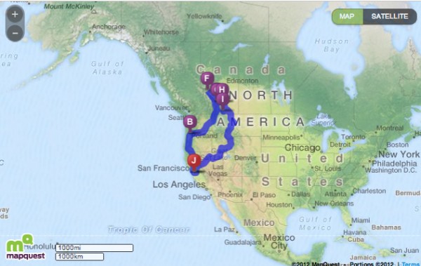 Screen capture of a Mapquest map. Credit: BMcC |
||
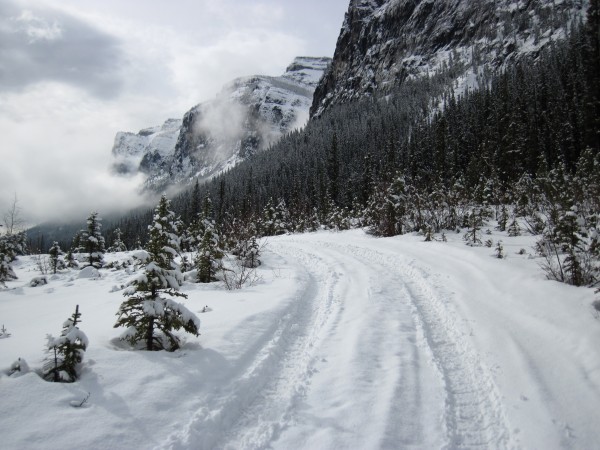
On February 22, I arrived in Banff with enough time to stop by the trailhead for The Professor Falls and the Trophy Wall before continuing onward to the airport to pick up my climbing partner. Just before 9am and only 1 vehicle there. No crowd.
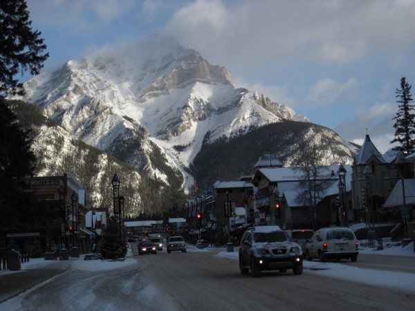 Banff, Alberta, en route to the airport in Calgary - 2/22/12 Credit: BMcC |
||
Before checking into our motel in Canmore, we drove west from the airport in Calgary, past Canmore, and north past Banff to Field, British Columbia, to check out ice and avi conditions on the "beer climbs" (Carlsberg Column, Labatt's Lane, Guinness Gully, etc.). My 1st time in that area. I can imagine spending days based in Field ticking off some of the routes Joe Josephson describes in Waterfall Ice. However, there had been some significant snow accumulation before our arrival and avi conditions were not appealing. Perhaps later on our trip.
Heading back south towards Canmore, we took another little side trip southwest on the Radium Highway to check out conditions on the Stanley Glacier and Headwall area. My 1st time seeing that area, too. Some great route names and legendary climbs: French Reality, Acid Howl, The Suffer Machine, The Cannibal, and Nemesis. Looked thin, not touching down, and like quite serious stuff. There are a couple of routes I noticed in Josephson's book that might be more my speed near the Stanley Glacier: A Gentleman's Day Out and An Elderly Man's Day Out.
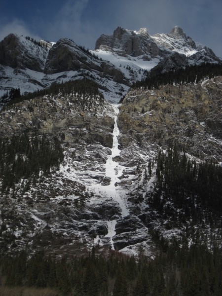
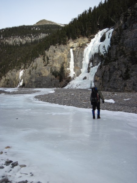
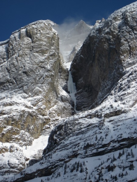
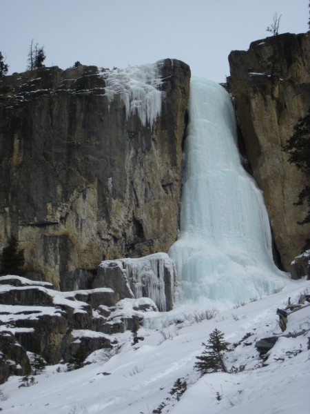
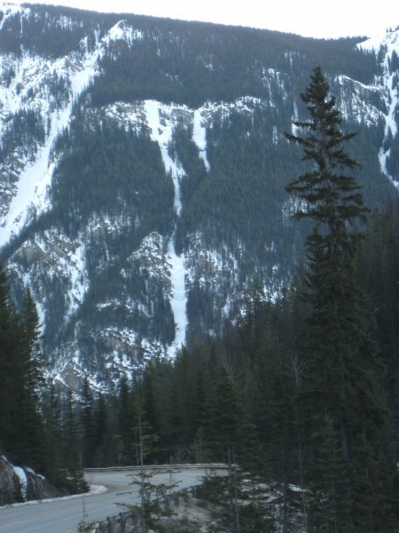
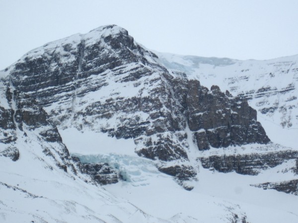
Nice views of the Trophy Wall just south of Banff.
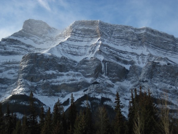 Mt. Rundle and the Trophy Wall - 2/22/12 Credit: BMcC |
||
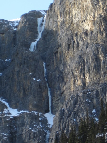
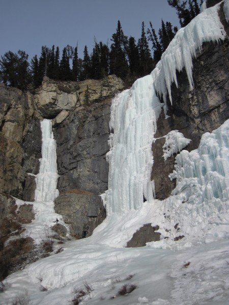
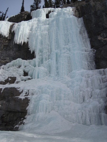
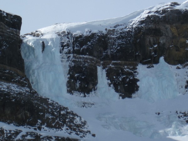
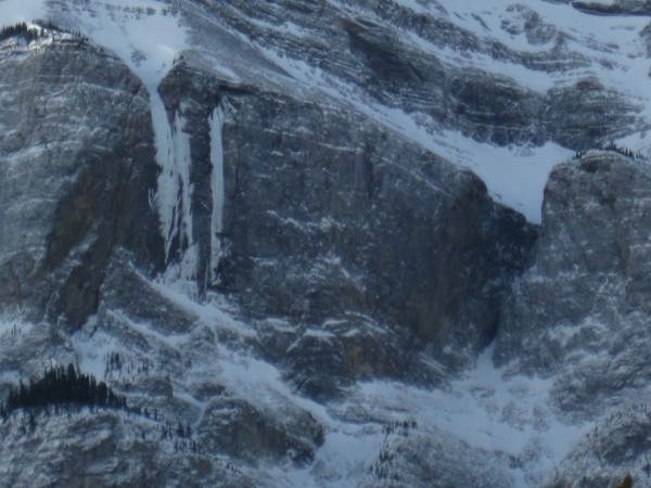 The Trophy Wall with the Terminator (150m WI 5+ - 6+), The Replicant (145m WI 5 - 6+), Poscriptum (45m WI 5+), and the Sea of Vapors (165m WI 5 - 7). Lower portions of the routes looked thin - 2/22/12 Credit: BMcC |
||
Would love to catch them fat and plastic someday - if only I could get on them in WI 3 or 4 conditions.
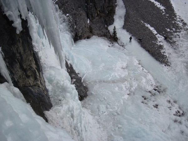
 Cascade Waterfall (300m WI 3). Fat ice, but high avi hazard - 2/22/12 Credit: BMcC |
||
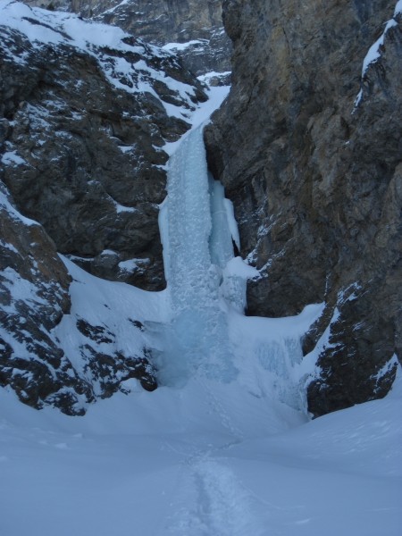
Tried the Ice Funnel in the Waiparous Creek Valley (north of the Ghost River Valley) on our 1st day. Hours of driving (some of it exciting) to reach the rim of the Waiparous (75 miles), followed by hours of postholing. The 1st pitch was easy scrambling. The lower bit of the 2nd pitch was steep (good), but very brittle (not good!). Each took a turn at it. During my go at it, with what I thought were moderate, well-aimed swings of my ice tools, I was cleaving off large chunks of ice, substantially narrowing the pillar, and making no progress to the steeper and thinner ice above. Too brittle. We bailed so we could get back to my Honda Pilot and through the sketchy parts of the drive out before dark.
 The Ice Funnel (150m WI 4) in the Waiparous Creek valley - 2/23/12 Credit: BMcC |
||
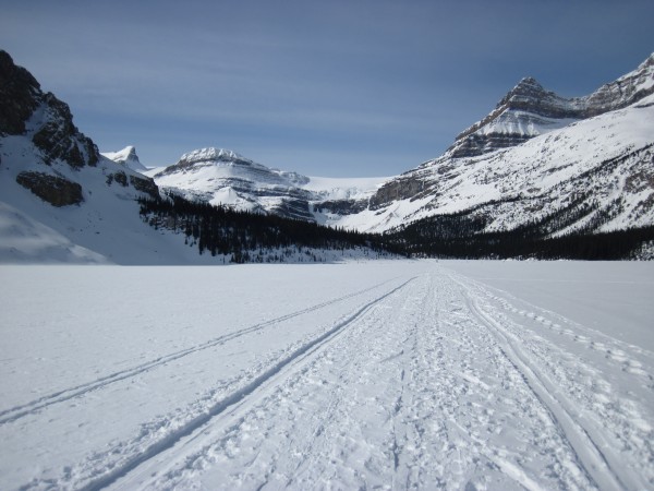
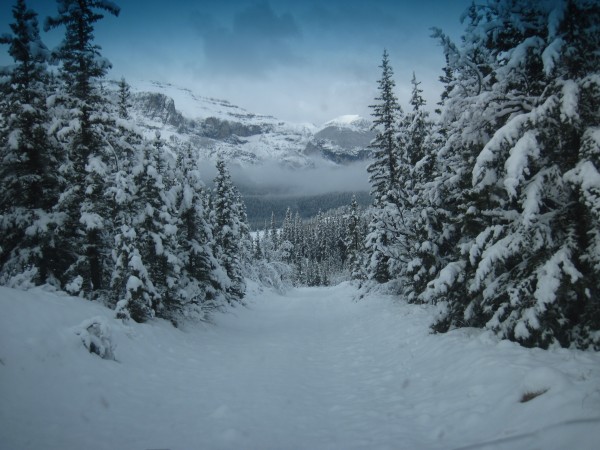
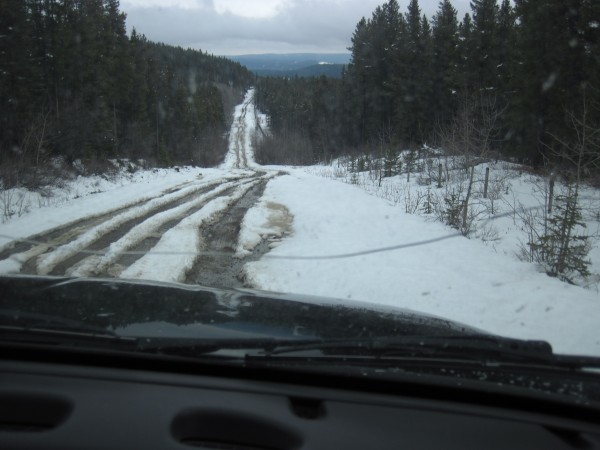
Mellow driving to the Ghost River Valley the next day (69 miles from motel to where we started our short approach walk)...
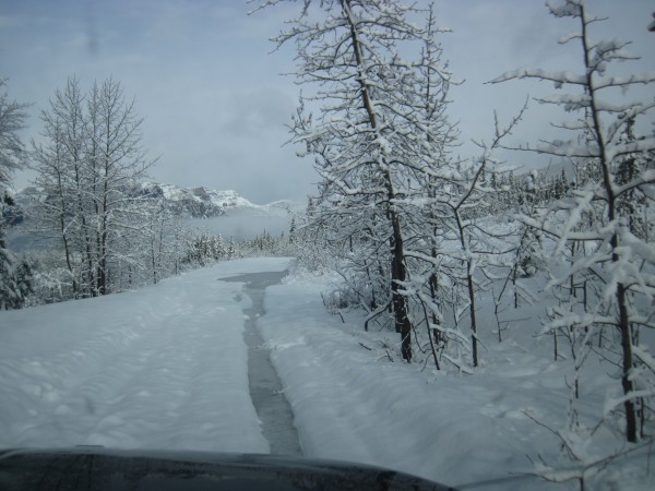
 Nice driving conditions getting to the Ghost River Valley - 2/24/12 Credit: BMcC |
||
 Moderate Ghost River crossing. Not too deep - 2/24/12 Credit: BMcC |
||
Skipped attempting the next crossing because the water looked deeper and the far bank of the river was definitely too abruptly tall and icy.
 A few minutes of hiking, hopping from rock to rock to get across some open water, and then walking on slick river ice got us to The Good, the Bad, and the Ugly (GBU) - 2/24/12 Credit: BMcC |
||
 The Good, the Bad, and the Ugly - The GBU (45m WI 4 - 5+) - 2/24/12 Credit: BMcC |
||
 GBU right side - 2/24/12 Credit: BMcC |
||
 Each took a lead. Did laps on left and right sides - 2/24/12 Credit: BMcC |
||
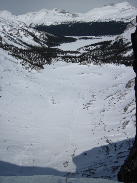
 The view from the GBU - 2/24/12 Credit: BMcC |
||
A good day. More climbing than the day before in the Waiparous Creek area with far less hiking. Snowing some with more weather coming in. Decent driving conditions, an easy approach stroll, and great ice.
Snowed overnight, so we headed off to the Evan-Thomas Creek for Moonlight and Snowline on our 3rd day. Merely 37 miles from the motel in Canmore (yay!) and a mellow walk up a packed trail. Overcast and snowing pretty much all day.
 Moonlight (110m WI 4) and Snowline (100m WI 4) - 2/25/12 Credit: BMcC |
||
The 1st pitch of each was pretty traveled and pocketed - steep hooking. The 2nd pitch of each was even steeper fun.
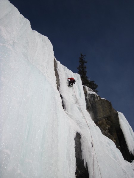
 The leader of a party on Moonlight - 2/25/12 Credit: BMcC |
||
 The leader of the party on Moonlight broke the last pitch into a couple of shorter pitches. VIew while I was rapping off Snowline - 2/25/12 Credit: BMcC |
||
Though snowing pretty continuously, it was a very mellow and pleasant day.
On our 4th day, with the fresh snow from the previous 2 days, avi forecasts continued to be somewhat elevated. Figured we'd climb something along the Icefields Parkway and move from our motel basecamp in Canmore north to Jasper.
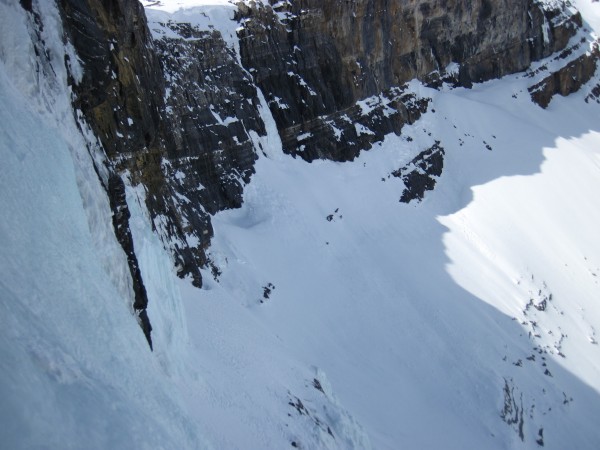
 The upper pitches of the Polar Circus - 2/26/12 Credit: BMcC |
||
Seemed like there was too much fresh and wind-moved snow for it to be avi safe. The Polar Circus has long been one of my dream routes: as in, it will only happen in my dreams that I'll find it in avi safe conditions with fat easy ice. I remain optimistic. Perhaps on my next trip.
After a few hours of driving with numerous stops to take pics, we arrived at the Weeping Wall (118 miles). A 10 minute approach got us to the right side of the lower Weeping Wall for some fun in the afternoon sun.
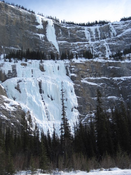 The Weeping Wall (160m WI 4-5), the Weeping Pillar (155m WI 6) and other upper tier routes - 2/27/12 Credit: BMcC |
||
 Weeping Wall - 3rd pitch of the right side route - 2/27/12 Credit: BMcC |
||
Pleasant afternoon, then north from the Weeping Wall to the Maligne Lodge on the edge of Jasper (77 miles). Cheap eats at the D'ed Dog (Irish Pub).
For our 5th day, we planned to head up the Beauty Creek trail to climb Stanley Senior. Air temp was 1 degree Fahrenheit at 7:30a.m. when we got gas in Jasper. As we drove to the trailhead (56 miles), the wind speed rose and temps dropped significantly.
 Blowing snow near the Beauty Creek trailhead - 2/27/12 Credit: BMcC |
||
 Temp at the Beauty Creek trailhead - 2/27/12 Credit: BMcC |
||
The air temp at the Beauty Creek trailhead was considerably lower than desired. Rather than risk temperature related discomforts such as frostbite, we opted to keep driving south in our search for ice in warmer climes...
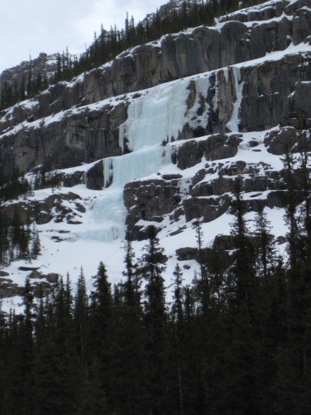
The 1st of our several stops was just south of Beauty Creek and across from Curtain Call. Not warmer, but well worth a stop and binocular inspection.
 Curtain Call (125m WI 6) looked stout - 2/27/12 Credit: BMcC |
||
Continued south to the Saskaschewan River Crossing and eastward along the David Thompson Highway to check out ice conditions there. Quite dry. Not a lot of snow. Not as cold in degrees, but much windier. Dang wind. Lower pitch on Kitty Hawk was missing; other routes looking unappealing or non-existant.
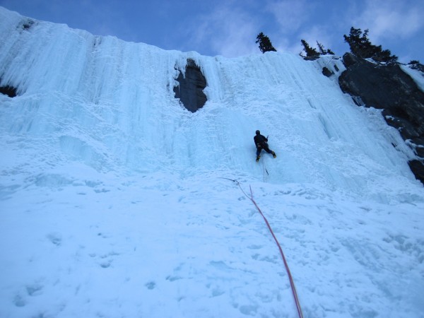
Back to Highway 93 and north to the Weeping Wall again. The air temp had climbed to 16 above 0. The wind was less brutal and getting some direct sun helped.
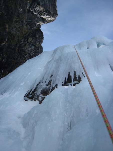
 On 2nd pitch on the left side route of the Weeping Wall - 2/27/12 Credit: BMcC |
||
 My lead, 3rd pitch on the Weeping Wall - 2/27/12 Credit: BMcC |
||
 The 3rd pitch on the left side of the Weeping Wall - 2/27/12 Credit: BMcC |
||
On our 6th day we headed east on Highway 16 to the Rocky River (23 miles). Temp was 8 degrees at 7:40am when left Jasper; 16 degrees and windy at the trailhead at 8:45am. Easy gravel flats and frozen river strolling, followed by steep hillside slipping on frozen turf, and some bushwacking through fallen trees - about 3.5 hrs.
 Rocky River Blues (230m WI 4) - 2/28/12 Credit: BMcC |
||
 Rocky River Blues - 1st pitch. Seemed harder than WI 4 - 2/28/12 Credit: BMcC |
||
 My turn - the 2nd pitch is mellow and quite fun at WI 3. The final pitch is WI 2 - 2/28/12 Credit: BMcC |
||
Other people claim 2.5hrs or so for the approach. Hiking down and out was less than 2 hrs. The frozen turf was still super slippery.
On our 7th day, we headed back to the Beauty Creek trailhead (about 56 miles) and to Stanley Sr. Not exactly balmy at 0 degrees Fahrenheit, but much nicer than the -14 of several days before.
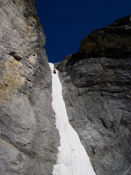
 Stanley Senior (45m WI 4) - 2/29/12 Credit: BMcC |
||
 Stanley Senior - my turn - 2/29/12 Credit: BMcC |
||
I sewed it up after a tense and somewhat confidence-hemorrhaging, fricking struggle to clip a biner with a frozen gate. I should of been much, much smoother. Should may be consider allowing for a rest day on future trips. Did laps before pulling the ropes.
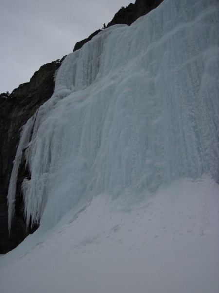
Headed down to Field, British Columbia, for the night (103 miles) for either a beer climb or Louise Falls en route to the Calgary airport on the next day (our 8th).
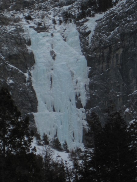
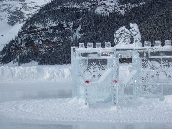 Louise Falls is visible in the distance just above the left corner of the ice castle - 3/1/12 Credit: BMcC |
||
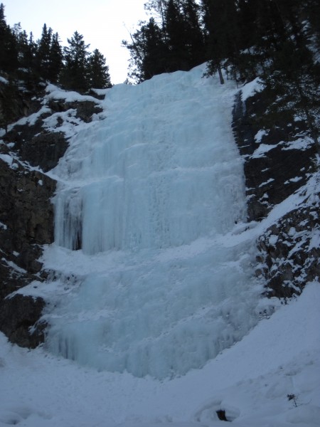
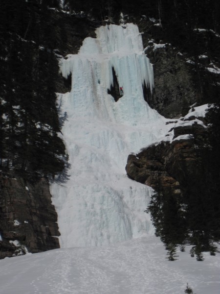
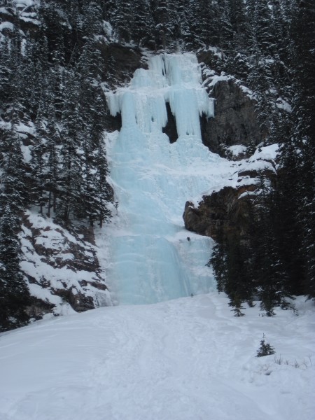 Louise Falls - well filled in and fun - 3/1/12 Credit: BMcC |
||
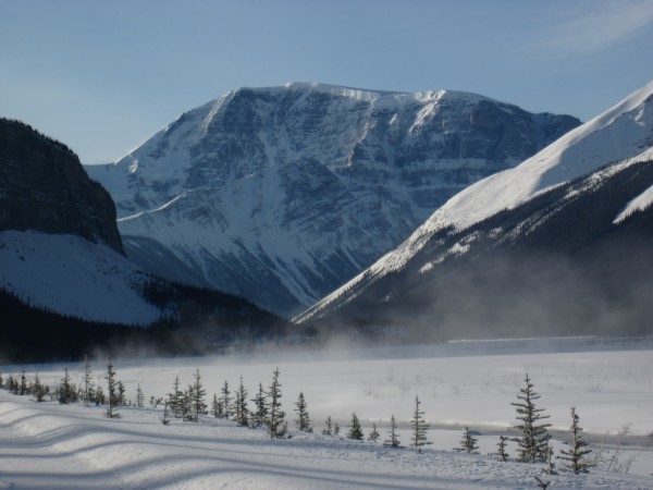
Began my drive home from the airport in Calgary by heading southward to Pincher Creek for the night so I could check out the ice in Waterton Lakes National Park.
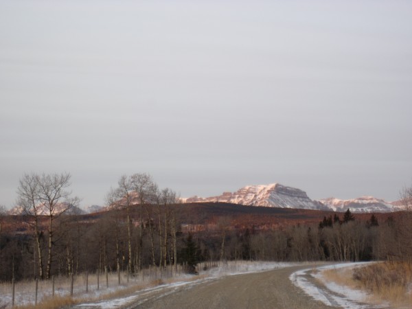
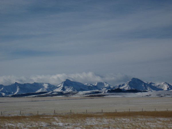 Just outside Waterton Lakes National Park - "where the mountains meet the prairie" - 3/2/12 Credit: BMcC |
||
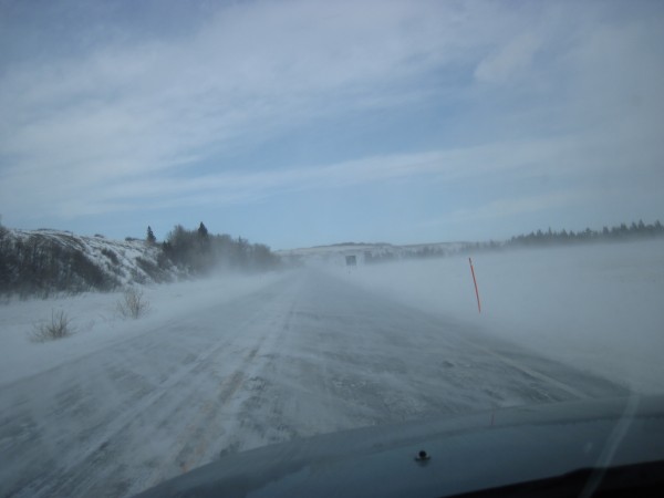 Quite unpleasantly, horribly windy. Weather forecast included higher winds for the next 2 days - 3/2/12 Credit: BMcC |
||
 Experts Choice looked fantastic - 3/2/12 Credit: BMcC |
||
The ice looked great, but for the pretty incredible wind. Put it off for a future trip. I headed for home feeling good about the fun routes we done, knowing that a month later I was heading back to the northwest for a couple more university tours and just might be able to add on some pic taking and a bit of ice.
April Fools Day - on the road again. Did the university visiting and after dropping the family off at the airport in Eugene, Oregon, around noon on April 7, I headed for Banff. I arrived less than 24 hours later after several stops for gas and for naps.
Before starting this trip, I had various potential partners lined up whom I had met in February, friends of theirs, and a couple of climbers I met in online climbing blogs. Turned out that their various work and family priorities and commitments changed. The changes made several of them unavailable and 2 of them available only for the latter several days of my visit, freeing me up to drive about, take pics, explore, and scramble up some wonderfully easy/fun ice on my own.
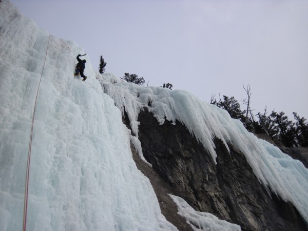
The parking for trail to The Professor Falls, was packed. Lots of day hikers. Still plenty of time to walk the asphalt path along the golf course, up the forested trail, and to scramble up The Professor Falls (280m WI 4). Met a couple of Canadian climbers who had just rapped using a single 60m rope. Cool - less ballast - I could take 1 of my 60m ice ropes and leave the other behind at the base of the route. No other parties on the route. Solitude! Great fun with pleasantly easy conditions.
 The Professor Falls (280m WI 4) - 4/8/12 Credit: BMcC |
||
 The uppermost pitch on Professor Falls - very mellow ice - 4/8/12 Credit: BMcC |
||
 Uppermost pitch on The Professor Falls - with rope stretch, a single 60m skinny ice line was just long enough for the rappel - 4//8/12 Credit: BMcC |
||
A modest drive (17 miles or so) from the golf course trailhead in Banff to my basecamp for the week in Canmore - the Canadian Alpine Clubhouse. Nice facility: large kitchen; huge living room with views of Canmore in the valley below; showers; laundry facilities; and wifi (spotty) for checking for avi and route conditions, and email. Had a nice upstairs room to myself (for about $25/night) with 2 pairs of bunkbeds and lots of hooks on which to hang my clothes, ropes, and ice gear for drying.
For my 2nd day, I headed to Bow Lake (75 miles) and snowshoed up to Bow Falls. Some postholing even with snowshoes. Bow Falls just to the left of the middle point of this pic. The ski tracks in the foreground lead to the Bow Lake Hut (far and away out of view around the toe of the ridge descending to the lake from the left) and a multi-day glacier ski tour.
 Crossing Bow Lake to get to Bow Falls - 4/9/12 Credit: BMcC |
||
 Closer to Bow Falls (just to the right of the center of this pic) - 4/9/12 Credit: BMcC |
||
 Bow Falls (95m WI 3-4) - 4/9/12 Credit: BMcC |
||
The uppermost portion of Bow Falls was getting some morning sun, but the ice below was fabulously plastic. It was very nice and even comforting, too, that the snow cornice was off to the right of the climb rather than overhanging and overshadowing it.
 Tracks in the snow with Bow Lake in the distance - 4/9/12 Credit: BMcC |
||
My tracks point the way back down from the cirque, connecting to the main Bow Hut Trail at the 1st band of trees on the right, and crossing Bow Lake to the trailhead near the base of the forest near the top of this pic.
 Gorby Falls (40m WI 3) as seen from up on Bow Falls - 4/9/1 Credit: BMcC |
||
Given the size of the cornice baking in the sun above Gorby Falls, the ice over there did not hold much appeal for me.
 Rapping down Bow Falls - 4/9/12 Credit: BMcC |
||
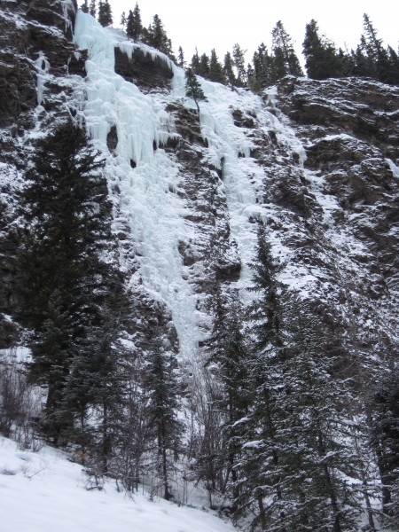
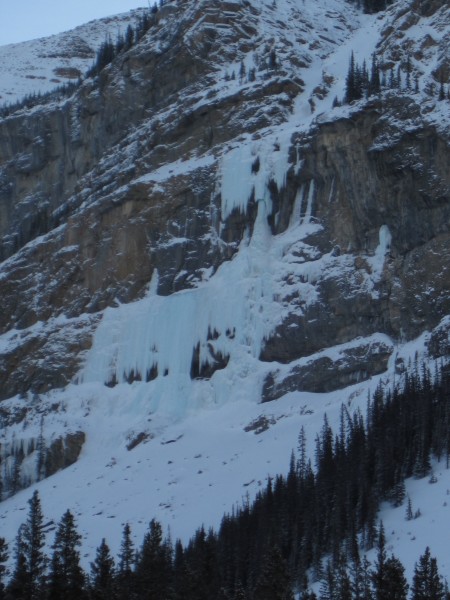
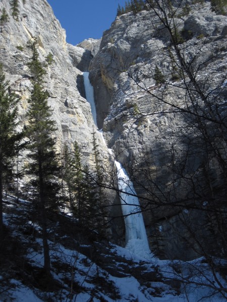
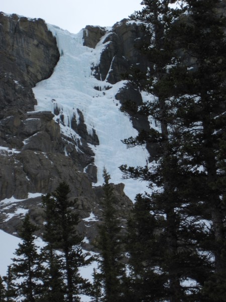
For my 3rd day of exploring and taking photos, I drove over to Field in British Columbia (68 miles), to check out the Guinness Gully (245m WI 4; bisecting the fuzzy image below). The 2 Canadians climbers I had met at the base of The Professor Falls had climbed it a few days earlier and told me Guinness was in good shape, and perhaps a bit easier than Professor. The 2 snowy looking bits of ice in the top 1/3 of this image are Guinness Stout (80m WI 4+) and High Test (60m WI 4+).
 Guinness Gully (245m WI 4) - 4/10/12 Credit: BMcC |
||
Parked near this cheery warning sign...
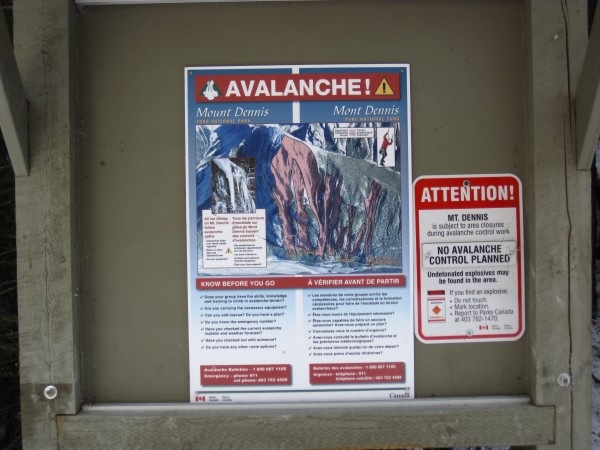 Sign says all of the ice climbs on Mt. Dennis are in avi chutes - 4/10/12 Credit: BMcC |
||
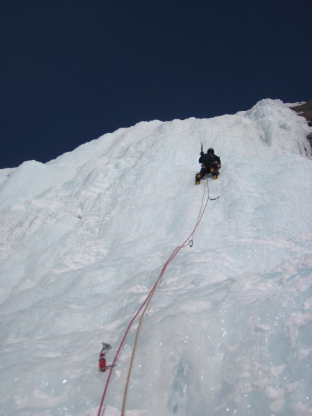
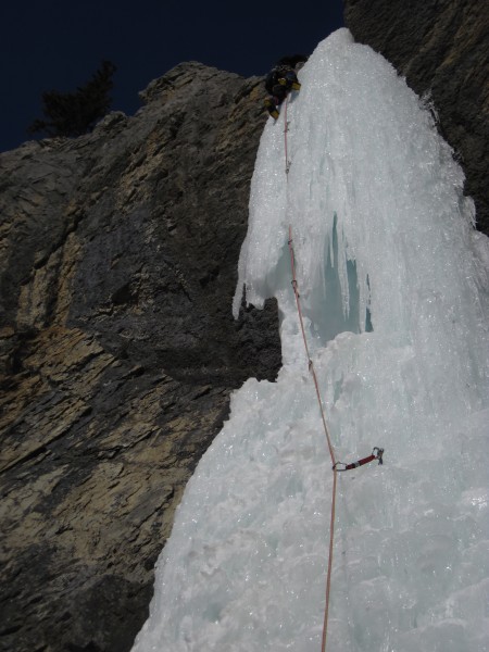
 One of the upper pitches on Guinness Gulley - fun - 4/10/12 Credit: BMcC |
||
 Almost done rappelling the Guinness Gully - 4/10/12 Credit: BMcC |
||
Fun route. Skipped the hour plus hike to High Test and Guinness Stout since the mid-day sun was beginning to cook the snow above.
On my 4th day, I planned to check out Shades of Beauty. It's on the opposite side of Beauty Creek from Stanley Senior which I had climbed with a partner in February. Looked really good then.
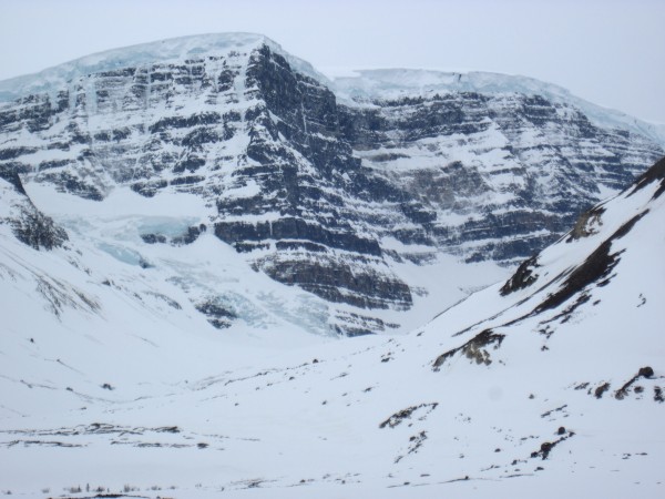
I drove past Mt. Andromedra on my way north to the Beauty Creek trailhead. The Andromedra Strain (image below) beckons. It's the icy corner/slot that intersects the ridge line about two-thirds of the way from the col at the left to the summit. Dreaming of finding it in mellow, easy conditions on a future trip. Dream on.
 The Andromedra Strain (V 5.9 A2 WI4) on Mt. Andromedra - 4/11/12 Credit: BMcC |
||
Slipstream on Snowdome is just a bit farther north.
 Slipstream (925m WI 4+) on Mount Snowdome - note the cornice - 4/11/12 Credit: BMcC |
||
After stops to take pictures of the Andromedra Strain, Slipstream, the Weeping Wall (118 miles from Canmore), and Curtain Call, I finally arrived at the Beauty Creek Trailhead (141 miles). Geared up and snowshoed in.
Shades of Beauty looked great.
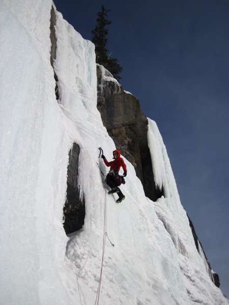
 Shades of Beauty (120m WI 4) - 4/11/12 Credit: BMcC |
||
The route met my expectations: wonderfully fun climbing and, as Joe Josephson wrote, "A classic climb -- and easy for its grade." It was the perfect route for my 4th day of exploring on this trip.
 A steep little headwall on Shades of Beauty - perhaps the crux - 4/11/12 Credit: BMcC |
||
You can see the highway from Shades of Beauty. Something seemed odd. There had been essentially no traffic noise for hours. I packed up, hiked out, and found a note on the windshield of my Pilot.
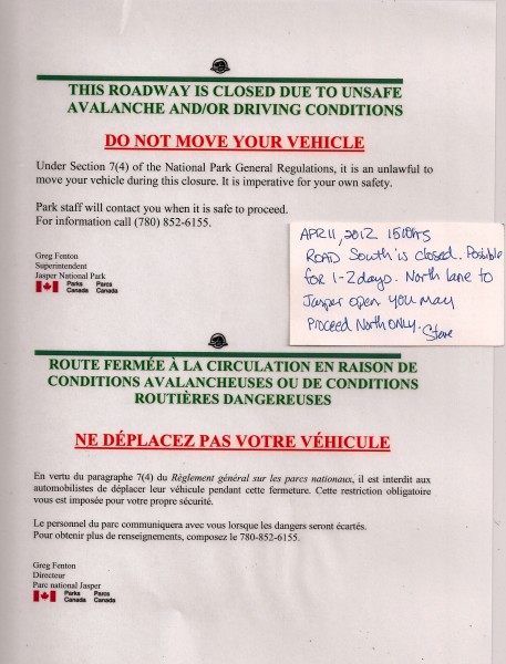 Dang it! I'd rather have had a $100 parking ticket than this. Credit: BMcC |
||
Since the road south to Canmore and all of my gear was to be closed for at least 1 to 2 days, I decided to drive north of Jasper, east to Edmonton, south to Calgary, and west to Canmore.
When I got close enough to Jasper to get a cell connection, I called the park wardens to find out when the road south might be reopened. Answer: 1 to 2 days. Called Hedd-wyn, the Canadian who was generously planning to climb with me on Thursday and Friday, and explained my dilemma. Canceled our Thursday plans.
Got lost briefly in both Edmonton (around midnight) and Calgary (some hours later) adding miles and 10s of minutes to my drive. Took a few breaks on the drive and a roadside nap, arriving back at the Clubhouse just after 6am (615 miles from trailhead to Canmore).
My 5th day turned into a rest day. Probably just as well, since it rained and poured all day long in Canmore.
For Friday the 13th of April (my 6th day), Hedd-wynn suggested that we climb Beowulf (670m WI 4) in the Ghost River Valley. Heck yeah!
We met part way to the Ghost, parked my Pilot for the day, and went onwards in his Ghost vehicle, a Dodge Durango.
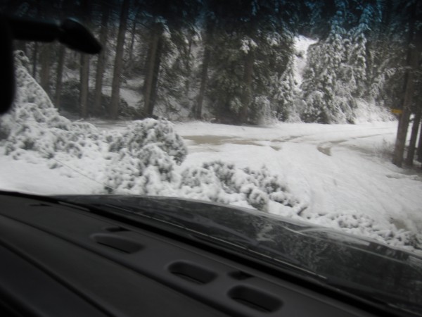 Downed tree blocking much of the road - drove over the top of it - 4/13/12 Credit: BMcC |
||
Some deep slushy snow on the road.
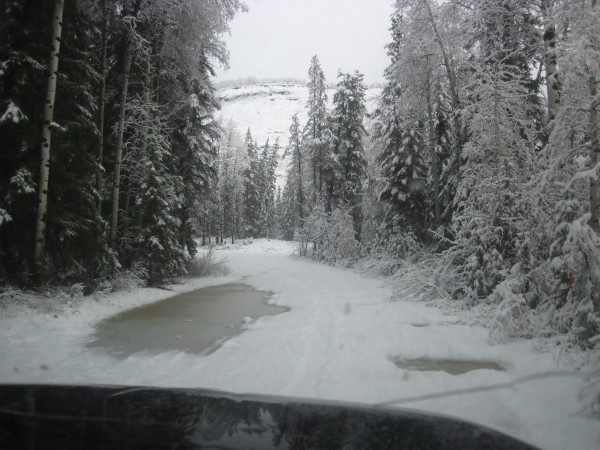 Put chains on all 4 wheels of the Durango and felt my optimism return - 4/13/12 Credit: BMcC |
||
I figured whatever happened was cool, Hedd-wyn was an experienced Ghost driver, the scenery was fantastic, and, worst case, we'd have to dig out the Durango from drift or 2. Best case, we'd get there and climb Beowulf.
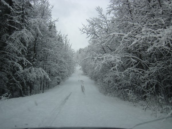 Ghost River approach drive - 4/13/12 Credit: BMcC |
||
 Traction was sometimes dubious, but the scenery getting to the Ghost was striking - 4/13/12 Credit: BMcC |
||
 Heading down the Big Hill - Ghost River Valley adventures and ice beckon - 4/13/12 Credit: BMcC |
||
Not good road conditions for a 2-wheel drive vehicle.
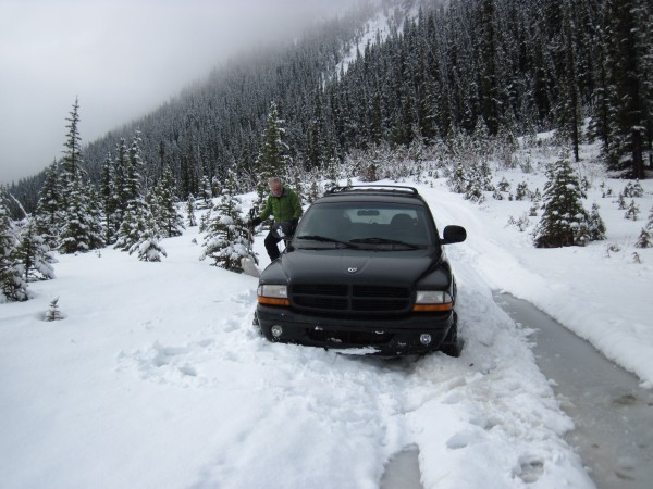 Hedd-wynn and the high-centered Durango - Friday the 13th. Many miles before the route we planned to climb - 4/13/12 Credit: BMcC |
||
Not good conditions for a 4-wheel-drive even with serious chains on all 4 wheels!
Dug snow out from under the Durango trying to un-high-center it. No traction, so it was time to get serious: more shoveling and we got out the come-along winch, lots of webbing, and long steel cables.
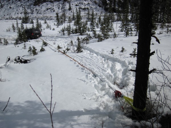 Shoveling and the come-along pulling at this angle didn't free the Durango - 4/13/12 Credit: BMcC |
||
1st tree we used was too small and the angle was wrong - we stopped before uprooting it; 2nd tree (this 1) was larger, but the angle was still wrong; the 3rd tree was also large, even farther away, and (paraphrasing what Goldilocks would have said) the angle was just right.
 The Ghost - 4/13/12 Credit: BMcC |
||
It was such a beautiful day in the Ghost. The sun had come out intermittently making the scenery even more special. However, it also warmed and further melted snow, and deepened the bogs and puddles. After what seemed like hours of shoveling and winch-work, Hedd-wyn got the Durango unstuck and turned around. Although we didn't climb any ice, we escaped without getting stuck again (yay!). The Ghost experience. Thank you, Hedd-wyn!
 Even after getting up the Big Hill and back onto the "main road" above the Ghost, the adventure driving continued - 4/13/12 Credit: BMcC |
||
I learned that for serious approach conditions in the Ghost, it could be good to have a couple of teams of climbers in 4-wheel drive vehicles, each with chains for all 4 wheels, come-alongs or more serious winches, webbing slings to wrap around the trees, steel cable, numerous shovels, lots of energy for shoveling and winching, and excellent luck. Some sort of saw or ax to deal with downed trees. It was clear that my 4-wheel drive Honda Pilot with 1 pair of chains and a wimpy little snow-camping shovel might not be adequate for some conditions. No one else drove down into the Ghost on that Friday the 13th.
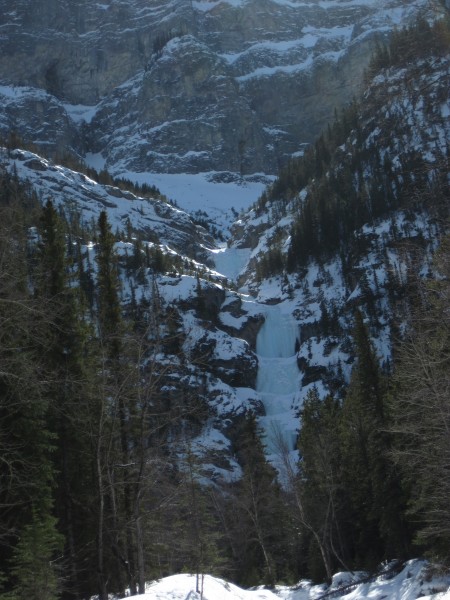
On the 7th day of my Canadian photo and ice tour, I headed for Murchison Falls with Jack Coulis (a Canadian friend of some Canadians whom I met climbing the Rocky River Blues back in February). Jack had driven down from Edmonton to the Clubhouse on the evening of Friday the 13th to climb with me Saturday and part of Sunday. I was looking forward to climbing and was feeling pretty well-rested after slacking off the previous 2 days (April 12 became a rest day after driving 615 miles to get back after climbing Shades of Beauty on the 11th; April 13 was a no-climbing, rest day, consisting instead of a nice picnic lunch along with hours of shoveling snow and winching in the Ghost River Wilderness). Hiking in snow and climbing ice on Mt. Murchison was going to be really fun.
 Murchison Falls (180m WI 4+) - 4/14/12 Credit: BMcC |
||
 Jack Coulis - 4/14/12 Credit: BMcC |
||
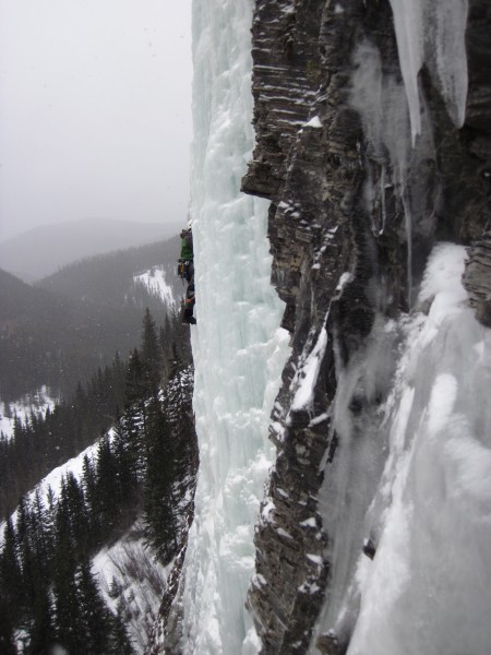
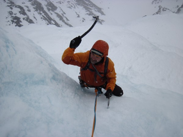 Jack cruising up the 3rd pitch of Murchison Falls - 4/14/12 Credit: BMcC |
||
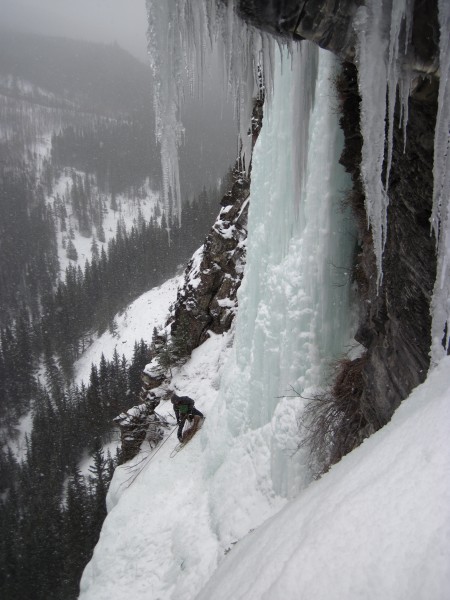
 Following the crux pitch (4th) of Murchison Falls - (photo courtesy of Jack Coulis) - 4/14/12 Credit: BMcC |
||
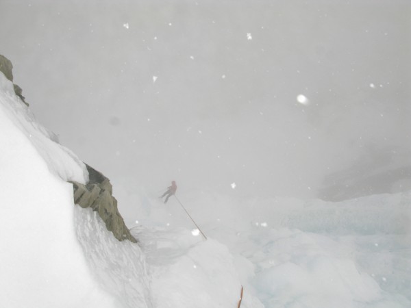
 Jack at the top of Murchison Falls in mini-blizzard conditions. He's wearing an ear-to-ear grin inside that hood - 4/14/12 Credit: BMcC |
||
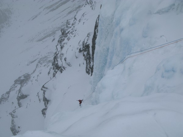
 Rappelling through falling snow into the void - 4/14/12 Credit: Jack Coulis |
||
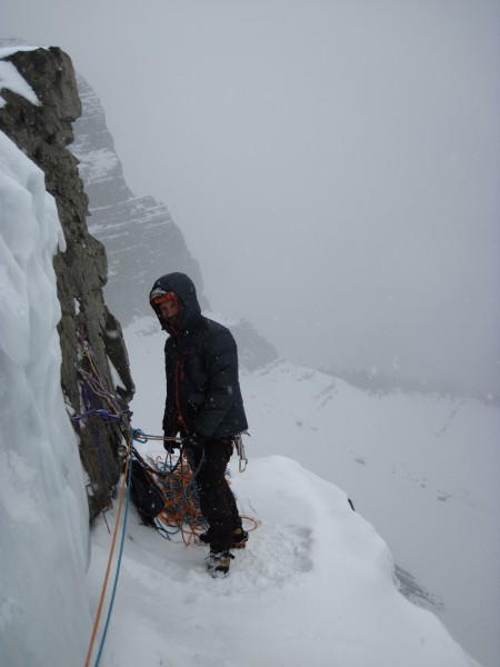
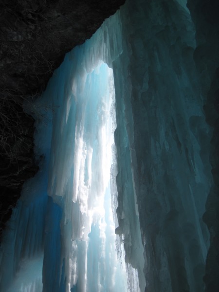
 Ice curtain at 1 of the fixed rap stations. Storming and blowing outside the ice cave and peaceful inside - 4/14/12 Credit: BMcC |
||
Jack had to return to Edmonton on Sunday, so we opted to do a short route on the last climb of my little picture taking and ice trip. Louise Falls seemed about right - modest drive from Canmore (51 miles), 20-30 minute approach walk on a sleigh trail, and several pitches of fun ice.
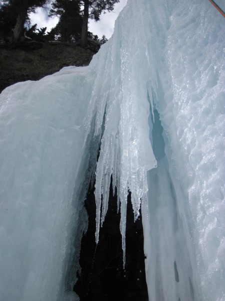
 Louise Falls (110m WI 4-5). The lead climber of the party ahead of us is visible near the bottom right of the ice cave - 4/15/12 Credit: BMcC |
||
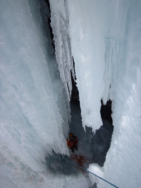
I led up the leftmost side of the falls a pitch. Jack led up into the ice cave from the left, traversed right inside the cave, and belayed just inside the large window/entrance to the cave. This allowed me to exit the cave and choose to either climb the right side curtain/pillar (running with water - I got hosed) or the left side.
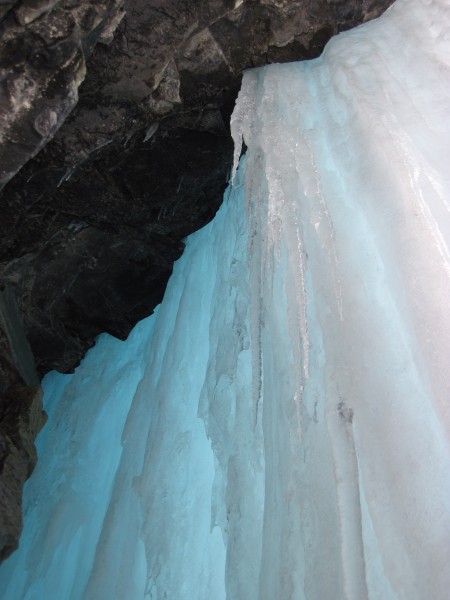
 From inside the ice cave on Louise Falls (110m WI 4-5) - 4/15/12 Credit: BMcC |
||
 From inside the ice cave on Louise Falls (110m WI 4-5) - 4/15/12 Credit: BMcC |
||
We had the option of hiking down from the top after finishing the climb, but chose to rap instead since there were no parties behind us. Jack rapped 1st. When I was leading this section out of the cave, I had initially started up the curtain/pillar of ice on the right side of the cave opening as did the party before us. However, by time we had gotten onto the ice, it had been in the sun for several hours and there was simply so much water running down the ice that I was getting soaked... I climbed back down to the cave and then out again, but up the left side of the cave opening - not as wet.
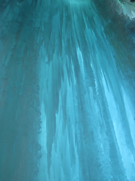
 Louise Falls - 4/15/12 Credit: BMcC |
||
 Jack the ice caveman on (in?) Louise Falls (110m WI 4-5) - 4/15/12 Credit: BMcC |
||
 My turn - hanging around on rappel outside and above the ice cave on Louise Falls - 4/15/12 Credit: Jack Coulis |
||
The Louise Falls climb and this rappel made for a great ending to my bit of Canadian photo taking and ice tripping.
Summary:
During the interval of February 23 to March 1, climbed: a bit of the Funnel; the Good, the Bad, and the Ugly; Snowline and Moonlight; the left and right sides of the Weeping Wall; Rocky River Blues; Stanley Senior; and Louise Falls (4,781 miles).
During the interval of April 8 to 15, climbed: The Professor Falls; Bow Falls; Guinness Gully; Shades of Beauty; Murchison Falls; and Louise Falls (4,927 miles).
It was wonderful taking pics, scrambling up easy stuff, and climbing with friends. I thought all of these routes were great fun and there are so many, many more routes to do.
I hope you enjoy the pics... Cheers to all!