Trip Report
Go With the Flow, A Modified Presidential Traverse.
|
Monday October 7, 2013 2:21pm
|
|
Go With the Flow; A Presidential Range Traverse.
When I decided to organize a traverse of New Hampshires Presidential Range a month ago I had delusions of a bevy of friends queuing up to join in. When I made the initial calls I had six or seven probably's. Nice. Things are looking promising.
I posted an invite here as well and got some useful beta, which ultimately didn't need to be used, but it was encouraging regardless. I also got a resounding 'Hell yeah!' Sort of response from Wilbeer. So it was decided, Wilbeer would join my friends and myself for a two day traverse.
After all my local friends bailed, citing domestic duties and general laziness, Wilbeer and I figured out the details.
We left the trailhead at 6:30 and the grind up to Madison Springs hut is a great way to wake up. It's around 3800 feet in four miles, the last two being considerably steeper than the first.
At the hut, we relaxed, drank some water and talked with some guy who wanted to know where he could go to get food stamps. I powered down a gu and promptly puked it back up. No worries, I'm not a breakfast guy anyhow.
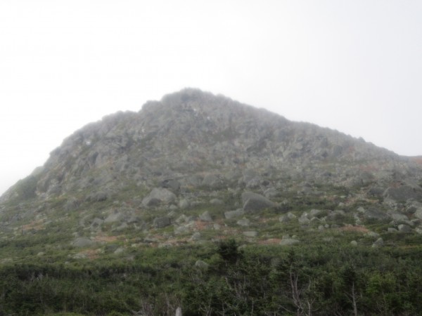
On to Mt Adams, which is the culmination of the large vertical. The trailhead is at 1200', summit at 5700', in around 4.5 miles. Nothing crazy hard, but a good warmup.
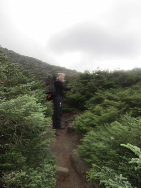
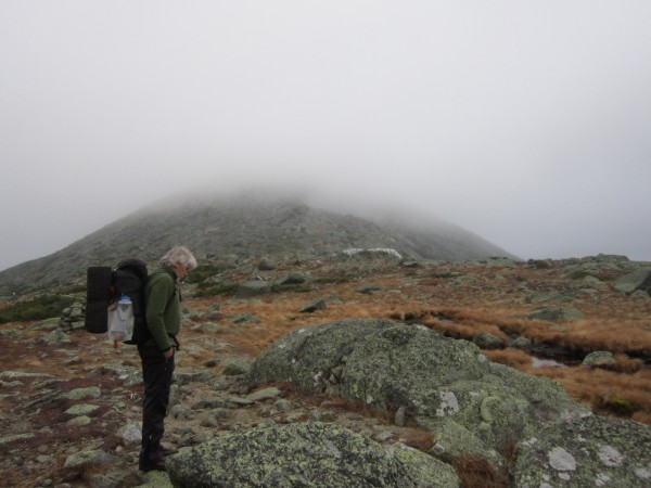
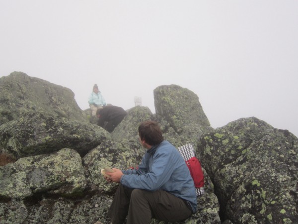
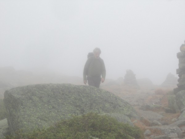
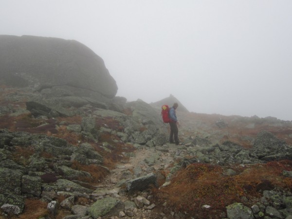
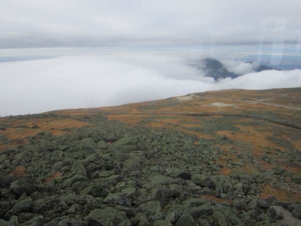
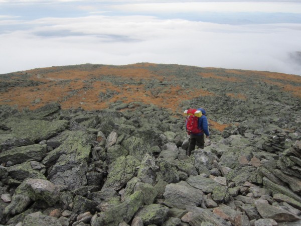
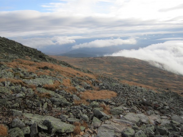
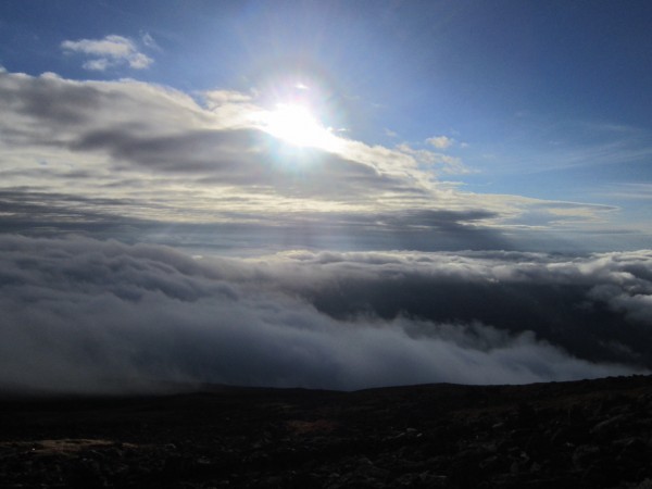
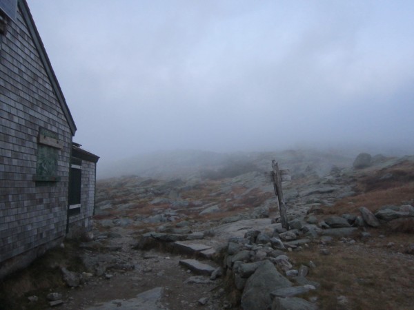
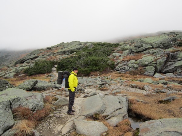
From there, we are completely in the clouds, whiteout style, for hours. The Presidential Ridge, while not as ragged and dramatic as ridges out west, is still pretty demanding physically. For miles you are only on talus, it's punishing if you're off the couch like I am.
Mt Jefferson was next, more one foot in front of the other sort of hiking. We didn't set a blistering pace by any means, but we were steady, stopping only at the Madison hut and on each peak to chill and drop the packs for ten or fifteen minutes.
This whole stretch is fairly level topographically but jagged in the small scale and this is where my knee began to twitch.
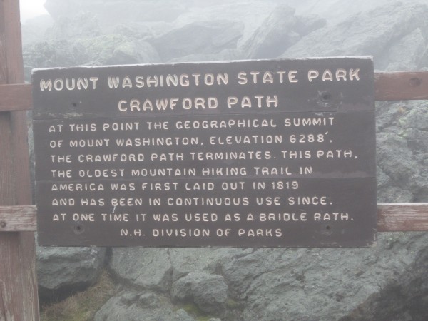
We cruised up to the summit of Washington. Ha! Cruised might not be the word. But we were hanging out in the cafeteria at 4:00
At this point my knee is a huge problem and I'm using my hands to move over rocks and limping. I can't step down onto my right leg, or it will crumple underneath me.
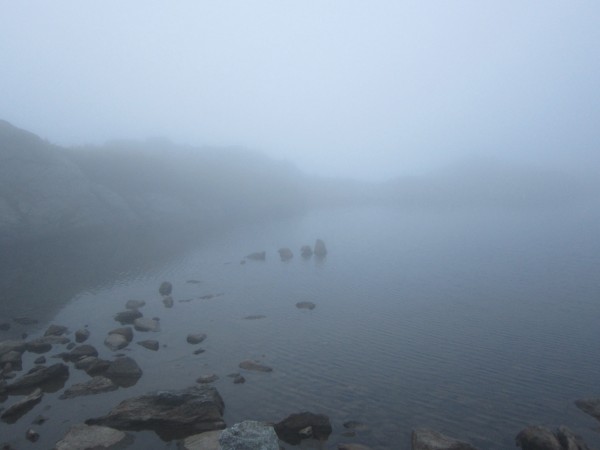
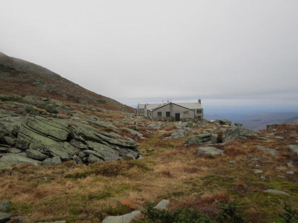
We leave the summit to go and camp at Lakes of the Clouds.
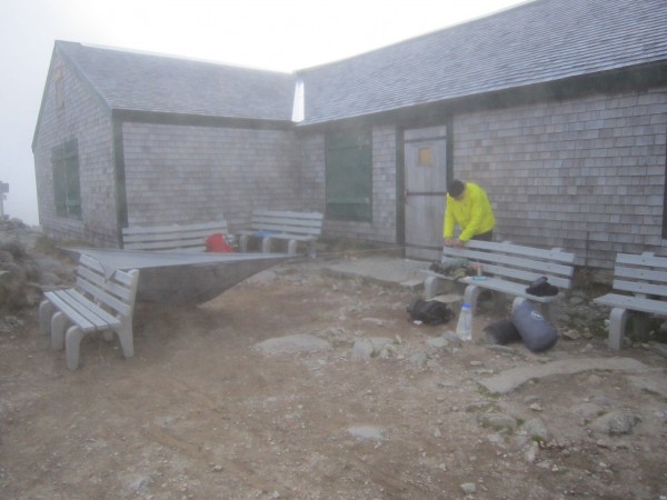
Where I was able to ascend with only moderate pain and instability in my knee, I was less fortunate with descending. We trudged down 1000 feet and 1.5 miles of talus to the hut and bivied in the lee.
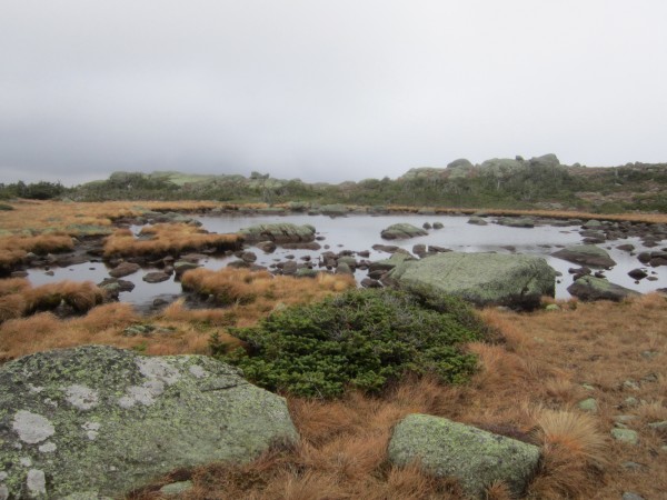
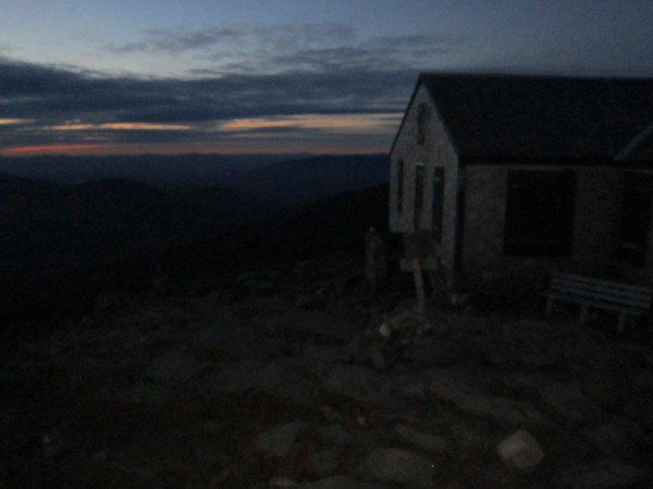
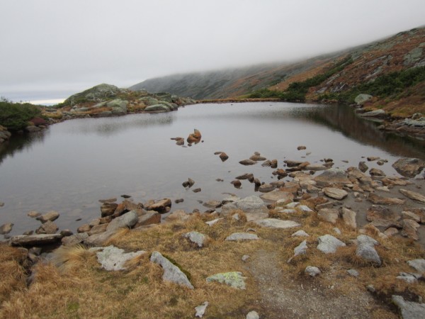
We were the only ones there and the clouds lifted, giving us a really nice sunset and views off to Mt Mansfield, Jay Peak, and Canada.
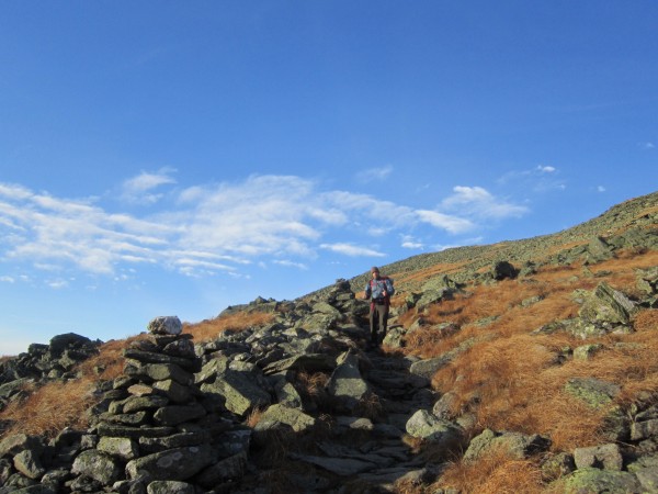
When I woke up I took a short walk and weighed the options with my knee. Continue hobbling down four miles of steep, rocky terrain, possibly scrambling my entire knee? Or, limp comfortably up a mile and a half of steep, rocky terrain to the summit? Wait, what? There's an auto road to the summit?
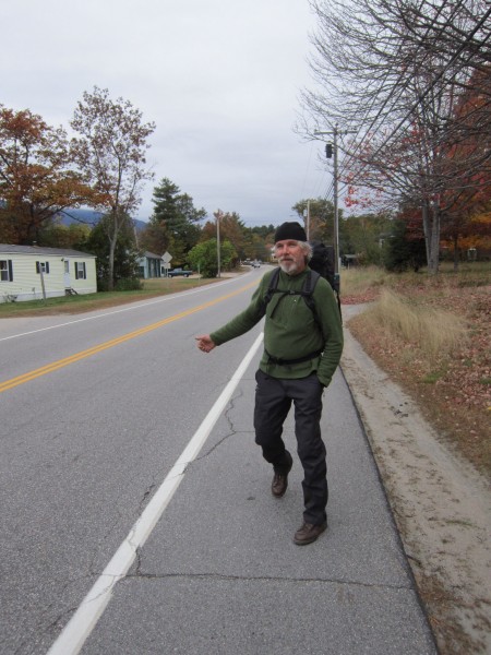
I should say right now that Wilbeer is a rad partner for a trip like this. The dude drove up from western NY to backpack with some internet loser he'd never met and was ready to go with the flow the whole time.
So, when I decided that we'd hike back up to the summit and find a ride down, I wasn't surprised that the answer was a smile and a no worries.
Back at the summit, it was great to walk on flat ground again.
Coffee, a chat with personnel at the cafeteria, and we decided that paying $30 a person for a ride down was out of the question. I took a walk outside and sure enough, the first tourists I ask for a ride agree without blinking.
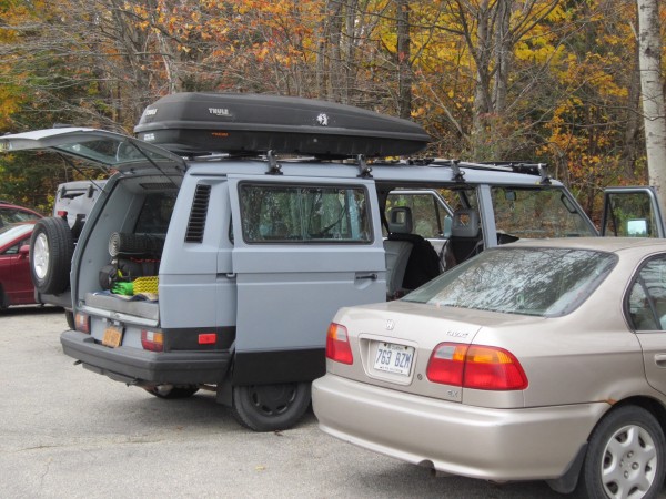
A ride to Gorham, some hitching, a serendipitous ride up a long ass hill, and we were back at the Vanagon.
In all, it was a great hike. We covered a lot of terrain and miles and went with the flow when things didn't go as planned.
I'd also say, having had a day to think about the trip, that bailing was a really good thing to do. I had a hard time accepting it, but I think I would have done far more damage to my knee if I had tried to tough it out.
And, if anyone's out in the Dacks, look up Wilbeer! I can't speak for his climbing, but he's a hiking machine and damn fun to share a trail with. He'd be a hell of a tour guide in the Dacks.
 Brandon-
|
|
About the Author
Brandon- is a climber from The Granite State.. |
Comments
Michelle
Social climber
1187 Hunterwasser
|
|
Awesome! And anyone in a Cloudveil is my friend!
|
|
survival
Big Wall climber
Terrapin Station
|
|
Wow. AWESOMENESS is upon you!
So beautiful, so different from the normal fare here.
That evening/sunset hut shot hit me!
That made me miss the East.
Thanks a million for sharing this.
|
|
anita514
Gym climber
Great White North
|
|
wow, good stuff!
how is the knee now?
|
|
RyanD
climber
|
|
Nice one, cool to see great views of an area I know nothing about. Those lakes are really cool. Good luck with the knee it's challenging when u are in limp mode far from the road.
|
|
hagerty
Social climber
A Sandy Area South of a Salty Lake
|
|
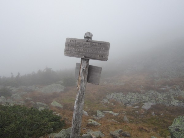
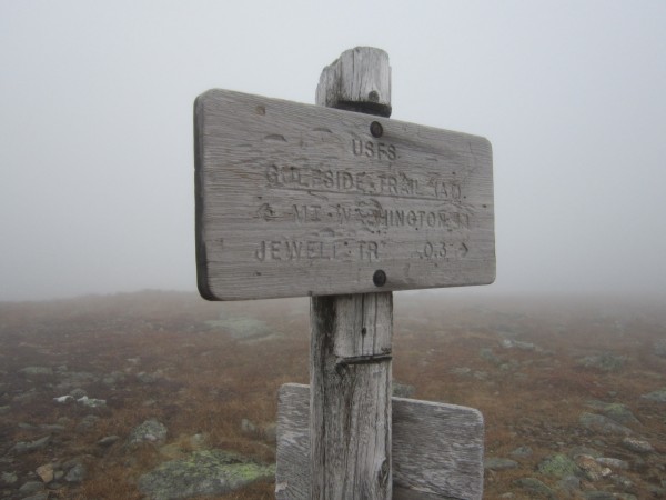
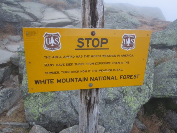
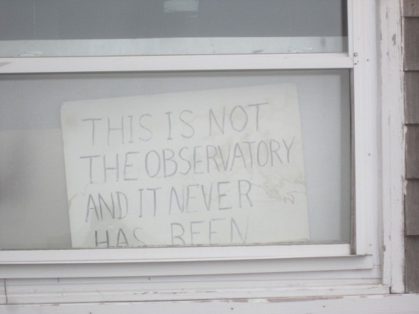
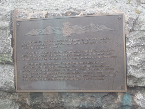
That sign that you doubted the veracity of is 100% correct. More people have died of hypothermia above treeline in the Presidentials in the summer than in the winter. An August thunderstorm can drop the temperature by 50 degrees within 20 minutes, then hit you with hail after you're soaked. The "worst weather" stems from Mt Washington having the highest ever (till recently) recorded wind speed of 234mph. March averages 22 days of winds over 100mph.
Nice TR!
PS: Mt. Adams is not even remotely 3rd class.
|
|
L
climber
Just livin' the dream
|
|
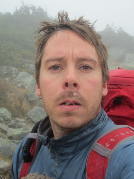
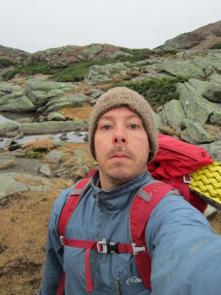
Great TR with photos! Loved the candid shots and especially that one self-portrait.
Two words you should remember when hiking: HIKING POLES. Not for old fogies anymore. Saves 40%+ of the impact on your knees downhill, and makes your arms strong as god's on the uphill. ;-)
Thanks again for posting up.
|
|
Brandon-
climber
The Granite State.
|
|
|
Author's Reply
|
Oct 7, 2013 - 04:04pm PT
|
Hagerty, We went around Star Lake and up Adams on that side. There were for sure some third class open books that we climbed just below the summit.
|
|
SCseagoat
Trad climber
Santa Cruz
|
|
Just stunning! Seeing and reading that TR made me miss my East Coast roots, ALOT. And ditto the hiking poles. I rarely see many folks out here hiking without them anymore, young and old. They also make some super light weight ones now too. Thanks again, for putting this together. You have some CLASSIC pics.
Loved it
Susan
|
|
Brandon-
climber
The Granite State.
|
|
|
Author's Reply
|
Oct 7, 2013 - 05:15pm PT
|
Wilbeer can be thanked for around 80% of the photos. He's got a good eye, I'm glad he asked me to relinquish control of the camera.
|
|
Big Mike
Trad climber
BC
|
|
Exellent photos Willbeer then! And nice work getting out of there Brandon. It sucks having your knee give out on you. Poles have been key for me coming back.
Looks like you had fun though!! Thanks for the report!
|
|
Deekaid
climber
|
|
hey get some hiking poles
just kidding good choice on turning back so to speak
|
|
Ezra Ellis
Trad climber
North wet, and Da souf
|
|
Kool!!!!!!!!!
Thanks!!!!
|
|
wilbeer
Mountain climber
Terence Wilson greeneck alleghenys,ny,
|
|
Thanks for all your kind words.
Always wanted to hike up there.I have skied Tucks and the Gulf of Slides,never knew the Whites were so chunky. It is hard to tell when its covered in snow.
That said,I am a team player.
Bad knees have sidelined a climbing partner of mine for some time.I have told Brandon of him,and his dogged determination. In mountains,things can go bad ,fast .
It is best to error safely than otherwise.
2/3's of the Traverse,close to 6000 vertical going up and near 4000 going down,summiting Mt. Washington twice,and getting back to the van in a little over 28 hours was actually fun.We cherry picked the best and Brandon can still walk.
Thank You for inviting me up to the Granite State.
|
|
Brandon-
climber
The Granite State.
|
|
|
Author's Reply
|
Oct 7, 2013 - 08:59pm PT
|
Wilbeer, if you want to add anything, talk sh#t, whatever, feel free. I only told a slice of the story. There was that moose, and a lot of Québécois.
|
|
Leggs
Sport climber
Made in California, living in The Old Pueblo
|
|
Awesome photos, Brandon...
In deserts of Tucson, we don't have sights like that. Thanks for sharing!
:)
|
|
Brandon-
climber
The Granite State.
|
|
|
Author's Reply
|
Oct 7, 2013 - 09:10pm PT
|
I only have a face, Ron.
I'm always on my game.
|
|
Reilly
Mountain climber
The Other Monrovia- CA
|
|
Looks like bloody Scotland!
|
|
10b4me
Social climber
Lida Junction
|
|
TFPU.
Descents kill knees.
|
|
wilbeer
Mountain climber
Terence Wilson greeneck alleghenys,ny,
|
|
Talk sh#t, aye.
Well ,if Hagerty,thinks a 40 foot ,75/80 degree corner leading to a ragged summit is not nearly 3rd class,I would like to know what is.
That Moose.
Creeping out of the woods,to the left,had to slow RTF down.Damn,massive beast,and i was closest to it.The Rocket Ship would not stand a chance.You had just said they were around,sitting in a van that damn thing was looking down at us.
All Good.
|
|
wilbeer
Mountain climber
Terence Wilson greeneck alleghenys,ny,
|
|
Reilly,I have never been to Scotland,but i have been to New Scotland[Nova Scotia]a few times.Some of my first comments above tree line was how much it reminded me of NS,Labrador.
Real cool alpine fix.
|
|
phylp
Trad climber
Upland, CA
|
|
Thanks for taking us along for the hike via your TR.
Yeah, bad knees and hard descents are a bad combo.
Wilbeer sounds like a great partner.
|
|
Edge
Trad climber
|
|
Sounds like a great adventure, and as the sign said in the gym of my kid's old elementary school, "If you had fun, you won!"
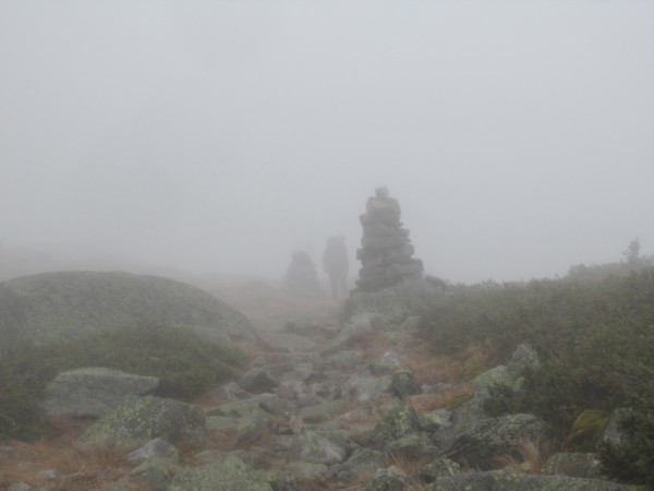
Thanks for the trip down memory lane in my old stomping grounds. That Presi fog can sure spin you around in a hurry. I remember getting lost in a Winter whiteout en route to Adams, and was saved by stumbling into the cairn at Thunderstorm Junction. For those who don't know, this cairn is maybe 15' tall, and I couldn't see the damned thing until I got within 10' of it. And yes, the endless walking on talus can wear you out in a hurry. Props to you both!
|
|
wilbeer
Mountain climber
Terence Wilson greeneck alleghenys,ny,
|
|
"Endless walking on talus"
Edge, I could not think of a better description. Great photo . Those cairns are something.
|
|
hagerty
Social climber
A Sandy Area South of a Salty Lake
|
|
"...if Hagerty,thinks a 40 foot ,75/80 degree corner leading to a ragged summit is not nearly 3rd class..."
If you did something like that, than I think you guys missed a turn and weren't on the trail at all. I've done Adams numerous times, including with a 65lb frame backpack during a winter traverse BITD. I've encountered dogs and little kids on the summit. There is nothing like what you describe on the trail.
Not questioning what you did or its difficulty, but it is misleading to refer to Adams as a 3rd class peak.
Excellent photos! A lot of people wouldn't bother and complain there weren't any good photos because of the fog and overcast. You easily disprove that notion!
|
|
wilbeer
Mountain climber
Terence Wilson greeneck alleghenys,ny,
|
|
After a few days to chew on it,I would like you all to know.
Brandon is no internet loser.He is a proud young carpenter from New Hampshire.A great person with a vigilant persona.We have a lot in common,and shared some great stories on this very worthwhile adventure.
Knowing what I know now,if I had a bad knee ,i doubt I would try such a hike.Vigilant,like i said.
I know this traverse would not add up to near as much as most here on the taco would have experienced,nor come close to many of the trips I have read about here.That matches most of the things I have done in mountains or on rock.The point being,it is as much about the character of the participants as the difficulty of the task .
Brandon showed me a side of the Granite State I was unaware of.He himself is a great guide. Thank You. Wilbeer
And I will be climbing in the Dacks the 17th.
|
|
anita514
Gym climber
Great White North
|
|
where in the Dacks will you be climbing?
|
|
wilbeer
Mountain climber
Terence Wilson greeneck alleghenys,ny,
|
|
The nearest SW facing cliff to Keene,N.Y.,HA!
Looking at climbing Peregrine Pillar Area,camping up The Nun Da Goa ridge a few miles outside of Keene.
Adirondack Rock, guide has some Beta.[Lawyer,Haas]
|
|
Reilly
Mountain climber
The Other Monrovia- CA
|
|
Yo, Brandon, we should all have such a bum knee! ;-)
|
|
Jaybro
Social climber
Wolf City, Wyoming
|
|
Nice! Beautiful back up there! Thanks
|
|
Brandon-
climber
The Granite State.
|
|
|
Author's Reply
|
Oct 9, 2013 - 07:18pm PT
|
Thanks for the kind words Willbeer. We obviously make a great team.
But, I'm trying to maintain the image of an internet loser, you're ruining my smokescreen, dammitt!!
If the knee is feeling better I'll try to make it to the Dacks. Chapel Pond is probably the closest spot to my house, where are you headed?
I'll bring the goodies...
|
|
wilbeer
Mountain climber
Terence Wilson greeneck alleghenys,ny,
|
|
Brandon,I am heading to the Lost Pond leanto,at Nun Da Goa ridge.
It is 4 miles east of Keene ,N.Y.,off rt.73.
You would have to go right by it on the way to Chapel Pond.
2 mile hike up a small mountain to the leanto.
Once on the ridge[a nice cirque],you can access a good bit of crags.
Those goodies are special.
|
|
Sierra Ledge Rat
Mountain climber
Old and Broken Down in Appalachia
|
|
Love that terrain and weather. I can relate to your knee issues, downhill is murder on my right knee. Now you got me interested in the traverse! TFPU!
|
|
Brandon-
climber
The Granite State.
|
|
|
Author's Reply
|
Oct 9, 2013 - 10:17pm PT
|
I've been thinking about the traverse, and it seems like it would be easier in one day, rather than two.
Having scoped it now, and thinking about our pace, rests, and loads carried, I'm pretty sure it would be easier and more enjoyable for a moderately fit person to just commit to doing it in a day.
Granted, this assumes good knees, so I can't prove it until next year.
|
|
Sierra Ledge Rat
Mountain climber
Old and Broken Down in Appalachia
|
|
I hate rushing. I hate all of this car-to-car in a day bullsh#t. What's the point? Slow down, plop your ass down in the woods and hang out. Savor the scenery. Make it last a few days.
|
|
Brandon-
climber
The Granite State.
|
|
|
Author's Reply
|
Oct 9, 2013 - 11:02pm PT
|
I agree with you mostly. I like getting out and staying out.
But the length of the traverse is just long enough to be a long day hike as easily as it is a short two day.
All that said, when the clouds lifted at Lakes of the Clouds and we had a great sunset and excellent night sky up on a mountainside, I appreciated that as well.
|
|
anita514
Gym climber
Great White North
|
|
+ 1 for bivying
what is Nun Da Gao like? I have heard about it, but never been. Can you bivy on top?
I usually hang out in the Keene valley area. if weather is not great for the Gunks this weekend, we will probably end up in the Dacks... always lots to do.
|
|
wilbeer
Mountain climber
Terence Wilson greeneck alleghenys,ny,
|
|
|
|
Oct 10, 2013 - 09:19am PT
|
Harry,it did not feel like rushing at all.We soaked up everything.Spectacular.Let me know ,I have unfinished buisiness there.
Anita,the NDG ridge,is ,well,fantastic ,you can bivy anywhere you would like in the preserve.Mostly established sites and platforms and you can even have a fire.
We are looking to snag the leanto at Lost Pond.It is first come first serve,but touron season is mostly over now.
The rock near Little Crow mountain is pretty damn good.
|
|
Brandon-
climber
The Granite State.
|
|
|
Author's Reply
|
Oct 17, 2013 - 04:43pm PT
|
I have unfinished buisiness there.
Me too, we should finish that thing this winter. Maybe do some skiing up there also.
|
|
wilbeer
Mountain climber
Terence Wilson greeneck alleghenys,ny,
|
|
|
|
Oct 17, 2013 - 07:49pm PT
|
I say yes.You could start at Tucks and ski the rest of it!
|
|
LilaBiene
Trad climber
Technically...the spawning grounds of Yosemite
|
|
|
|
Oct 20, 2013 - 01:18am PT
|
What a gorgeous trip. Next time, I want in! Snow? All the better,
Thanks for sharing, you guys. I love this part of the world we're in. ")
|
|
Todd Eastman
Social climber
Putney, VT
|
|
|
|
Oct 20, 2013 - 01:33am PT
|
Love that ridge! I spent may days winter and summer up there with my mom and dad and brothers when we were kids. Many bailed efforts, destroyed tents, groping through whiteouts, and thicketeering through the krumholtz. Ah, the fun!!!
|
|
mouse from merced
Trad climber
The finger of fate, my friends, is fickle.
|
|
|
|
Oct 20, 2013 - 01:20pm PT
|
All internet losers bitch about bad knees.
No pain, no elevation gain.
It is interesting to me and gratifying, too, that you posted up this TR and I posted my Brown Mountain TR.
Class II is very legitimate climbing, especially if you have poor health.
The point being that you got yourself out of bed, off the couch, out of the car, or away from the table.
Both you guys are swell.
Braces, braces,
Everyone's in braces
As we go...
--On the Upward TRail
|
|
Brandon-
climber
The Granite State.
|
|
|
Author's Reply
|
Jul 3, 2014 - 02:38pm PT
|
Bump. Anyone interested in doing this in the fall? I'm in way better shape and the knee, while not fixed, is strong.
|
|
|
 |
|
Recent Trip Reports
- The Kohala Ditch Trail: 36ish hrs on foot... to and from the headwaters. [5 of 5]
May 31, 2019; 11:57pm
- A Winter Traverse of the California section of the PCT Part 8
May 31, 2019; 11:18pm
- Supertopo,A trip report for posterity
May 31, 2019; 11:00pm
- Balch Fest 2013. Two Days in and Around and On The Flake. The Official Trip Report
May 31, 2019; 10:57pm
- TR: My visit to the Canoe
May 31, 2019; 10:24pm
- Death, Alpine Climbing, The Shield on El Cap
May 31, 2019; 4:07pm
- Andy Nisbet (1953-2019)
May 31, 2019; 2:11pm
- Drama on Baboquivari Peak
May 31, 2019; 1:19pm
- Joffre + The Aemmer Couloir: ski descents come unexpected catharsis [part 2]
May 31, 2019; 7:45am
- Lost To The Sea, by Disaster Master
May 30, 2019; 5:36am
- My Up And Down Life, Disaster Master
May 29, 2019; 11:44pm
- Halibut Hats and Climbers-What Gives?
May 29, 2019; 7:24pm
- G Rubberfat Overhang-First Ascent 1961
May 29, 2019; 12:28pm
- Coonyard Pinnacle 50 Years Later
May 29, 2019; 12:24pm
- Great Pumpkin with Mr Kamps and McClinsky- 1971
May 29, 2019; 12:02pm
- View more trip reports >
|