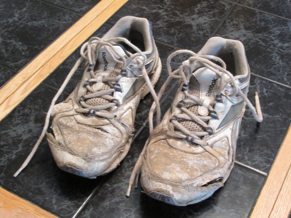
 I put some serious wear and tear into my Reeboks. Credit: Unlucky |
||
Of Livingston, Montana
July 28, 2013. I finally managed to bag Gannet Peak. After spending several years trying to get a group together to assault the mountain, I decided to try it solo. I have now hiked both of the twenty-mile routes into the base area of Gannett and can offer a few observations. My total combined round-trip mileage on these hikes is probably around 100. Facts worth mentioning: Gannett is not only the highest point in Wyoming but the apex of the entire Central Rockies (according to Wikipedia) and is connected to what is probably the largest glacier in the American Rockies. The mountain is situated deep in a wilderness system that normally requires a 40-mile-plus round trip by either of the two most popular trails. The maps indicate that there is another, shorter, approach by way of the Wind River Indian Reservation to the east but that a tribal permit and guide are required to approach from that trailhead.
The trail system from the South/Fremont Lake (Pinedale) side is much more lush than the trail from the north. In fact the beginning of the Glacier Trail on the north end (near Dubois) is a virtual desert. Pros of the north approach: you get a better look of Gannett Peak in all its glory from a greater distance. There are places in the Wilson Meadows (approximately 12 miles in from the north) where you can get a great postcard shot of Gannett from its best (front) angle. By contrast, you barely see Gannett enough to recognize it above the other surrounding mountains from Titcomb Basin (south) approach. Only when you reach the top of Bonney Pass do you get a great (side) view of the mountain if you come from the south trail.
This time I opted to try my luck from the north. I tried and failed (due to lack of time) with a friend last summer from the south. This year I started from the Glacier Trail trailhead around noon and made good progress until reaching Downs Fork Meadows. There I misread my map and ended up taking the wrong trail up Downs Fork Creek for a distance of a couple miles. I camped the first night in the shadows of the Bears Tooth. The next morning I had to backtrack to the bridge across Dinwoody Creek where I reconnected to the Glacier Trail into the bottom of the Dinwoody Glacier.
On the weekend I summited, the mountain seemed to be covered with would-be climbers who were failing to summit for one reason or another. During my 20-mile hike into the base of the mountain I encountered two groups who said they had been turned away by bad conditions on the ice. A large group of commercially guided climbers who had all failed to summit were camped in the boulder field at the front base of the mountain. Apparently one member had injured an ankle the day before and the guides had made the decision to abort the climb. They were breaking camp as I hiked past and they indicated the injured guy was well enough to try to limp all the way south to Fremont Lake with the assistance of the others.
Another group of four climbers were from eastern states and appeared to be very well equipped. They camped overnight very close to my tent. They had rope, crampons, climbing boots, ice axes and lots of gear. Each of their packs probably weighed twice what mine weighed. They indicated they would be starting their summit push around 2:00 a.m. the following morning. This kind of mega-early start seems to be the culture nowadays and I think it has a lot to do with influence of the guide services. Most of the guide companies start out early, in the dark, because they have slowpokes among them and they need to make sure they get their groups up and down before the afternoons, when bad weather is more likely.
Another benefit of early a.m. summit starts is the fact that glaciers and snow fields are more solid. As soon as the July sun hits the snow, the snow softens and by noon it can be downright slushy. However, the hard snow is only good if you are equipped with crampons and ice axes. For guys like me, with nothing but tennis shoes and leather gloves, the conditions are better later in the day, when a guy can kick into the snow with his shoes. I told the four guys camping near me that I would sleep in until daylight so that I could more easily kick my way up the Dinwoody Glacier in my own style. In retrospect I wish I had invited them to sleep in and join me, as they ended up choosing a bad route in the dark and failing to summit.
I woke around 7ish and took the most direct route up: straight up the Dinwoody waterfalls in front of the mountain and then continuing straight ahead up the Dinwoody Glacier. Unfortunately the snow was still too icy and I was unable to get good footing. I turned around and descended to near the bottom of the Glacier and went left on the mountain until reaching a large mass of 5.0 or 5.1 rocks at the base of the Gooseneck Pinnacle. From there I thought I could work my way around the left of the Pinnacle to the top ridge.
When I got high enough on the Pinnacle to get a look around the left side I realized I had badly misjudged the topography. It was something like a 90 degree drop and unclimbable. Therefore I had to work my way back around to the right. I felt the climbing was getting a little sketchy for me to the right so I descended to descend and try to make my way to the couloir by working through the gap between the top of the glacier and the cliff.
The gap between the top of the glacier and the cliff was wide enough to shuffle along, but it required some care. In some places the gap opened up into a 15-foot drop down under the ice, and one slip could result in being stuck in the gap in a worst-case scenario. If I fell down into the bottom of the glacier Im quite sure I would never be seen again. On the other hand, I did not want to risk kicking across the top of the glacier as icy as it was, as one slip could send me hundreds of feet down. I was able to shuffle my way horizontally across this bergschrund by jamming one foot against the rock and kicking the other into the inside of the icy snow. When I reached the couloir I was sopping wet.
From the snowy couloir I ventured onto the outside snow and kicked hard all the way up and around until I found sure footing on some rocks. From there it was simply an arduous scramble across the ridge to the peak. I summited around lunchtime.
Upon my return to the couloir I found it soft enough to glissade down on my sneakers while holding a sharp stone for a make-shift ice axe. When I got back to my tent I found the group of four guys next door had been turned back and had returned to camp after becoming too tired to try again. They were frustrated and now wanted to simply hang out for the next 24 hours before heading back down. It was 2:00 in the afternoon and I decided to break camp and try to hike my way all the way out by dark. I made it about 15 miles before darkness set in and I ended up camping one more night (my third) on the top of Burro Flats, a barren tundra at around 11,000 feet elevation.
Upon first light I was back on trail and I made it to the trailhead by 8:00 or so. It was a great trip, with great weather. I am now a 44-state highpointer.