I am not in a hurry to leave the motel. I shop all three gas stations for food for the next few days. Each one has something different to offer. I walk the mile back to the trail and the tunnel underneath Interstate 15. The trail parallels the train track for a while and eventually climbs above.
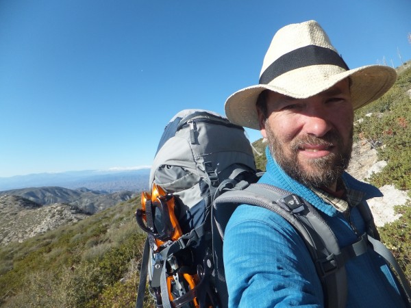
I climb out on a rock with a good view and drink a tallboy I carried up. It is my birthday!
Yesterday with the shootings cell service was almost unavailable but today my phone is working well. I call another friend and finish my beer. It is another climb up and around Ralston Peak then a drop to the San Andreas fault. Bike spring is dry and it is warm again. My pack is light now with only a little food so I climb quickly up the next ridge. Darkness comes again and I keep walking. I eventually reach a flat spot in the trail and bivy there.
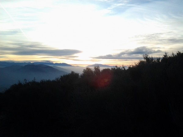 San G and San J Credit: Jay S |
||
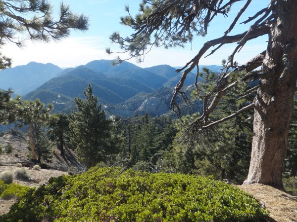
In the morning there is more climbing up Blue Ridge with views of San Jacinto and San Gorgonio. Midmorning as I am taking a snack break two hikers come down the trail and we nod hellos. They look to have come from Canada. These will be the last of any backpackers I will see for the next few months.
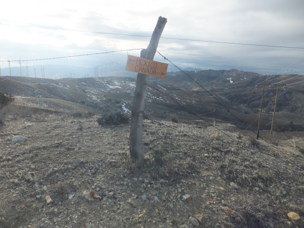
I reach the Mount Baldy trail and remember being here almost thirty years ago when I hiked this after breaking my leg. It was a tough trip then after spending 6 months on crutches. I consider doing it again but I am feeling pressed for time.
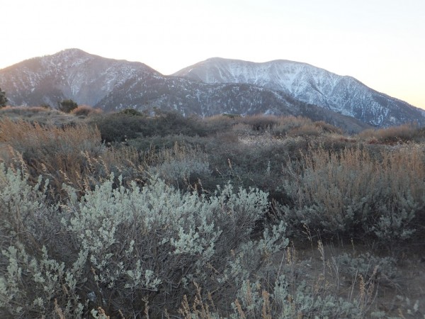 Baldy Credit: Jay S |
||
Morning brings more sunshine and I continue dropping down Blue Ridge reaching Mountain High ski area. It looks like they have enough manmade snow with the little bit of natural to be open. The trail zigzags down and I find a bag of Doritos smack dab in the middle of the trail. I eat the rest of the bag and run into a bear can to put the bag in.
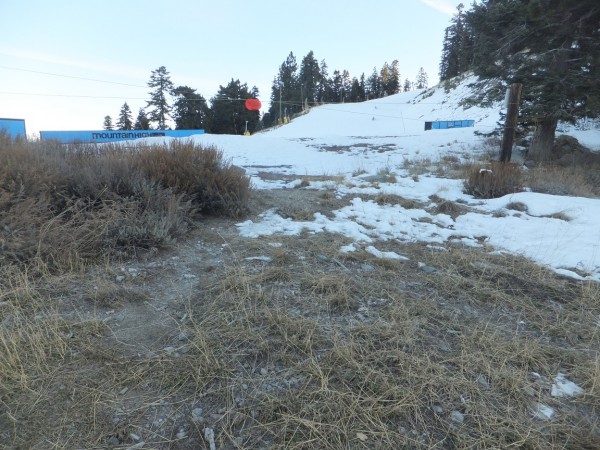 Credit: Jay S |
||
Dec 8th 2015
My package is not available right away so I get a late start. I manage to hitch another ride with somebody who takes me out of their way to get me back to the trailhead. Thanks.
 Credit: Jay S |
||
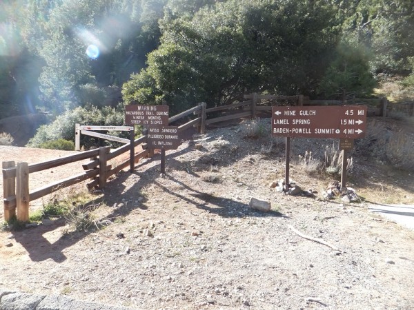
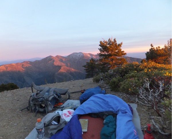
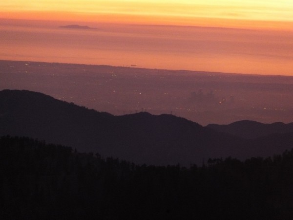
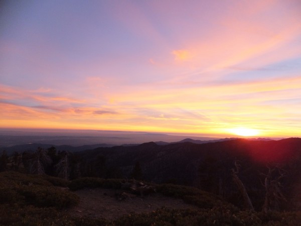
I make the short walk over to the summit of Baden Powell from the PCT. It is early afternoon and I decide to bivy on top next to a Manzanita bush. I am witness to a spectacular sunset. The air is clear and I can see the coastline and the islands past LA. The other direction Interstate 15 disappears into darkness. I am surrounded by millions of people and utterly alone with a 1,500 year old Limber Pines on a ridge that is basically unchanged by humans. Imagine what these trees have seen.
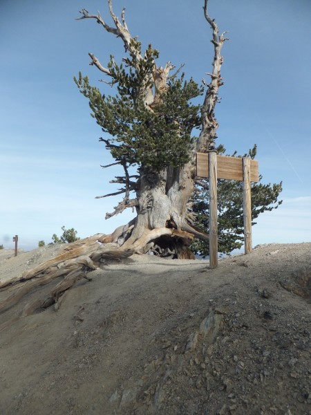 Limber Pine Credit: Jay S |
||
 Credit: Jay S |
||
 Credit: Jay S |
||
 Credit: Jay S |
||
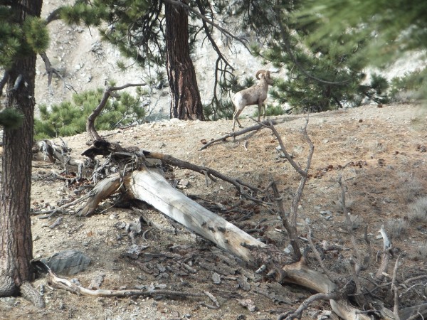
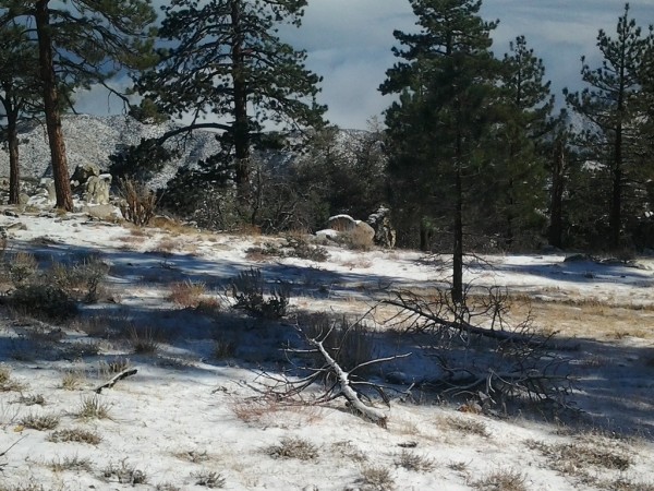
It is a warm night, above freezing and with a light breeze. I have coffee in the morning and pack up. The north side of the ridge has snow and the south side is dry. I see a couple of Bighorn Sheep on the slopes of Thorp Peak.
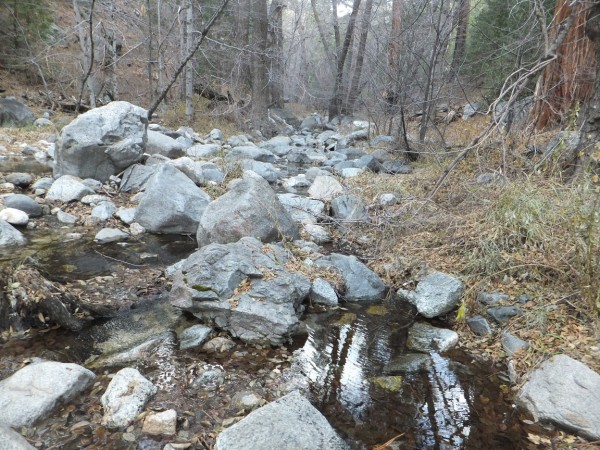
There is great water flowing at Little Jimmy Spring. I fill my three bottles and have a snack. There are some lovely cedars here.
 Credit: Jay S |
||
 Credit: Jay S |
||
These are my thoughts
If closing areas to humans helps species recover I am all for it. So much of the planet is overran with people. We humans have the ability to trash everything for our own desires. I see a growing anti-wilderness sentiment in a lot of the new outdoor recreation crowd. They want to mountain bike, snowmobile, dirt bike, build fires and structures and manufacture climbs all because I want to.
The more people doing things jeopardizes the natural outdoor world we love. One person climbing at Williamson Rock probably wouldnt bother the frogs but hundreds will have an impact. Especially if there is a lot of tree cutting and manufacturing of routes and or trails.
I opt for the old endangered species detour and climb into the Pleasant View wilderness. I really enjoy this 4 mile section and reach the highway again at the closure above Williamson Rock. I walk the highway to the old Snowcrest Ski area and bivy under a nice Ponderosa Pine.
Dec 10th 2015
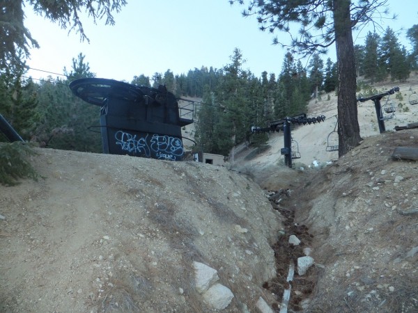
I wake up and have a casual pack up. I go across the highway to take some photos. The Ski Area has not been open in years. A causality of climate change and a public desire for bigger and better. It is if the clock stopped and everything is in a slow rate of decay. It is interesting that this is in the drainage above the frog closure area. What impact did or does the resort have? Why are the remnant dilapidated lifts and other garbage still here?
 Credit: Jay S |
||
 Credit: Jay S |
||
It is ¼ mile to Mount Waterman Ski area, so curious to its fate I hide my pack behind a stump and venture down the road. I am surprised to see the area has had maintenance and is under video surveillance. It looks like it could open if it snows more. Mount Waterman started in the 1930s and continues to operate when there is snow.
The next section of trail follows what I believe to be the old highway 2. The two roads parallel each other and cross each other many times. Thank God there is no traffic. What an oddity to be so close to LA and have such peace and quiet. It is a nice decent to Camp Glenwood. It is also strange to have garbage cans and shitters everywhere but still see so much garbage. It is also handy for toilet paper theft. I cross highway 2 for the last time and see burn warning signs. It is much better than cutting the trees all down along the trail. I camp under a pine at mile 406 back in the Pleasant View Wilderness with a big anticipation of an incoming storm.
The storm is a total dud. Lots of wind and a little rain. I pack up and am moving by 8am with a low of 29 degrees. I have two cups of coffee this morning. I bypass Sulfur Spring and make the climb up to Fiddleneck Spring. There is fog and clouds swirling everywhere. I arrive at Fiddleneck and am not disappointed to see a bunch of dried fiddlenecks (winter). The water is to shallow to collect without a piece of plastic hose.
I continue on to Fountainhead Spring and it is really starting to snow! I find a dribble to fit my Nalgene under and have a snack. The snow is now starting to stick. It takes a while to fill the bottle and it has a thick layer of debris on the bottom but tastes great. I drink half and toss the rest thinking the snow will give me plenty of water. I walk another mile and the sun comes out. Its is a bright blue sky with a ½ inch of new snow. So much for my water woos. I cannot wait to get to the Sierra Nevada where there is water everywhere.
 Credit: Jay S |
||
It is a nice decent through a mixed burn. The burn becomes worse further down and has killed everything. The oaks sprout right up from the old trees. The dead oaks bark peels off and falls in the trail. There is also a small animal that leaves piles of liquid sh#t in the trail about the size of a soup can lid. At this point I think it is a squirrel or a chipmunk or the small feline prints I see. Coming down the Snow Creek switchbacks in the dark a few weeks ago I saw three catlike creatures.
Dropping lower I look for new pines and cedars. I see one fir and a half dozen ponderosas that survived. I wonder if there have been any studies done in regards to climate change and forest regeneration on low elevation aspects?
It is a long drop to the Mill Creek fire station. The little bit of snow provides a nice cushion under my sore feet. The snow disappears on the sunny slopes. I get to the day use area and jettison my garbage and the garbage I have picked up on the way-Helium balloons (more on this later).
The hydrant is marked danger do not drink. I walk down to the fire station and knock on the door. The water is contaminated with E.coli. The kind fireman gives me a gallon (8 16 oz bottles) of bottled water. I hate the bottled water concept but am grateful. The Angeles Forest highway is busy and it is three pm so I continue on. The Mount Gleason Road is closed to vehicles-yes! I climb up about a mile and a half and the ridge above me looks inviting for a campsite. I tramp up a game trail and see a game camera on a tree. I wave as it takes my picture. The site is not right. It is under dead oaks with wind. I drop back to the trail with another wave into the camera. The area here is with nice mature Oaks that havent burned. Everthing is sloping. I come back into the burn so I backtrack and climb up to the ridge again. This time I find a site and get busy setting the tent up. I am freezing. I have dinner and see that I have a good 3g signal. Today for some reason I have thought of an old junior high flame and google her name. Her Facebook page comes right up. She is happily married with two kids and her husband she met at age 15. She likes quiet days with her cats. Thank God that wasnt me. It is a cold night!
Dec 12 2015
It is only 25 degrees but for some reason I am cold. I fire up the stove and have two cups of coffee. The stove is limping along so I let it run to make me warmer. Burning unleaded constantly this stove needs cleaning. Without pliers I cannot remove the jet but manage to poke the orifice out. It runs better. I shake a ton of ice off the tent and am on the trail by 7:15 to witness a nice sunrise. The air is really clear after the storm. The trail is in the shade most of the morning so I keep my down jacket on until noon. The trail continues through the burn with mixed areas that survived. I see snowy peaks to the north! There is a lot of green grass poking out of the dusting of snow left on the ground.
 Credit: Jay S |
||
I get an early start in the am and tunnel underneath highway 14 at dawn. It is a cool walk into Vasquez Rocks state park. I see two coyotes leaving Agua Dulce as I enter the outskirts of town. I wonder what they found to eat? I have breakfast at a café and get a few groceries and head north. This is the first section the trail has followed roads any length of time.
It is another climb up with views of the last ridge I walked. I crest the top and there is more snow. Bear Spring is frozen solid. I drop down and cross the road to another pleasant campsite.
The next bit is a mixed hike through forest and scrub with nice views on the high aspects. I come to the Lake Hughes road and try to hitch a ride but walk the few miles into Green Valley for a gas station resupply which amounts to energy bars and beef jerky. I walk the short distance back to the trail to face another closure from another fire. After walking the busy highway I am in no mood to walk the busy road around the closure. There is a new power line being constructed across the highway to provide power for the unquenchable thirst of Los Angeles and the workers are basically on the trail. I wait for cover of darkness then walk a few miles with no headlamp. I find another sweet bivy spot and rest for a few hours.
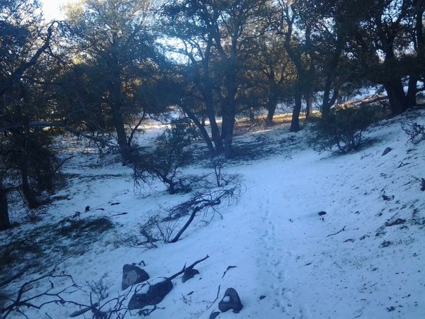
Morning finds me moving quickly to get out of the closed area. There is a dirt road that parallels the trail at times that has a few vehicles on it. In a couple of spots the trail is washed out from recent rains but not as in bad of shape as I had expected. I leave the burn and am back in the oaks and pines again. North slopes are snowy while south slopes are dry. I drop to an abandoned campground to spend the evening. There are a couple of high school students hanging out on a picnic table that I converse with. They have hiked up to be in solitude with the firs and oaks. I consider giving them a snort of whiskey but think better of it. I encourage them to spend as much time outside as possible. The boys depart and I find the spring flowing with plenty of water. It is a nice bivy under and ancient oak.
 Credit: Jay S |
||
 Credit: Jay S |
||
Morning brings another big decent to the Antelope Valley. I reach highway 138 and hitchhike east to a store for a burger and a beer and pick up a few more supplies. I try to hitch a ride back to the trail but end up walking so I take a shortcut back to the aqueduct that the trail follows and find a cell phone that has been thrown out. I through it in my pocket for latter inspection.
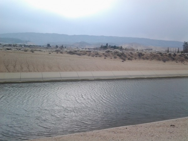 Credit: Jay S |
||
The dogs sulk off. I continue walking to put some space between me and the dogs. I camp near a clump of Joshua trees. I set the tent up for the first time in a while. I am awoken by what I believe are dogs attacking me. Fortunately it is only a dream that was very real. Somewhat shaken I have an uneasy nights sleep.
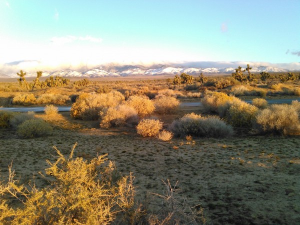
Morning brings a dusting of snow that melts quickly when the sun rises. The Tehachapis are covered. The scene could be in the middle of Wyoming. I follow the aqueduct for miles. It is cold and windy. I find a beer stash that someone left for thirsty hikers and suck down two with my hands freezing from the cold beers.
 Credit: Jay S |
||
 Credit: Jay S |
||
 Credit: Jay S |
||
Dec 22nd
Wow where to begin? I sit here in Mojave at the Best Western with no lights. Big wind storm starting at 4 am. Thank God I was here last night instead of in that POS Tent. Woke up at Tylerhorse Canyon yesterday morning to 38 degrees and calm. The creek was flowing enough to get decent water. Had two cups of coffee and was on the trail by 7:30am. Had fantastic views as the air was clear from yesterdays windstorm. The dirt bikes have torn the hell out of this section along with a big rain event last month. This section has signs everywhere saying no motorcycles but it is clearly not even being enforceable. How do you balance the idiots rights of access to public lands? They will obviously tear it up with total disregard for their actions. Kind of like our population in general. We want what we want when we want myself included. As long as we can pay for it is OK. Like those damned helium balloons everywhere (more on this later).
I shed layers for the climb out of Gamble Spring Canyon. It is pleasant and I can see the big three clearly today. How cool to look out and see San Jacinto over three hundred trail miles away. I climb the hill quickly anticipating a Sierra Nevada view at the top. I am disappointed to see clouds only to the north and east. At mile 449 there is a water stash. I take a break and am back in hat and gloves immediately at 6000 feet. I have mixed emotions about the caches from a garbage and independent ideal. (more later)
There is about a foot of snow on the north slope, the most Ive seen anywhere so far. It is short lived as I start another decent. I am bummed the trail spends so little time in the Tehachapis. Looking down are a few cabins that owners have put up a few no dirt bikes signs. I continue over the hill and consider taking a crap on one of their trails where it joins the PCT. I call on my higher self and dont.
A mile later 5 of them drive by above me. It is a snowy and muddy and the have torn the hell out of this section. I put a few logs and a stump in the trail to detour them back to the road. It is a nice drop following the ridge down below the wind turbines. There is a light breeze but the turbines are moving. I watch birds fly in and out of them but they seem to be OK. I saw the prettiest of bluebirds today as well.
Dropping down to Oak Creek in light drizzle and cloud cover I follow the water sign to a disappointing campsite. I have been going back and forth in my head the bailout options here. I really want to bang out the next 8 miles tomorrow but it is not in the cards. It is 4pm and I decide to hitchhike to Mojave on the Oak Creek road. There is no traffic! I wait 20 minutes with only one car going by. I decide to give it till 4:30 then I will back track to some big oaks. I hate going backwards.
Right at 4:29 a semi without a trailer stops. I am soaked and cold. When we shake hands he says those are some cold hands. We talk about failing mothers and mother in laws. His is 95 and just broke her femur and still wants to live at home. It just becomes a role reversal and we become the wise responsible ones. Mike drops me off at the Best Western. As I am checking in I meet a retired surgeon named Bill whos son hiked the PCT 20 years ago. He invites me to dinner. After a shower and a quick rinse of my boots and pant legs to clean the mud off I am warm again. It is pouring rain in Mojave! We drive a mile with his wife Gestina to dinner. I have steak and Sierra Nevada. They are an interesting couple from the bay area.
They were at the zoo one day and saw a young tiger that was pacing (Bear in San Bernardinos). Two days later 3 people were taunting the tiger. The tiger jumped the fence and killed one person. The other two were treated by Bill. The news media wanted info so Bill told them that the two men that survived had only superficial injuries and that the real predator is man with the x gunshot wounds and stabbings that had happened earlier that day but where not news. Kind of like all of the terror bullshit now on the media after the shooting earlier this month. At first I think the wind is a train but it lasts to long
The hotel has tiles blowing off the roof and signs are taking a beating. I hear later that trucks have been blown off the road in this storm.
The second night in the motel is quiet and peaceful except for the TV.
My cousin picks me up in the afternoon to help me facilitate my Christmas Eve flight to Kansas for the visit to my parents
 Credit: Jay S |
||
.