We four; my wife Bronwen, our son Tim and friend Loz are headed for Snake Dyke, being accommodated in a Yosemite Pines cabin near Groveland in part explains the very early start to the day, but experience tells us we wont clocking a fast time today, we have to take into account the effect multiplier of dodgy knees and hips. Any reader over a certain age will probably sympathise and understand the adage that going up is easy, its the coming down that sucks.
Bronwen has been wanting to do Snake Dyke for as long as she has known of it,
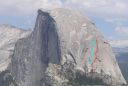
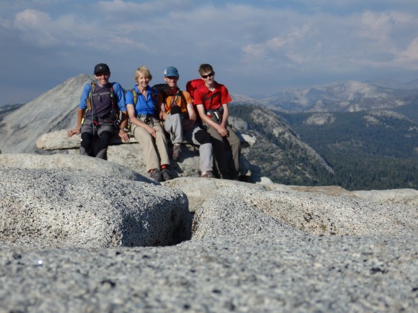
 Bronwen pointing out the objective on our first excursion into the Valley - it was frighteningly hot. Credit: Blakey |
||
but for various reasons on our other trips to the valley we hadnt got around to it. So, on this occasion it became a definite objective, and I spent some time ensuring I knew the various approaches. This would probably be her last opportunity to do the route as her knees are much worse than mine. Which are bad enough. Our knees contrast markedly with our son Tims - 14 years old and brim full of fresh stem cells hes in the early stages of learning the craft and had never had a big mountain day anywhere near what he was going to experience.
Loz well, hes as tough as nails, a bundle of irrepressible energy and his presence made the whole adventure possible.
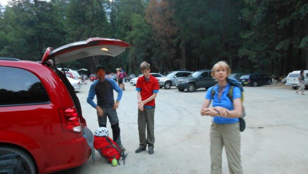
0400 isnt a good time to wake up a 14 year old boy, but Tim was up and about without too much drama In the certain knowledge of course that he would sleep in the car.
Circumstances dictated we were in the Valley in late July and it was as expected hot, our local programme meant we would do the route on a Friday, hopefully minimising the numbers the route might see over a weekend.
We were out of the cabin before five, but even then there were cars headed into the valley at least the drive was a bit quicker than the normal commute, most folks that early were driving purposefully and we didnt get stuck behind anyone doing 25mph.
So, we parked up at the Happy Isles campsite around 0600,
 Off we go, Bronwen's loss of focus was temporary. Credit: Blakey |
||
and started off rehydrating at the Vernal Falls toilet. Even at six the trail was busy with hikers leapfrogging us and them.
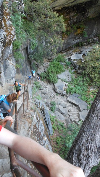 Eight o'clockish and busy already.... Credit: Blakey |
||
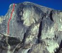
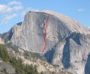
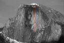
Above Vernal Falls the hump of Half Dome become visible, lit by the early morning sun it still looked a long way off. We ground our way up the path, steepeng up past Liberty Cap to the junction with the Muir Trail This was even busier though a short while later we identified the climbers trail branching off to the left. Only 40m from the main trail you enter a different world, a small trail, sometimes subtle weaves through the trees, marked by the occasional cairn, no people its deliciously quiet with your footfall muffled by the loam. By now the South Face of Half Dome looming up behind Lost Lake.was dominating the view, it is impressively blank, but the diagonal talus rake used by the normal approach is visible.
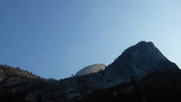 Half Dome catching the early sun. Credit: Blakey |
||
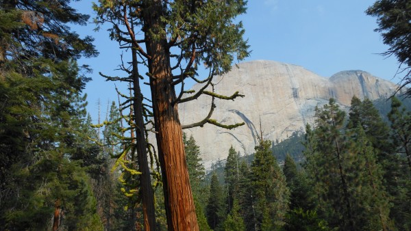 From the climbers trail the blankness of the South Face dominates your view. Credit: Blakey |
||
We soon reached the point, marked by a slightly larger cairn where the usual trail kicked right to access the talus ramp and horizontal traverse above the South Faces substructure. Bronwen didnt like the sound of this, so we opted for the alternative approach which switchbacks up a tree coverd rake over to the West. We continued following the cairns, heading for a vegetated spur. There are too many cairns hereabouts, but anyone with any navigational nous and common sense will pick the right level at which to traverse, but in truth the path isnt good and as an approach, it is I suspect, a poor alternative to the more usual slab traverse. We plodded ever upwards eventually broke out of the trees, got to the base at about 1130 and had lunch and some fluids.
A huge bonus, it transpired that we had the route to ourselves, and so wouldnt be either held up, or hold up anyone any faster. We paired up and drew straws, Tim would climb with me on a twin 60, Bronwen with Loz on a single 60m 9.4 If circumstances dictated we would bale from above.
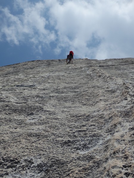
The climbing is only 5.7 in a couple of places and could easily be dismissed as casual, and while the first pitch can be well protected, the crux third pitch isnt and if the belay isnt arranged well, any slide on the rising unprotected traverse could get ugly! I wonder how many times it has seen a strung out leader fall? Id guess the crux pitch could be very testing for a 5.7 leader.
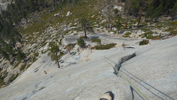 Looking down pitch one Credit: Blakey |
||
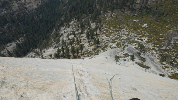 Looking down the traverse on pitch three Credit: Blakey |
||
The absence of protection on the route was a bit puzzling and while the rest of the route isnt particularly difficult, I felt (god forbid) that it would be more balanced with a couple more bolts. Regardless of my views on protection it flowed quite nicely and the dyke provided enough variation in the climbing to keep it interesting.
(Id expect the third pitch could seriously freak out a British VS leader - we dont do slabs). Anyhow, apart from some spaghetti with the twins, the climbing was uneventful, if sensational.
 Looking down to Loz on the third pitch. He clipped the bolts at the end, with a long sling, I'd missed these out and continued past a single bolt to the belay. He didn't get any drag and the angle for Bronwen didn't look too bad. Credit: Blakey |
||
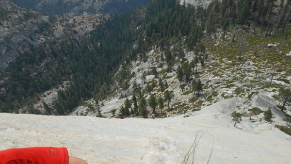
The weather was still bright, though in the distance some dark clouds confirmed the 20% chance of thunderstorms, these warranted attention, but they seemed to keep their distance, and I was confident we would be able to get off, or get up quite smartly if the weather broke. The key judgement would be making the right descision if it started to rain on the class 3. The higher we got we benefited from a delicious breeze which had been absent on the grind up through the trees.
The higher we got, the more threatening the clouds became, but they never got really close and eventually drifted off somewhere else, but their presence had added some spice and urgency to the climbing. By the time we were at the final belay they had all dissipated, off to pester someone else somewhere else. It was a relief as Id been running the what ifs through my head most of the way up.
 Loz's view of Tim Dyke hiking around pitch four or five. Credit: Blakey |
||
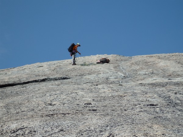
Tim and I had got a pitch or so ahead of Bron and Loz, so we relaxed at the big cracks where the description ends, enjoyed the view and position and waited for them to appear, which the eventually did.
Bronwen, by virtue of being tail end Charlie (and conscious of the clouds) was a bit frazzled. We rested a while, then did Snake Dyke Part Deux. While youre only walking on the top half of the climb, in the early stages the drop off tugs at your heels and the penalty for an inadvertent slip, well, it doesnt bear thinking about. We stayed roped up and ground it out, it was like doing shuttle runs on a Squash court but with a lot less oxygen. As the angle eased Tim was on the verge of his second wind, and tried to sneak in a snooze, after a very short cat nap he was was up and running again.
 It's not far Tim (Lie No:1), I promise (Lie No 2) Credit: Blakey |
||
Eventually we topped out to an empty summit it was quite amazing, the last time Id been there was in 96 after doing Regular Route and the contrast was startling, silent, empty and quite serene, amongst the souvenirs someone had left behind a shirt and pair of jeans ..
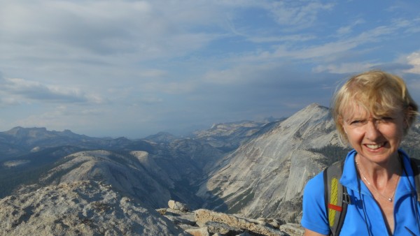 Bronwen happy on the summit, an ambition realised! Credit: Blakey |
||
 Credit: Blakey |
||
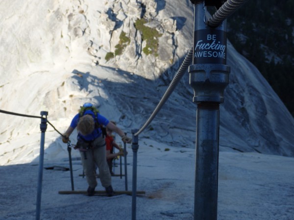
After an extended photo session we started the hard part. Getting down. Cocodamol and Diclophenac digested we hit the cables they are without doubt quite freaky, but we made steady progress and eventually got to the base of the sub dome. Breaking out the walking poles we began hiking out on the trail passing a tent inside the woodline aways to the left, (the Ranger who checks permits perhaps?)
 Down we go.... Credit: Blakey |
||
The descent goes on a bit doesnt it ..The light eventually disappeared when we were approaching the Muir Trail switchbacks, head torches came out and illuminated the shape and shadow of the trail. Tim found a Scorpion, but we were a bit brain numb and collectively unimpressed - we plodded on. Tim by now was tired and increasingly grumpy, and we redistributed his weight between Loz and I. Tim was then expertly cajoled by Loz down the trail with an endless stream of daft jokes and stories. The switchbacks seemed neverending in the dark, (someone on here must know how many there are) But eventually we got to the Vernal Falls water fountain and rehydrated, and took a break during which Tim perked up, and then we set off again. We hadnt seen anyone in a while but soon were passed by several parties heading up the trail who looked like they were aiming for the route.
We reached the Happy Isles toilets at about 2230 and stumbled around looking for the car, the long day was turning into an endless night navigation exercise we had to be on the right trail the car had to be here somewhere, but we couldnt recognise anything, just trees and dirt looking much like trees and dirt anywhwere in the valley. We were standing around trying to figure out what to do, when some distant big lights suddenly became small lights up close, attached to a couple of females with a hand held Yagi antennae. They were 'looking' for a troublesome Bear would you shout if you see it? they asked. I could guarantee we would shout, probably very loudly. They confirmed we were on the right track and just had to keep going, and off they went into the trees pointing the antennae looking for a signal and an awkward Bear.
Eventually we were relieved to pick out the reflectors on cars in the lot, emerged from the trees and found the car. We were all pretty beat, it was 2300 and we had been on the go a while. Any how there was nothing for it but to drink more water then scoot. We got back to the cabin just after midnight. All in all a leisurely(!) round trip of 20hrs.
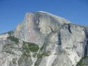
We allowed ourselves the luxury of a sleep in the next day, and in the afternoon went for a stroll in the Valley, eventually having a paddle in the river underneath Half Dome from below it is very, very big! and definitely as a route, not to be missed..
And reader, I wouldn't have missed it for the world, It was, by my 45 years experience a Grand Day Out. I am however content that I dont have to go up there again. Overall it is a very tough day, and would be easy to underestimate. Bronwen and Tims determination throughout was remarkable, they did really well. Tim now has a point of reference if I say its going to be a long day and Bronwen has a better idea of what real exhaustion looks and feels like. A final honourable mention for Loz without who it would not have been possible. Thanks.