Chuckwalla, Global Peak 5.9 |
||
Red Rocks, Nevada USA | ||
|
Google Maps Overview
|
|
|
A map of the general Red Rocks, Nevada USA area is shown below. No GPS coordinates for this specific route are available at this time. Approach
The approach is long with a lot of bushwacking and routefinding. It takes most people at least 3 hours. Park at the Black Velvet Canyon (BVC) parking lot. Hike up the old road/mountain bike trail toward BVC for a few hundred yards, but when the BVC trail takes off right, follow the winding bike trail left for about 0.5 mile to a large triangular boulder (Matterhorn Boulder). From here, the bike trail heads south, but hike southwest toward the mouth of Mud Spring Canyon and a huge brown boulder (dont get too high, stay in the easy flats). From the giant brown boulder, head up into the canyon following burro trails to the right of the canyon bottomagain, dont go too high, but follow the main burro trail. Hike up the canyon for about a half mileyou will get closer to a red rock band on the right (Chinle formation, like the junky stuff below Frogland). Near the end of the rock band is the first place it looks possible to cut upgo up here, following a few large old cairns. There is a small roof on the top of a 300-foot brown rock formation above this point (the Turtle Head); its easy to spot even in the dark on the way down since the roof cuts against the neon-lit skyline. Cut right above the red rock band for a bit to get to a large ramp which heads up and left at the base of the Turtle Head formation. There are some boulder problem/bushwacking approach difficulties here. Follow the ramp up and around the corner to a spectacular view of the North branch of Mud Spring Canyon, and your first fairly good view of Global Peak. Contour down and right on a ledge system, passing through a short narrows slot, to the canyon bottom above some killer swimming pools. From here, a long section up the main canyon bottom gets you to a bushy ramp to the left. In this canyon you encounter boulder-hopping, bushwacking, and a few 5th class sections (see next paragraph), the last of which has a rap anchor off a tree. Follow this bushy ramp up a few hundred yards past some tricky spots to the base of the sheer wall. Chuckwalla heads up the blank face to the left of the obvious corner system (Sidewinder), and starts above a low-angle ramp, going up a 30-foot-tall flake, then left and back right past three bolts to an anchor at a break in angle on the face. The first 5th class section in the canyon bottom is easy with only a 20-foot chimney/corner that is probably more like 4th classits easy to hand up packs. The second (with the rap anchor) is a two-step waterfall/giant boulder blockage, about 40 feet high. At the first step you face climb 15 feet up on the left wall about 30 feet before the overhung boulder, then step onto a ledge and walk to the start of the second tier. The face is difficult with a pack, but without, theres a nice finger lock that is not too scary; you can haul packs once youre up. The second tier is a surprisingly slippery chimney up the right side of the big bouldera good spotter is all you really needthen haul the packs up with a rope, and fix the line to the rap anchor for your partner(s) to grab (or you could set up a belay). Descent
Rappel and reverse the approach. The raps will take 30-45 minutes, and the descent is not much faster than the approach. Remember to leave your harnesses on and keep a rope on top of your pack for the rappel past the 40-foot 5th class section.
|
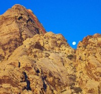 Photo: Greg Barnes
|
Home | Climbing Areas | Free
Topos | Guidebooks | Route
Beta | Forum | Trip Reports |
Photos | Articles
Links | Terms | Privacy | FAQ | Contact
| About Us
Climbing Areas
Rock Climbing Yosemite |
Big Wall Rock Climbing Yosemite |
Rock Climbing Tuolumne |
Rock Climbing Sierra
Rock Climbing Red Rocks |
Rock Climbing Southwest |
Rock Climbing Zion |
Rock Climbing Tahoe |
Climbing Alaska
All trademarks property of their respective owners
How can we improve SuperTopo? Got feedback?
![]() Let us know!
Let us know!
Climbing is dangerous. Climb at your own risk.